Dompu elevation
Dompu (West Nusa Tenggara, Kabupaten Dompu), Indonesia elevation is 32 meters and Dompu elevation in feet is 105 ft above sea level [src 1]. Dompu is a seat of a second-order administrative division (feature code) with elevation that is 159 meters (522 ft) smaller than average city elevation in Indonesia.
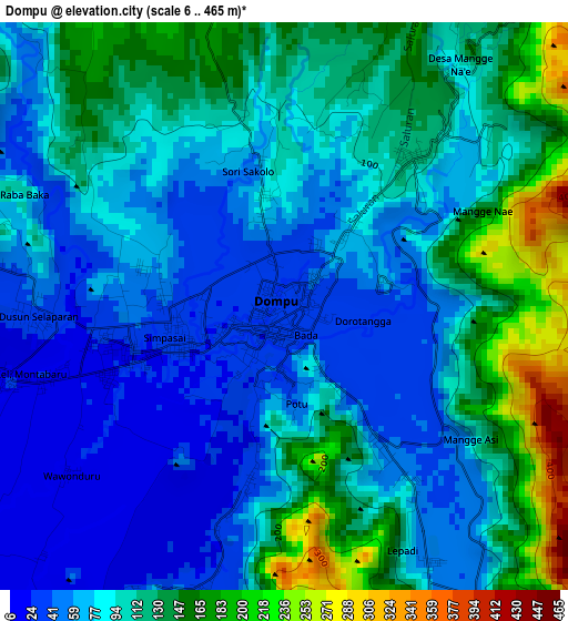
Below is the Elevation map of Dompu, which displays elevation range with different colors. Scale of the first map is from 6 to 465 m (20 to 1526 ft) with average elevation of 97.1 meters (=319 ft) [note 1]
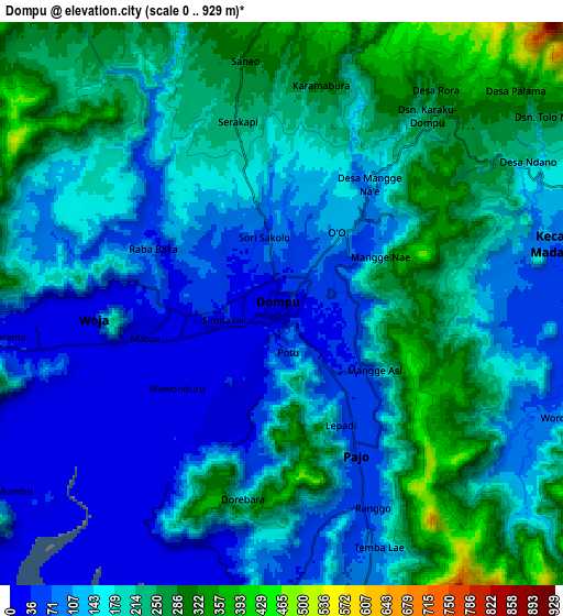
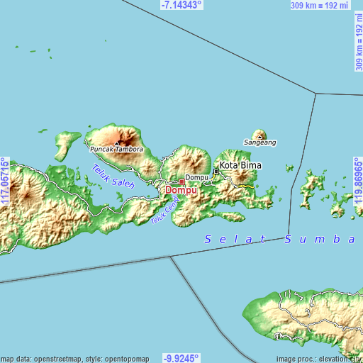
These maps also provides idea of topography and contour of this city, they are displayed at different zoom levels. More info about maps, scale and edge coordinates you can find below images.
| \ | Map #1 | Map #2 | Topo.Map |
| Scale [m] | 6..465 m | 0..929 m | × |
| Scale [ft] | 20..1526 ft | 0..3048 ft | × |
| Average | 97.1 m = 319 ft | 168.4 m = 552 ft | × |
| Width | 9.66 km = 6 mi | 19.33 km = 12 mi | 309.2 km = 192.1 mi |
| Height | 9.66 km = 6 mi | 19.33 km = 12 mi | 309.3 km = 192.2 mi |
| ↑Max Latitude | -8.493039° | -8.449573° | -7.14343° |
| Latitude at center | -8.5365° | -8.5365° | -8.5365° |
| ↓Min Latitude | -8.579956° | -8.623407° | -9.9245° |
| ← Min Longitude | 118.419455° | 118.375509° | 117.05715° |
| Longitude center | 118.4634° | 118.4634° | 118.4634° |
| →Max Longitude | 118.507345° | 118.551291° | 119.86965° |
Nearby cities:
Cities around Dompu sort by population:
• Bima elevation 15 m
30.2 km,  73°
73°
• Maria 387 m
41.8 km,  88°
88°
• Raba 19 m
32.3 km, 74°
• Tangga 41 m
28.6 km,  117°
117°
• Malaju 17 m
26.3 km,  343°
343°
• Kore 12 m
25.4 km,  314°
314°
• Kempo 26 m
23.7 km,  268°
268°
• Godo 4 m
22.5 km,  96°
96°
• Woha 51 m
22.2 km,  114°
114°
• Donggo 690 m
19.1 km,  49°
49°
• Sila 24 m
17.6 km,  77°
77°
• Woja 20 m
16.4 km,  227°
227°
Multilingual:
 En español:
Dompu elevación 32 m.
 En France:
Dompu élévation 32 m.


Sources and notes:
- [note 1] Map square and city borders are not equal. Map elevation data is calculated only from area inside that square.
- [src 1] Elevation data from geonames database provided with same terms of usage.
- [src 2] The elevation map of Dompu is generated using elevation data from NASA's 3 arcsec (90m) resolution SRTM data.
- [src 3] Base (background) map © OpenStreetMap contributors tiles are generated by Geofabrik and OpenTopoMap.
Copyright & License:
This Dompu Elevation Map is licensed under CC BY-SA. You may reuse any part from this page, if you give a proper credit by linking to this URL:
 More info on terms of use page.