Karanganom elevation
Karanganom (Central Java), Indonesia elevation is 217 meters and Karanganom elevation in feet is 712 ft above sea level [src 1]. Karanganom is a populated place (feature code) with elevation that is 26 meters (85 ft) bigger than average city elevation in Indonesia.
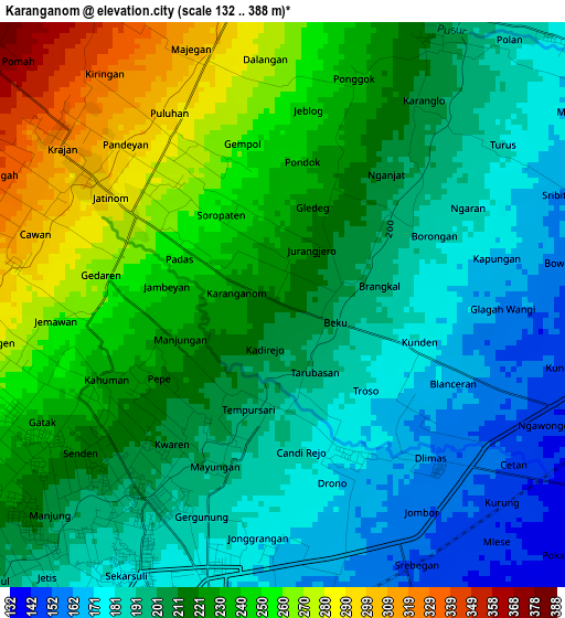
Below is the Elevation map of Karanganom, which displays elevation range with different colors. Scale of the first map is from 132 to 388 m (433 to 1273 ft) with average elevation of 215.9 meters (=708 ft) [note 1]
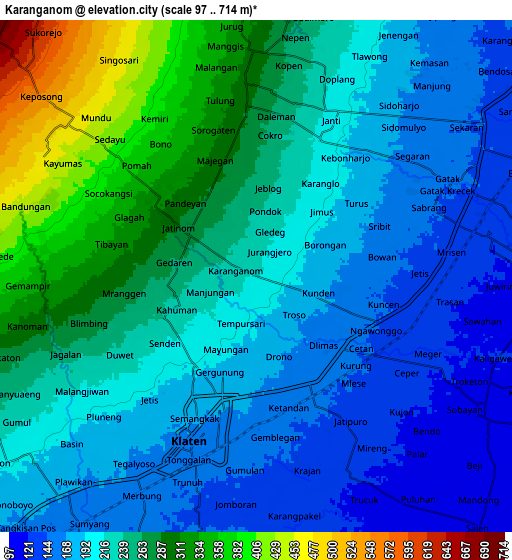
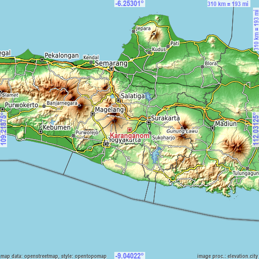
These maps also provides idea of topography and contour of this city, they are displayed at different zoom levels. More info about maps, scale and edge coordinates you can find below images.
| \ | Map #1 | Map #2 | Topo.Map |
| Scale [m] | 132..388 m | 97..714 m | × |
| Scale [ft] | 433..1273 ft | 318..2343 ft | × |
| Average | 215.9 m = 708 ft | 227.6 m = 747 ft | × |
| Width | 9.69 km = 6 mi | 19.37 km = 12 mi | 309.9 km = 192.6 mi |
| Height | 9.69 km = 6 mi | 19.37 km = 12 mi | 309.9 km = 192.6 mi |
| ↑Max Latitude | -7.605333° | -7.561773° | -6.25301° |
| Latitude at center | -7.64889° | -7.64889° | -7.64889° |
| ↓Min Latitude | -7.692442° | -7.73599° | -9.04022° |
| ← Min Longitude | 110.581055° | 110.537109° | 109.21875° |
| Longitude center | 110.625° | 110.625° | 110.625° |
| →Max Longitude | 110.668945° | 110.712891° | 112.03125° |
Nearby cities:
Cities around Karanganom sort by population:
• Klaten elevation 159 m
6.7 km,  197°
197°
• Kartasura 134 m
16.5 km,  49°
49°
• Boyolali 438 m
13.3 km,  345°
345°
• Baki 104 m
18 km,  77°
77°
• Wedi 148 m
11.6 km,  205°
205°
• Gatak 144 m
10.9 km, 53°
• Ceper 130 m
6.6 km,  115°
115°
• Jogonalan 223 m
11.5 km,  238°
238°
• Delanggu 153 m
7.4 km,  60°
60°
• Ngemplak 143 m
14.9 km,  42°
42°
• Trucuk 123 m
8.6 km,  154°
154°
• Kebonarun 193 m
8.9 km,  230°
230°
Multilingual:
 En español:
Karanganom elevación 217 m.
 En France:
Karanganom élévation 217 m.
 Auf Deutsch:
Karanganom höhe über dem Meeresspiegel ist 217 m.

Sources and notes:
- [note 1] Map square and city borders are not equal. Map elevation data is calculated only from area inside that square.
- [src 1] Elevation data from geonames database provided with same terms of usage.
- [src 2] The elevation map of Karanganom is generated using elevation data from NASA's 3 arcsec (90m) resolution SRTM data.
- [src 3] Base (background) map © OpenStreetMap contributors tiles are generated by Geofabrik and OpenTopoMap.
Copyright & License:
This Karanganom Elevation Map is licensed under CC BY-SA. You may reuse any part from this page, if you give a proper credit by linking to this URL:
 More info on terms of use page.