Kediri elevation
Kediri (East Java), Indonesia elevation is 74 meters and Kediri elevation in feet is 243 ft above sea level [src 1]. Kediri is a populated place (feature code) with elevation that is 117 meters (384 ft) smaller than average city elevation in Indonesia.
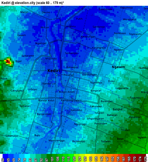
Below is the Elevation map of Kediri, which displays elevation range with different colors. Scale of the first map is from 60 to 179 m (197 to 587 ft) with average elevation of 77.9 meters (=256 ft) [note 1]
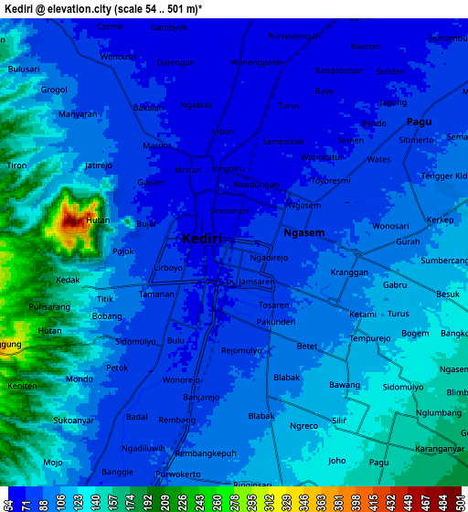
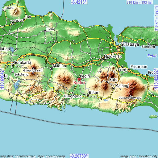
These maps also provides idea of topography and contour of this city, they are displayed at different zoom levels. More info about maps, scale and edge coordinates you can find below images.
| \ | Map #1 | Map #2 | Topo.Map |
| Scale [m] | 60..179 m | 54..501 m | × |
| Scale [ft] | 197..587 ft | 177..1644 ft | × |
| Average | 77.9 m = 256 ft | 104.3 m = 342 ft | × |
| Width | 9.68 km = 6 mi | 19.36 km = 12 mi | 309.8 km = 192.5 mi |
| Height | 9.68 km = 6 mi | 19.36 km = 12 mi | 309.8 km = 192.5 mi |
| ↑Max Latitude | -7.773131° | -7.729587° | -6.4213° |
| Latitude at center | -7.81667° | -7.81667° | -7.81667° |
| ↓Min Latitude | -7.860205° | -7.903735° | -9.20739° |
| ← Min Longitude | 111.972725° | 111.928779° | 110.61042° |
| Longitude center | 112.01667° | 112.01667° | 112.01667° |
| →Max Longitude | 112.060615° | 112.104561° | 113.42292° |
Nearby cities:
Cities around Kediri sort by population:
• Kedungwaru elevation 90 m
29.9 km,  201°
201°
• Nganjuk 59 m
26.6 km,  332°
332°
• Tulungagung 89 m
30.4 km, 204°
• Kertosono 43 m
27.5 km,  19°
19°
• Pare 141 m
20.7 km,  74°
74°
• Gampengrejo 59 m
5.6 km,  0°
0°
• Ngoro 93 m
30.4 km,  60°
60°
• Tamanan 91 m
31.1 km, 203°
• Pakel 89 m
23.9 km,  210°
210°
• Karangrejo 88 m
23.9 km, 209°
• Ngantru 91 m
23.7 km, 205°
• Ngasem 78 m
2.9 km, 65°
Multilingual:
 En español:
Kediri elevación 74 m.
 En France:
Kediri élévation 74 m.


Sources and notes:
- [note 1] Map square and city borders are not equal. Map elevation data is calculated only from area inside that square.
- [src 1] Elevation data from geonames database provided with same terms of usage.
- [src 2] The elevation map of Kediri is generated using elevation data from NASA's 3 arcsec (90m) resolution SRTM data.
- [src 3] Base (background) map © OpenStreetMap contributors tiles are generated by Geofabrik and OpenTopoMap.
Copyright & License:
This Kediri Elevation Map is licensed under CC BY-SA. You may reuse any part from this page, if you give a proper credit by linking to this URL:
 More info on terms of use page.