Muaralabuh elevation
Muaralabuh (West Sumatra), Indonesia elevation is 439 meters and Muaralabuh elevation in feet is 1440 ft above sea level [src 1]. Muaralabuh is a seat of a third-order administrative division (feature code) with elevation that is 248 meters (814 ft) bigger than average city elevation in Indonesia.
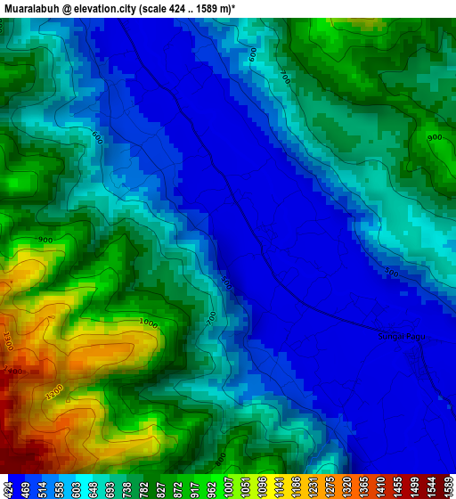
Below is the Elevation map of Muaralabuh, which displays elevation range with different colors. Scale of the first map is from 424 to 1589 m (1391 to 5213 ft) with average elevation of 691.1 meters (=2267 ft) [note 1]
These maps also provides idea of topography and contour of this city, they are displayed at different zoom levels. More info about maps, scale and edge coordinates you can find below images.
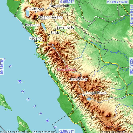
| \ | Map #1 | Topo.Map |
| Scale [m] | 424..1589 m | × |
| Scale [ft] | 1391..5213 ft | × |
| Average | 691.1 m = 2267 ft | × |
| Width | 9.77 km = 6.1 mi | 312.6 km = 194.2 mi |
| Height | 9.77 km = 6.1 mi | 312.6 km = 194.2 mi |
| ↑Max Latitude | -1.418169° | -0.05601° |
| Latitude at center | -1.4621° | -1.4621° |
| ↓Min Latitude | -1.506031° | -2.86731° |
| ← Min Longitude | 100.979055° | 99.61675° |
| Longitude center | 101.023° | 101.023° |
| →Max Longitude | 101.066945° | 102.42925° |
Nearby cities:
Cities around Muaralabuh sort by population:
• Semurup elevation 808 m
70.3 km,  146°
146°
• Siulak 862 m
64 km, 147°
• Pasarbaru 5 m
59.6 km,  287°
287°
• Siulakderasmudik 1160 m
54.5 km,  155°
155°
• Painan 8 m
51.4 km,  283°
283°
• Alahanpanjang 1414 m
50 km,  329°
329°
• Pasarkuok 5 m
44.6 km,  272°
272°
• Mandarahan 61 m
42.9 km,  210°
210°
• Kambang 6 m
42.1 km,  232°
232°
• Lubukgadang 428 m
28.7 km,  104°
104°
• Surian 1061 m
27.8 km, 325°
• Padang Aro 456 m
27.7 km,  105°
105°
Multilingual:
 En español:
Muaralabuh elevación 439 m.
 En France:
Muaralabuh élévation 439 m.
 Auf Deutsch:
Muaralabuh höhe über dem Meeresspiegel ist 439 m.

Sources and notes:
- [note 1] Map square and city borders are not equal. Map elevation data is calculated only from area inside that square.
- [src 1] Elevation data from geonames database provided with same terms of usage.
- [src 2] The elevation map of Muaralabuh is generated using elevation data from NASA's 3 arcsec (90m) resolution SRTM data.
- [src 3] Base (background) map © OpenStreetMap contributors tiles are generated by Geofabrik and OpenTopoMap.
Copyright & License:
This Muaralabuh Elevation Map is licensed under CC BY-SA. You may reuse any part from this page, if you give a proper credit by linking to this URL:
 More info on terms of use page.