Panggul elevation
Panggul (East Java), Indonesia elevation is 13 meters and Panggul elevation in feet is 43 ft above sea level [src 1]. Panggul is a seat of a third-order administrative division (feature code) with elevation that is 178 meters (584 ft) smaller than average city elevation in Indonesia.
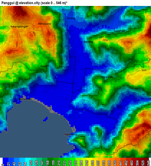
Below is the Elevation map of Panggul, which displays elevation range with different colors. Scale of the first map is from 0 to 546 m (0 to 1791 ft) with average elevation of 178.2 meters (=585 ft) [note 1]
These maps also provides idea of topography and contour of this city, they are displayed at different zoom levels. More info about maps, scale and edge coordinates you can find below images.
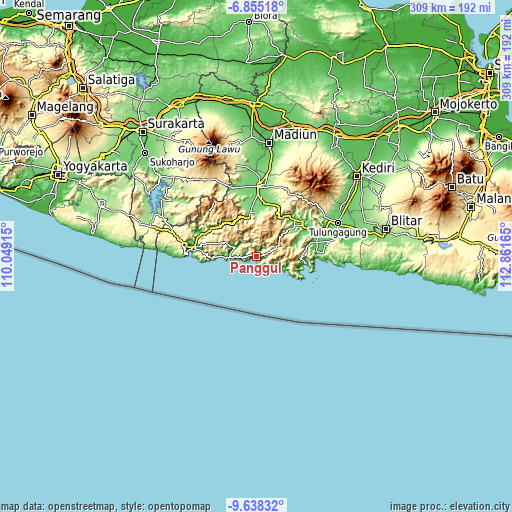
| \ | Map #1 | Topo.Map |
| Scale [m] | 0..546 m | × |
| Scale [ft] | 0..1791 ft | × |
| Average | 178.2 m = 585 ft | × |
| Width | 9.67 km = 6 mi | 309.5 km = 192.3 mi |
| Height | 9.67 km = 6 mi | 309.5 km = 192.3 mi |
| ↑Max Latitude | -8.205707° | -6.85518° |
| Latitude at center | -8.2492° | -8.2492° |
| ↓Min Latitude | -8.292688° | -9.63832° |
| ← Min Longitude | 111.411455° | 110.04915° |
| Longitude center | 111.4554° | 111.4554° |
| →Max Longitude | 111.499345° | 112.86165° |
Nearby cities:
Cities around Panggul sort by population:
• Gondang elevation 124 m
31.6 km,  44°
44°
• Gandusari 108 m
30.5 km,  64°
64°
• Prigi 15 m
28.7 km,  95°
95°
• Karangan 129 m
28.7 km,  51°
51°
• Bungkal 131 m
26.8 km,  359°
359°
• Dawang 171 m
24.2 km,  349°
349°
• Kampak 124 m
24.1 km,  69°
69°
• Ngrayun 528 m
19.7 km, 357°
• Pule 726 m
18.2 km, 39°
• Munjungan 11 m
14.8 km,  113°
113°
• Dongko 535 m
14.8 km, 62°
• Sukorejo 38 m
8.3 km,  271°
271°
Multilingual:
 En español:
Panggul elevación 13 m.
 En France:
Panggul élévation 13 m.


Sources and notes:
- [note 1] Map square and city borders are not equal. Map elevation data is calculated only from area inside that square.
- [src 1] Elevation data from geonames database provided with same terms of usage.
- [src 2] The elevation map of Panggul is generated using elevation data from NASA's 3 arcsec (90m) resolution SRTM data.
- [src 3] Base (background) map © OpenStreetMap contributors tiles are generated by Geofabrik and OpenTopoMap.
Copyright & License:
This Panggul Elevation Map is licensed under CC BY-SA. You may reuse any part from this page, if you give a proper credit by linking to this URL:
 More info on terms of use page.