Sinjai elevation
Sinjai (South Sulawesi), Indonesia elevation is 6 meters and Sinjai elevation in feet is 20 ft above sea level [src 1]. Sinjai is a seat of a second-order administrative division (feature code) with elevation that is 185 meters (607 ft) smaller than average city elevation in Indonesia.
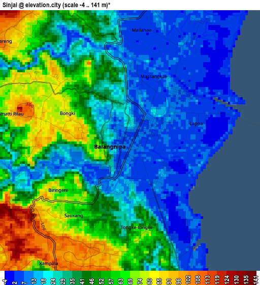
Below is the Elevation map of Sinjai, which displays elevation range with different colors. Scale of the first map is from -4 to 141 m (-13 to 463 ft) with average elevation of 39 meters (=128 ft) [note 1]
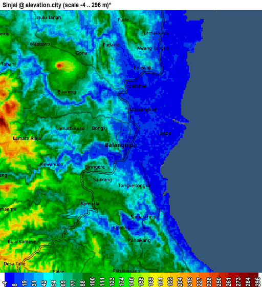
These maps also provides idea of topography and contour of this city, they are displayed at different zoom levels. More info about maps, scale and edge coordinates you can find below images.
| \ | Map #1 | Map #2 | Topo.Map |
| Scale [m] | -4..141 m | -4..296 m | × |
| Scale [ft] | -13..463 ft | -13..971 ft | × |
| Average | 39 m = 128 ft | 70.7 m = 232 ft | × |
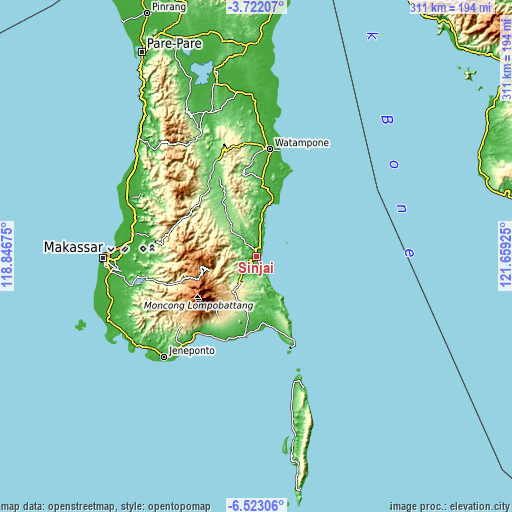
| Width | 9.73 km = 6 mi | 19.47 km = 12.1 mi | 311.4 km = 193.5 mi |
| Height | 9.73 km = 6 mi | 19.47 km = 12.1 mi | 311.5 km = 193.6 mi |
| ↑Max Latitude | -5.080329° | -5.036555° | -3.72207° |
| Latitude at center | -5.1241° | -5.1241° | -5.1241° |
| ↓Min Latitude | -5.167868° | -5.211633° | -6.52306° |
| ← Min Longitude | 120.209055° | 120.165109° | 118.84675° |
| Longitude center | 120.253° | 120.253° | 120.253° |
| →Max Longitude | 120.296945° | 120.340891° | 121.65925° |
Nearby cities:
Cities around Sinjai sort by population:
• Watampone elevation 34 m
65.6 km,  7°
7°
• Maros 9 m
76.5 km,  279°
279°
• Taccipi 173 m
69.1 km,  353°
353°
• Palakka 58 m
66 km,  3°
3°
• Matango 101 m
57.8 km,  332°
332°
• Bantaeng 10 m
57.7 km,  215°
215°
• Apala 33 m
57.3 km, 6°
• Bulukumba 10 m
48 km,  189°
189°
• Camming 118 m
39.8 km, 330°
• Kadai 24 m
36.5 km,  15°
15°
• Bulubulu 17 m
23.7 km, 7°
• Palattae 156 m
23 km,  317°
317°
Multilingual:
 En español:
Sinjai elevación 6 m.
 En France:
Sinjai élévation 6 m.


Sources and notes:
- [note 1] Map square and city borders are not equal. Map elevation data is calculated only from area inside that square.
- [src 1] Elevation data from geonames database provided with same terms of usage.
- [src 2] The elevation map of Sinjai is generated using elevation data from NASA's 3 arcsec (90m) resolution SRTM data.
- [src 3] Base (background) map © OpenStreetMap contributors tiles are generated by Geofabrik and OpenTopoMap.
Copyright & License:
This Sinjai Elevation Map is licensed under CC BY-SA. You may reuse any part from this page, if you give a proper credit by linking to this URL:
 More info on terms of use page.