Waingapu elevation
Waingapu (East Nusa Tenggara), Indonesia elevation is 26 meters and Waingapu elevation in feet is 85 ft above sea level [src 1]. Waingapu is a seat of a second-order administrative division (feature code) with elevation that is 165 meters (541 ft) smaller than average city elevation in Indonesia.
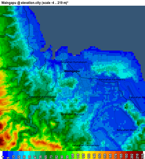
Below is the Elevation map of Waingapu, which displays elevation range with different colors. Scale of the first map is from -4 to 219 m (-13 to 719 ft) with average elevation of 47.8 meters (=157 ft) [note 1]
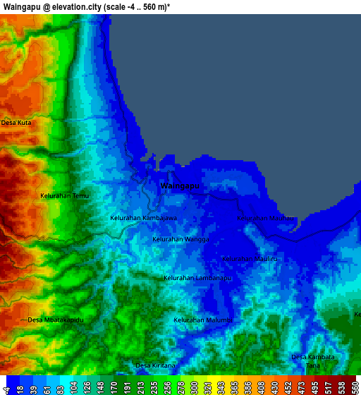
These maps also provides idea of topography and contour of this city, they are displayed at different zoom levels. More info about maps, scale and edge coordinates you can find below images.
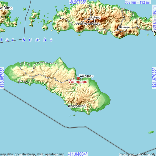
| \ | Map #1 | Map #2 | Topo.Map |
| Scale [m] | -4..219 m | -4..560 m | × |
| Scale [ft] | -13..719 ft | -13..1837 ft | × |
| Average | 47.8 m = 157 ft | 160.8 m = 528 ft | × |
| Width | 9.63 km = 6 mi | 19.27 km = 12 mi | 308.3 km = 191.6 mi |
| Height | 9.63 km = 6 mi | 19.27 km = 12 mi | 308.3 km = 191.6 mi |
| ↑Max Latitude | -9.613375° | -9.570044° | -8.26765° |
| Latitude at center | -9.6567° | -9.6567° | -9.6567° |
| ↓Min Latitude | -9.70002° | -9.743334° | -11.04004° |
| ← Min Longitude | 120.220155° | 120.176209° | 118.85785° |
| Longitude center | 120.2641° | 120.2641° | 120.2641° |
| →Max Longitude | 120.308045° | 120.351991° | 121.67035° |
Nearby cities:
Cities around Waingapu sort by population:
• Kabukarudi elevation 167 m
99.4 km,  265°
265°
• Waikabubak 431 m
95.9 km, 270°
• Iteng 47 m
95.5 km,  10°
10°
• Waibakul 420 m
93.3 km, 271°
• Kotawaikabubak 423 m
92.2 km, 271°
• Ngalu 37 m
72.9 km,  138°
138°
• Nggongi 29 m
59.9 km,  183°
183°
• Kananggar 729 m
44.3 km,  165°
165°
• Malahar 241 m
38.7 km,  212°
212°
• Rambangaru 14 m
32.7 km,  314°
314°
• Kawangu 10 m
8.6 km,  102°
102°
• Kamalaputi 7 m
0.9 km,  355°
355°
Multilingual:
 En español:
Waingapu elevación 26 m.
 En France:
Waingapu élévation 26 m.


Sources and notes:
- [note 1] Map square and city borders are not equal. Map elevation data is calculated only from area inside that square.
- [src 1] Elevation data from geonames database provided with same terms of usage.
- [src 2] The elevation map of Waingapu is generated using elevation data from NASA's 3 arcsec (90m) resolution SRTM data.
- [src 3] Base (background) map © OpenStreetMap contributors tiles are generated by Geofabrik and OpenTopoMap.
Copyright & License:
This Waingapu Elevation Map is licensed under CC BY-SA. You may reuse any part from this page, if you give a proper credit by linking to this URL:
 More info on terms of use page.