Percut elevation
Percut (North Sumatra), Indonesia elevation is 11 meters and Percut elevation in feet is 36 ft above sea level [src 1]. Percut is a populated place (feature code) with elevation that is 180 meters (591 ft) smaller than average city elevation in Indonesia.
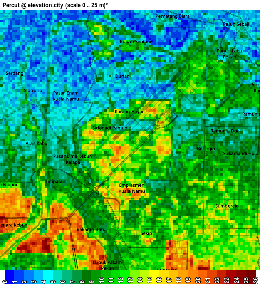
Below is the Elevation map of Percut, which displays elevation range with different colors. Scale of the first map is from 0 to 25 m (0 to 82 ft) with average elevation of 8.7 meters (=29 ft) [note 1]
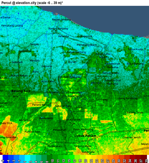
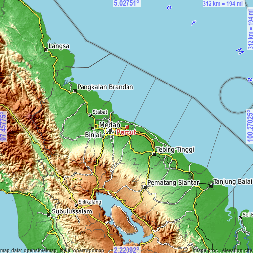
These maps also provides idea of topography and contour of this city, they are displayed at different zoom levels. More info about maps, scale and edge coordinates you can find below images.
| \ | Map #1 | Map #2 | Topo.Map |
| Scale [m] | 0..25 m | -6..39 m | × |
| Scale [ft] | 0..82 ft | -20..128 ft | × |
| Average | 8.7 m = 29 ft | 9.7 m = 32 ft | × |
| Width | 9.75 km = 6.1 mi | 19.51 km = 12.1 mi | 312.1 km = 193.9 mi |
| Height | 9.75 km = 6.1 mi | 19.51 km = 12.1 mi | 312.1 km = 193.9 mi |
| ↑Max Latitude | 3.669156° | 3.71301° | 5.02751° |
| Latitude at center | 3.6253° | 3.6253° | 3.6253° |
| ↓Min Latitude | 3.581442° | 3.537581° | 2.22092° |
| ← Min Longitude | 98.820055° | 98.776109° | 97.45775° |
| Longitude center | 98.864° | 98.864° | 98.864° |
| →Max Longitude | 98.907945° | 98.951891° | 100.27025° |
Nearby cities:
Cities around Percut sort by population:
• Medan elevation 26 m
22.4 km,  257°
257°
• Binjai 34 m
42.1 km,  266°
266°
• Sunggal 32 m
28.1 km, 258°
• Perbaungan 19 m
12 km,  122°
122°
• Tebingtinggi 24 m
46.8 km,  134°
134°
• Belawan 5 m
26.1 km,  309°
309°
• Labuhan Deli 4 m
24 km,  298°
298°
• Berastagi 1402 m
62 km,  219°
219°
• Deli Tua 56 m
23.9 km,  236°
236°
• Stabat 12 m
47.5 km,  284°
284°
• Sei Rampah 7 m
34.1 km, 117°
• Lubuk Pakam 16 m
7.4 km,  172°
172°
Multilingual:
 En español:
Percut elevación 11 m.
 En France:
Percut élévation 11 m.


Sources and notes:
- [note 1] Map square and city borders are not equal. Map elevation data is calculated only from area inside that square.
- [src 1] Elevation data from geonames database provided with same terms of usage.
- [src 2] The elevation map of Percut is generated using elevation data from NASA's 3 arcsec (90m) resolution SRTM data.
- [src 3] Base (background) map © OpenStreetMap contributors tiles are generated by Geofabrik and OpenTopoMap.
Copyright & License:
This Percut Elevation Map is licensed under CC BY-SA. You may reuse any part from this page, if you give a proper credit by linking to this URL:
 More info on terms of use page.