Csenger elevation
Csenger (Szabolcs-Szatmár-Bereg), Hungary elevation is 120 meters and Csenger elevation in feet is 394 ft above sea level [src 1]. Csenger is a seat of a second-order administrative division (feature code) with elevation that is 9 meters (30 ft) smaller than average city elevation in Hungary.
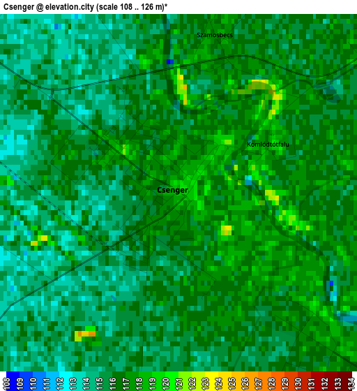
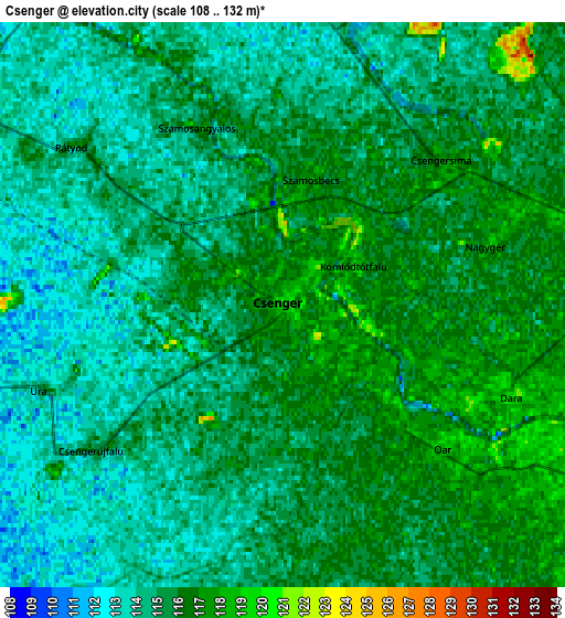
Below is the Elevation map of Csenger, which displays elevation range with different colors. Scale of the first map is from 108 to 126 m (354 to 413 ft) with average elevation of 115.7 meters (=380 ft) [note 1]
These maps also provides idea of topography and contour of this city, they are displayed at different zoom levels. More info about maps, scale and edge coordinates you can find below images.
| \ | Map #1 | Map #2 | Topo.Map |
| Scale [m] | 108..126 m | 108..132 m | × |
| Scale [ft] | 354..413 ft | 354..433 ft | × |
| Average | 115.7 m = 380 ft | 114.9 m = 377 ft | × |
| Width | 6.56 km = 4.1 mi | 13.12 km = 8.2 mi | 209.9 km = 130.4 mi |
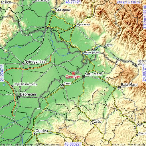
| Height | 6.56 km = 4.1 mi | 13.12 km = 8.2 mi | 209.9 km = 130.4 mi |
| ↑Max Latitude | 47.86531° | 47.894784° | 48.7712° |
| Latitude at center | 47.83582° | 47.83582° | 47.83582° |
| ↓Min Latitude | 47.806313° | 47.776789° | 46.88327° |
| ← Min Longitude | 22.637015° | 22.593069° | 21.27471° |
| Longitude center | 22.68096° | 22.68096° | 22.68096° |
| →Max Longitude | 22.724905° | 22.768851° | 24.08721° |
Nearby cities:
Cities around Csenger sort by population:
• Mátészalka elevation 124 m
29.8 km,  296°
296°
• Fehérgyarmat 111 m
20.5 km,  323°
323°
• Nagyecsed 115 m
21.8 km,  278°
278°
• Kocsord 112 m
25 km, 297°
• Ópályi 118 m
32 km, 304°
• Porcsalma 118 m
10 km, 301°
• Tunyogmatolcs 110 m
21.6 km,  312°
312°
• Mérk 117 m
23.1 km,  256°
256°
• Tarpa 109 m
31.8 km,  340°
340°
• Nyírcsaholy 119 m
26.8 km,  286°
286°
• Tyukod 109 m
9 km, 282°
• Ököritófülpös 115 m
15.8 km, 305°
Multilingual:
 En español:
Csenger elevación 120 m.
 En France:
Csenger élévation 120 m.


Sources and notes:
- [note 1] Map square and city borders are not equal. Map elevation data is calculated only from area inside that square.
- [src 1] Elevation data from geonames database provided with same terms of usage.
- [src 2] The elevation map of Csenger is generated using elevation data from NASA's 3 arcsec (90m) resolution SRTM data.
- [src 3] Base (background) map © OpenStreetMap contributors tiles are generated by Geofabrik and OpenTopoMap.
Copyright & License:
This Csenger Elevation Map is licensed under CC BY-SA. You may reuse any part from this page, if you give a proper credit by linking to this URL:
 More info on terms of use page.