Doboz elevation
Doboz (Bekes), Hungary elevation is 84 meters and Doboz elevation in feet is 276 ft above sea level [src 1]. Doboz is a populated place (feature code) with elevation that is 45 meters (148 ft) smaller than average city elevation in Hungary.
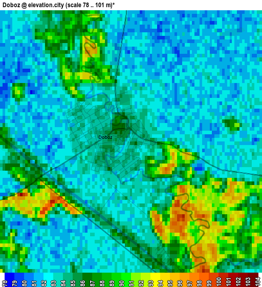
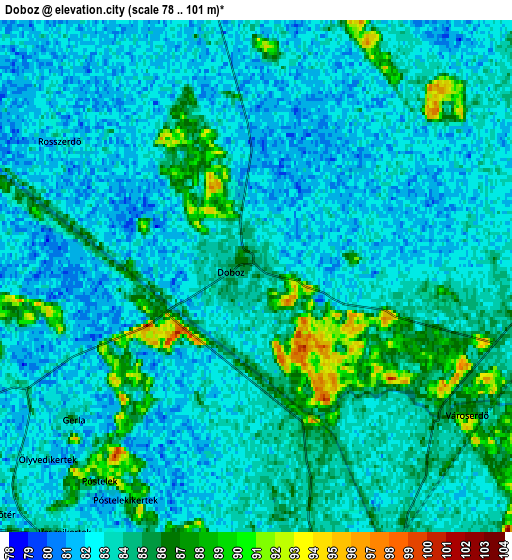
Below is the Elevation map of Doboz, which displays elevation range with different colors. Scale of the first map is from 78 to 101 m (256 to 331 ft) with average elevation of 84.2 meters (=276 ft) [note 1]
These maps also provides idea of topography and contour of this city, they are displayed at different zoom levels. More info about maps, scale and edge coordinates you can find below images.
| \ | Map #1 | Map #2 | Topo.Map |
| Scale [m] | 78..101 m | 78..101 m | × |
| Scale [ft] | 256..331 ft | 256..331 ft | × |
| Average | 84.2 m = 276 ft | 83.2 m = 273 ft | × |
| Width | 6.7 km = 4.2 mi | 13.4 km = 8.3 mi | 214.3 km = 133.2 mi |
| Height | 6.7 km = 4.2 mi | 13.4 km = 8.3 mi | 214.3 km = 133.2 mi |
| ↑Max Latitude | 46.763441° | 46.793536° | 47.68856° |
| Latitude at center | 46.73333° | 46.73333° | 46.73333° |
| ↓Min Latitude | 46.703202° | 46.673057° | 45.76088° |
| ← Min Longitude | 21.206055° | 21.162109° | 19.84375° |
| Longitude center | 21.25° | 21.25° | 21.25° |
| →Max Longitude | 21.293945° | 21.337891° | 22.65625° |
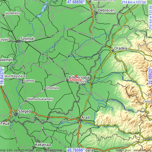
Nearby cities:
Cities around Doboz sort by population:
• Békéscsaba elevation 87 m
12.7 km,  244°
244°
• Gyula 86 m
9.6 km,  164°
164°
• Békés 83 m
9.6 km,  292°
292°
• Mezőberény 81 m
18.9 km,  299°
299°
• Sarkad 86 m
10.3 km,  79°
79°
• Vésztő 83 m
20.4 km,  3°
3°
• Újkígyós 91 m
23.5 km,  224°
224°
• Elek 93 m
22.2 km,  180°
180°
• Kétegyháza 90 m
22.8 km,  192°
192°
• Szabadkígyós 83 m
17.3 km, 221°
• Okány 87 m
20 km,  22°
22°
• Méhkerék 87 m
16.2 km,  69°
69°
Multilingual:
 En español:
Doboz elevación 84 m.
 En France:
Doboz élévation 84 m.


Sources and notes:
- [note 1] Map square and city borders are not equal. Map elevation data is calculated only from area inside that square.
- [src 1] Elevation data from geonames database provided with same terms of usage.
- [src 2] The elevation map of Doboz is generated using elevation data from NASA's 3 arcsec (90m) resolution SRTM data.
- [src 3] Base (background) map © OpenStreetMap contributors tiles are generated by Geofabrik and OpenTopoMap.
Copyright & License:
This Doboz Elevation Map is licensed under CC BY-SA. You may reuse any part from this page, if you give a proper credit by linking to this URL:
 More info on terms of use page.