Kiszombor elevation
Kiszombor (Csongrád), Hungary elevation is 79 meters and Kiszombor elevation in feet is 259 ft above sea level [src 1]. Kiszombor is a populated place (feature code) with elevation that is 50 meters (164 ft) smaller than average city elevation in Hungary.
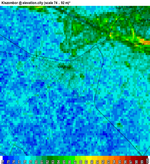
Below is the Elevation map of Kiszombor, which displays elevation range with different colors. Scale of the first map is from 74 to 92 m (243 to 302 ft) with average elevation of 78 meters (=256 ft) [note 1]
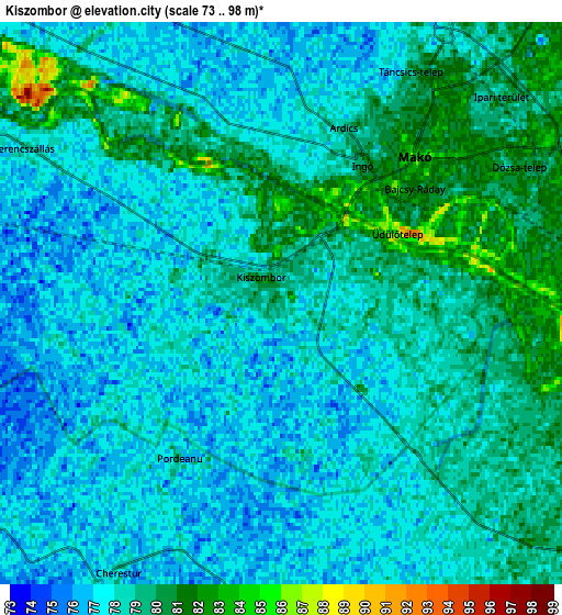
These maps also provides idea of topography and contour of this city, they are displayed at different zoom levels. More info about maps, scale and edge coordinates you can find below images.
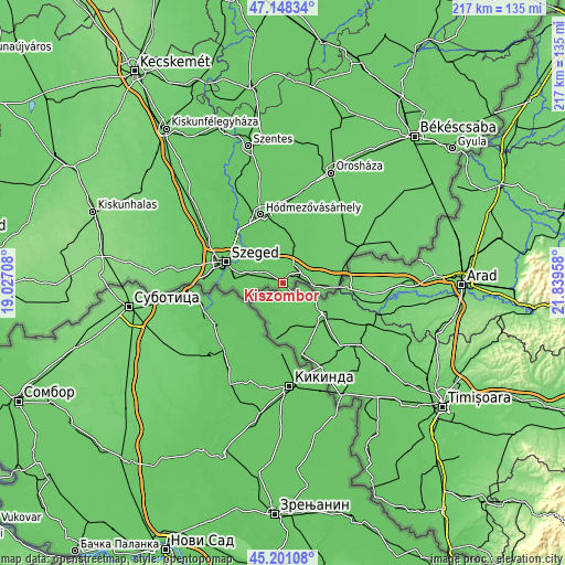
| \ | Map #1 | Map #2 | Topo.Map |
| Scale [m] | 74..92 m | 73..98 m | × |
| Scale [ft] | 243..302 ft | 240..322 ft | × |
| Average | 78 m = 256 ft | 78 m = 256 ft | × |
| Width | 6.77 km = 4.2 mi | 13.53 km = 8.4 mi | 216.5 km = 134.5 mi |
| Height | 6.77 km = 4.2 mi | 13.53 km = 8.4 mi | 216.5 km = 134.5 mi |
| ↑Max Latitude | 46.213747° | 46.244148° | 47.14834° |
| Latitude at center | 46.18333° | 46.18333° | 46.18333° |
| ↓Min Latitude | 46.152896° | 46.122445° | 45.20108° |
| ← Min Longitude | 20.389385° | 20.345439° | 19.02708° |
| Longitude center | 20.43333° | 20.43333° | 20.43333° |
| →Max Longitude | 20.477275° | 20.521221° | 21.83958° |
Nearby cities:
Cities around Kiszombor sort by population:
• Szeged elevation 84 m
23.3 km,  289°
289°
• Hódmezővásárhely 80 m
27.1 km,  343°
343°
• Makó 81 m
5.3 km,  46°
46°
• Sándorfalva 83 m
32.4 km,  307°
307°
• Algyő 78 m
24.1 km, 314°
• Apátfalva 82 m
11.7 km,  99°
99°
• Földeák 81 m
15.7 km,  19°
19°
• Deszk 78 m
15.1 km,  284°
284°
• Röszke 79 m
30.8 km,  270°
270°
• Csanádpalota 86 m
24.2 km,  72°
72°
• Békéssámson 85 m
30.2 km,  30°
30°
• Maroslele 75 m
11.3 km,  325°
325°
Multilingual:
 En español:
Kiszombor elevación 79 m.
 En France:
Kiszombor élévation 79 m.
 Auf Deutsch:
Kiszombor höhe über dem Meeresspiegel ist 79 m.

Sources and notes:
- [note 1] Map square and city borders are not equal. Map elevation data is calculated only from area inside that square.
- [src 1] Elevation data from geonames database provided with same terms of usage.
- [src 2] The elevation map of Kiszombor is generated using elevation data from NASA's 3 arcsec (90m) resolution SRTM data.
- [src 3] Base (background) map © OpenStreetMap contributors tiles are generated by Geofabrik and OpenTopoMap.
Copyright & License:
This Kiszombor Elevation Map is licensed under CC BY-SA. You may reuse any part from this page, if you give a proper credit by linking to this URL:
 More info on terms of use page.