Rákóczifalva elevation
Rákóczifalva (Jász-Nagykun-Szolnok), Hungary elevation is 85 meters and Rákóczifalva elevation in feet is 279 ft above sea level [src 1]. Rákóczifalva is a populated place (feature code) with elevation that is 44 meters (144 ft) smaller than average city elevation in Hungary.
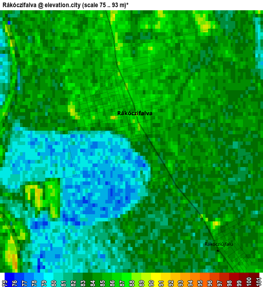
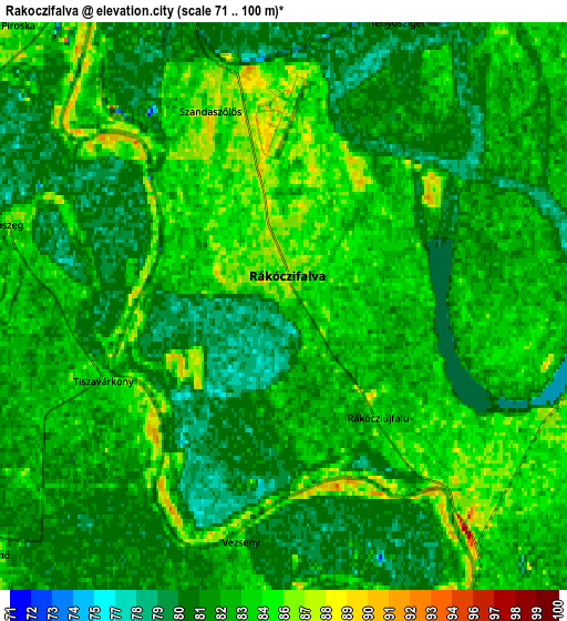
Below is the Elevation map of Rákóczifalva, which displays elevation range with different colors. Scale of the first map is from 75 to 93 m (246 to 305 ft) with average elevation of 82.9 meters (=272 ft) [note 1]
These maps also provides idea of topography and contour of this city, they are displayed at different zoom levels. More info about maps, scale and edge coordinates you can find below images.
| \ | Map #1 | Map #2 | Topo.Map |
| Scale [m] | 75..93 m | 71..100 m | × |
| Scale [ft] | 246..305 ft | 233..328 ft | × |
| Average | 82.9 m = 272 ft | 82.5 m = 271 ft | × |
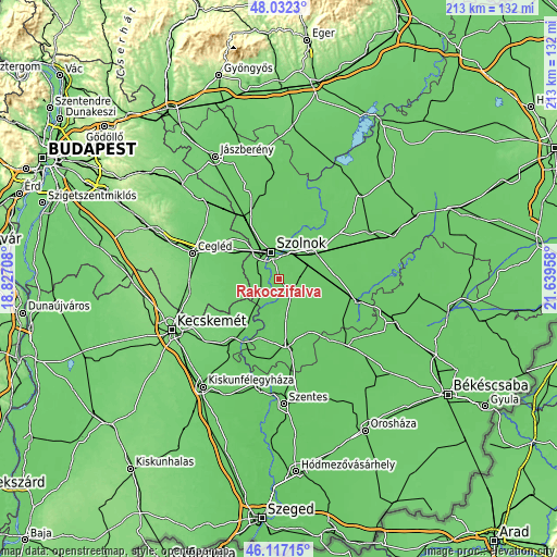
| Width | 6.65 km = 4.1 mi | 13.31 km = 8.3 mi | 212.9 km = 132.3 mi |
| Height | 6.65 km = 4.1 mi | 13.31 km = 8.3 mi | 212.9 km = 132.3 mi |
| ↑Max Latitude | 47.113245° | 47.143144° | 48.0323° |
| Latitude at center | 47.08333° | 47.08333° | 47.08333° |
| ↓Min Latitude | 47.053398° | 47.023449° | 46.11715° |
| ← Min Longitude | 20.189385° | 20.145439° | 18.82708° |
| Longitude center | 20.23333° | 20.23333° | 20.23333° |
| →Max Longitude | 20.277275° | 20.321221° | 21.63958° |
Nearby cities:
Cities around Rákóczifalva sort by population:
• Szolnok elevation 85 m
11.4 km,  347°
347°
• Törökszentmiklós 82 m
17.8 km,  51°
51°
• Abony 91 m
21 km,  304°
304°
• Tiszaföldvár 86 m
11.2 km,  173°
173°
• Tiszakécske 85 m
19.4 km,  210°
210°
• Tószeg 84 m
6.6 km,  286°
286°
• Cibakháza 85 m
14 km,  191°
191°
• Kengyel 85 m
7.6 km,  90°
90°
• Szajol 81 m
12.2 km,  24°
24°
• Jászkarajenő 83 m
13.2 km,  253°
253°
• Tiszapüspöki 84 m
16.1 km, 23°
• Rákócziújfalu 83 m
3.1 km,  126°
126°
Multilingual:
 En español:
Rákóczifalva elevación 85 m.
 En France:
Rákóczifalva élévation 85 m.
 Auf Deutsch:
Rákóczifalva höhe über dem Meeresspiegel ist 85 m.

Sources and notes:
- [note 1] Map square and city borders are not equal. Map elevation data is calculated only from area inside that square.
- [src 1] Elevation data from geonames database provided with same terms of usage.
- [src 2] The elevation map of Rákóczifalva is generated using elevation data from NASA's 3 arcsec (90m) resolution SRTM data.
- [src 3] Base (background) map © OpenStreetMap contributors tiles are generated by Geofabrik and OpenTopoMap.
Copyright & License:
This Rákóczifalva Elevation Map is licensed under CC BY-SA. You may reuse any part from this page, if you give a proper credit by linking to this URL:
 More info on terms of use page.