Vaja elevation
Vaja (Szabolcs-Szatmár-Bereg), Hungary elevation is 140 meters and Vaja elevation in feet is 459 ft above sea level [src 1]. Vaja is a populated place (feature code) with elevation that is 11 meters (36 ft) bigger than average city elevation in Hungary.
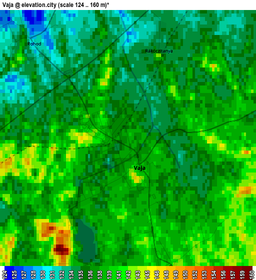
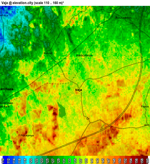
Below is the Elevation map of Vaja, which displays elevation range with different colors. Scale of the first map is from 124 to 160 m (407 to 525 ft) with average elevation of 137.2 meters (=450 ft) [note 1]
These maps also provides idea of topography and contour of this city, they are displayed at different zoom levels. More info about maps, scale and edge coordinates you can find below images.
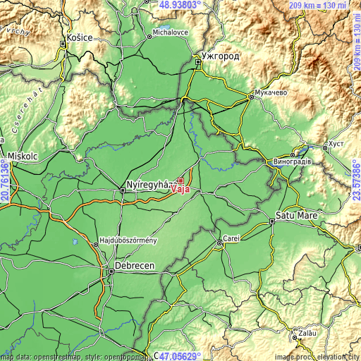
| \ | Map #1 | Map #2 | Topo.Map |
| Scale [m] | 124..160 m | 110..160 m | × |
| Scale [ft] | 407..525 ft | 361..525 ft | × |
| Average | 137.2 m = 450 ft | 136.1 m = 447 ft | × |
| Width | 6.54 km = 4.1 mi | 13.08 km = 8.1 mi | 209.2 km = 130 mi |
| Height | 6.54 km = 4.1 mi | 13.08 km = 8.1 mi | 209.2 km = 130 mi |
| ↑Max Latitude | 48.035134° | 48.06451° | 48.93803° |
| Latitude at center | 48.00574° | 48.00574° | 48.00574° |
| ↓Min Latitude | 47.97633° | 47.946903° | 47.05629° |
| ← Min Longitude | 22.123665° | 22.079719° | 20.76136° |
| Longitude center | 22.16761° | 22.16761° | 22.16761° |
| →Max Longitude | 22.211555° | 22.255501° | 23.57386° |
Nearby cities:
Cities around Vaja sort by population:
• Mátészalka elevation 124 m
12.9 km,  115°
115°
• Nyírmada 129 m
7.2 km,  19°
19°
• Baktalórántháza 130 m
6.3 km,  264°
264°
• Hodász 147 m
10 km,  165°
165°
• Ópályi 118 m
11.8 km,  94°
94°
• Nyírmeggyes 135 m
12.3 km,  143°
143°
• Ófehértó 136 m
11.9 km,  227°
227°
• Nyírkarász 112 m
11 km,  334°
334°
• Nagydobos 116 m
11.7 km,  60°
60°
• Kántorjánosi 146 m
8.2 km,  189°
189°
• Nyírgyulaj 144 m
14.3 km,  201°
201°
• Petneháza 114 m
9.2 km,  311°
311°
Multilingual:
 En español:
Vaja elevación 140 m.
 En France:
Vaja élévation 140 m.


Sources and notes:
- [note 1] Map square and city borders are not equal. Map elevation data is calculated only from area inside that square.
- [src 1] Elevation data from geonames database provided with same terms of usage.
- [src 2] The elevation map of Vaja is generated using elevation data from NASA's 3 arcsec (90m) resolution SRTM data.
- [src 3] Base (background) map © OpenStreetMap contributors tiles are generated by Geofabrik and OpenTopoMap.
Copyright & License:
This Vaja Elevation Map is licensed under CC BY-SA. You may reuse any part from this page, if you give a proper credit by linking to this URL:
 More info on terms of use page.