Budapest XXIII. kerület elevation
Budapest XXIII. kerület (Budapest), Hungary elevation is 105 meters and Budapest XXIII. kerület elevation in feet is 344 ft above sea level [src 1]. Budapest XXIII. kerület is a section of populated place (feature code) with elevation that is 24 meters (79 ft) smaller than average city elevation in Hungary.
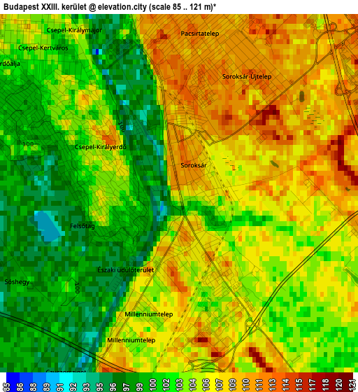
Below is the Elevation map of Budapest XXIII. kerület, which displays elevation range with different colors. Scale of the first map is from 85 to 121 m (279 to 397 ft) with average elevation of 104.4 meters (=343 ft) [note 1]
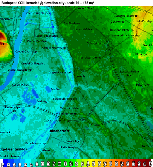
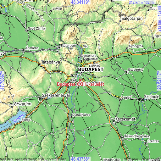
These maps also provides idea of topography and contour of this city, they are displayed at different zoom levels. More info about maps, scale and edge coordinates you can find below images.
| \ | Map #1 | Map #2 | Topo.Map |
| Scale [m] | 85..121 m | 79..175 m | × |
| Scale [ft] | 279..397 ft | 259..574 ft | × |
| Average | 104.4 m = 343 ft | 106.7 m = 350 ft | × |
| Width | 6.62 km = 4.1 mi | 13.23 km = 8.2 mi | 211.7 km = 131.5 mi |
| Height | 6.62 km = 4.1 mi | 13.23 km = 8.2 mi | 211.7 km = 131.5 mi |
| ↑Max Latitude | 47.427618° | 47.45734° | 48.34119° |
| Latitude at center | 47.39788° | 47.39788° | 47.39788° |
| ↓Min Latitude | 47.368125° | 47.338353° | 46.43738° |
| ← Min Longitude | 19.070975° | 19.027029° | 17.70867° |
| Longitude center | 19.11492° | 19.11492° | 19.11492° |
| →Max Longitude | 19.158865° | 19.202811° | 20.52117° |
Nearby cities:
Cities around Budapest XXIII. kerület sort by population:
• Budapest XVIII. kerület elevation 127 m
6.9 km,  41°
41°
• Budapest X. kerület 136 m
9.6 km,  19°
19°
• Budapest XXI. kerület 105 m
4.9 km,  317°
317°
• Budapest XX. kerület 114 m
4.4 km,  346°
346°
• Budapest XIX. kerület 124 m
6.6 km, 22°
• Kispest 115 m
6.3 km, 17°
• Budapest XXII. kerület 104 m
6.5 km,  299°
299°
• Szigetszentmiklós 99 m
8.1 km,  221°
221°
• Gyál 113 m
8.2 km,  100°
100°
• Dunaharaszti 100 m
5 km,  194°
194°
• Taksony 105 m
8.4 km,  205°
205°
• Alsónémedi 102 m
9.8 km,  160°
160°
Multilingual:
 En español:
Budapest XXIII. kerület elevación 105 m.
 En France:
Budapest XXIII. kerület élévation 105 m.
 Auf Deutsch:
Budapest XXIII. kerület höhe über dem Meeresspiegel ist 105 m.
 На русском:
Budapest XXIII. kerület высота над уровнем моря 105 м
Sources and notes:
- [note 1] Map square and city borders are not equal. Map elevation data is calculated only from area inside that square.
- [src 1] Elevation data from geonames database provided with same terms of usage.
- [src 2] The elevation map of Budapest XXIII. kerület is generated using elevation data from NASA's 3 arcsec (90m) resolution SRTM data.
- [src 3] Base (background) map © OpenStreetMap contributors tiles are generated by Geofabrik and OpenTopoMap.
Copyright & License:
This Budapest XXIII. kerület Elevation Map is licensed under CC BY-SA. You may reuse any part from this page, if you give a proper credit by linking to this URL:
 More info on terms of use page.