Ács elevation
Ács (Komárom-Esztergom), Hungary elevation is 116 meters and Ács elevation in feet is 381 ft above sea level [src 1]. Ács is a populated place (feature code) with elevation that is 13 meters (43 ft) smaller than average city elevation in Hungary.
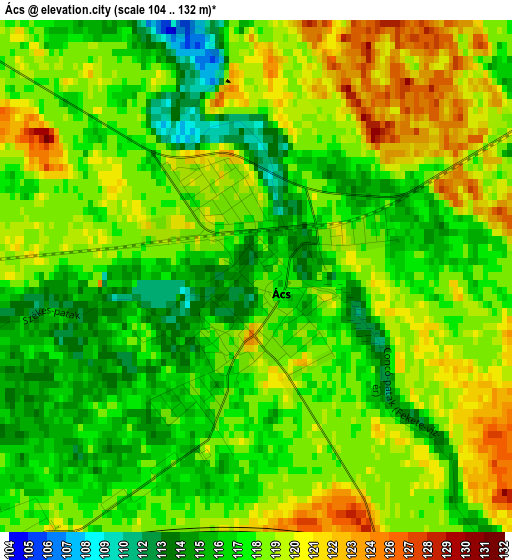
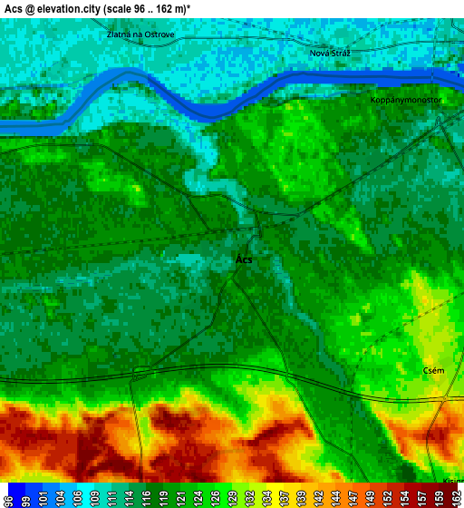
Below is the Elevation map of Ács, which displays elevation range with different colors. Scale of the first map is from 104 to 132 m (341 to 433 ft) with average elevation of 118 meters (=387 ft) [note 1]
These maps also provides idea of topography and contour of this city, they are displayed at different zoom levels. More info about maps, scale and edge coordinates you can find below images.
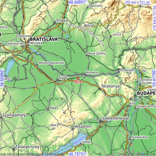
| \ | Map #1 | Map #2 | Topo.Map |
| Scale [m] | 104..132 m | 96..162 m | × |
| Scale [ft] | 341..433 ft | 315..531 ft | × |
| Average | 118 m = 387 ft | 120.9 m = 397 ft | × |
| Width | 6.58 km = 4.1 mi | 13.15 km = 8.2 mi | 210.4 km = 130.7 mi |
| Height | 6.58 km = 4.1 mi | 13.15 km = 8.2 mi | 210.4 km = 130.7 mi |
| ↑Max Latitude | 47.74187° | 47.771414° | 48.64993° |
| Latitude at center | 47.71231° | 47.71231° | 47.71231° |
| ↓Min Latitude | 47.682733° | 47.653139° | 46.75751° |
| ← Min Longitude | 17.967365° | 17.923419° | 16.60506° |
| Longitude center | 18.01131° | 18.01131° | 18.01131° |
| →Max Longitude | 18.055255° | 18.099201° | 19.41756° |
Nearby cities:
Cities around Ács sort by population:
• Komárom elevation 112 m
8.8 km,  66°
66°
• Kisbér 177 m
23.4 km,  175°
175°
• Bábolna 134 m
8 km,  198°
198°
• Nagyigmánd 128 m
9.5 km,  146°
146°
• Kocs 141 m
19.2 km,  127°
127°
• Pér 128 m
19 km,  233°
233°
• Almásfüzitő 112 m
18.8 km,  84°
84°
• Mocsa 129 m
13.8 km,  109°
109°
• Naszály 117 m
18.4 km,  93°
93°
• Bőny 125 m
12.7 km,  236°
236°
• Töltéstava 121 m
22.9 km,  245°
245°
• Dunaalmás 128 m
23.3 km, 85°
Multilingual:
 En español:
Ács elevación 116 m.
 En France:
Ács élévation 116 m.


Sources and notes:
- [note 1] Map square and city borders are not equal. Map elevation data is calculated only from area inside that square.
- [src 1] Elevation data from geonames database provided with same terms of usage.
- [src 2] The elevation map of Ács is generated using elevation data from NASA's 3 arcsec (90m) resolution SRTM data.
- [src 3] Base (background) map © OpenStreetMap contributors tiles are generated by Geofabrik and OpenTopoMap.
Copyright & License:
This Ács Elevation Map is licensed under CC BY-SA. You may reuse any part from this page, if you give a proper credit by linking to this URL:
 More info on terms of use page.