Ásotthalom elevation
Ásotthalom (Csongrád), Hungary elevation is 110 meters and Ásotthalom elevation in feet is 361 ft above sea level [src 1]. Ásotthalom is a populated place (feature code) with elevation that is 19 meters (62 ft) smaller than average city elevation in Hungary.
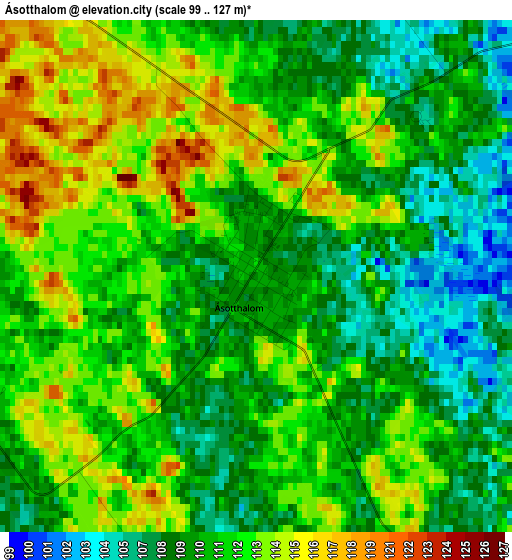
Below is the Elevation map of Ásotthalom, which displays elevation range with different colors. Scale of the first map is from 99 to 127 m (325 to 417 ft) with average elevation of 110.9 meters (=364 ft) [note 1]
These maps also provides idea of topography and contour of this city, they are displayed at different zoom levels. More info about maps, scale and edge coordinates you can find below images.
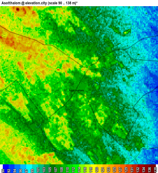
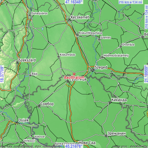
| \ | Map #1 | Map #2 | Topo.Map |
| Scale [m] | 99..127 m | 90..138 m | × |
| Scale [ft] | 325..417 ft | 295..453 ft | × |
| Average | 110.9 m = 364 ft | 108.5 m = 356 ft | × |
| Width | 6.76 km = 4.2 mi | 13.53 km = 8.4 mi | 216.5 km = 134.5 mi |
| Height | 6.76 km = 4.2 mi | 13.53 km = 8.4 mi | 216.4 km = 134.5 mi |
| ↑Max Latitude | 46.229159° | 46.259551° | 47.16348° |
| Latitude at center | 46.19875° | 46.19875° | 46.19875° |
| ↓Min Latitude | 46.168324° | 46.137882° | 45.21678° |
| ← Min Longitude | 19.739395° | 19.695449° | 18.37709° |
| Longitude center | 19.78334° | 19.78334° | 19.78334° |
| →Max Longitude | 19.827285° | 19.871231° | 21.18959° |
Nearby cities:
Cities around Ásotthalom sort by population:
• Mórahalom elevation 92 m
8.1 km,  74°
74°
• Tompa 131 m
18.8 km,  272°
272°
• Domaszék 83 m
18.4 km, 72°
• Zsombó 87 m
20.4 km,  46°
46°
• Röszke 79 m
19.3 km,  93°
93°
• Üllés 98 m
16 km,  17°
17°
• Bordány 88 m
17.1 km,  38°
38°
• Kelebia 129 m
12.8 km, 269°
• Kisszállás 130 m
24.3 km,  291°
291°
• Ruzsa 113 m
10.3 km,  344°
344°
• Zákányszék 94 m
11.7 km, 44°
• Forráskút 91 m
20.9 km,  27°
27°
Multilingual:
 En español:
Ásotthalom elevación 110 m.
 En France:
Ásotthalom élévation 110 m.
 Auf Deutsch:
Ásotthalom höhe über dem Meeresspiegel ist 110 m.

Sources and notes:
- [note 1] Map square and city borders are not equal. Map elevation data is calculated only from area inside that square.
- [src 1] Elevation data from geonames database provided with same terms of usage.
- [src 2] The elevation map of Ásotthalom is generated using elevation data from NASA's 3 arcsec (90m) resolution SRTM data.
- [src 3] Base (background) map © OpenStreetMap contributors tiles are generated by Geofabrik and OpenTopoMap.
Copyright & License:
This Ásotthalom Elevation Map is licensed under CC BY-SA. You may reuse any part from this page, if you give a proper credit by linking to this URL:
 More info on terms of use page.