Budaörs elevation
Budaörs (Pest), Hungary elevation is 139 meters and Budaörs elevation in feet is 456 ft above sea level [src 1]. Budaörs is a populated place (feature code) with elevation that is 10 meters (33 ft) bigger than average city elevation in Hungary.
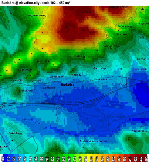
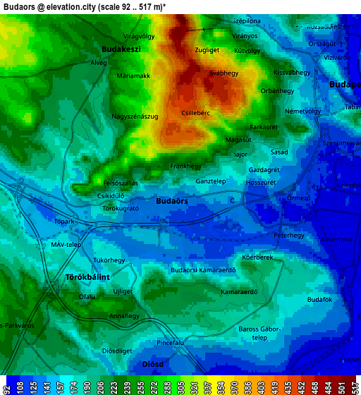
Below is the Elevation map of Budaörs, which displays elevation range with different colors. Scale of the first map is from 102 to 450 m (335 to 1476 ft) with average elevation of 203.1 meters (=666 ft) [note 1]
These maps also provides idea of topography and contour of this city, they are displayed at different zoom levels. More info about maps, scale and edge coordinates you can find below images.
| \ | Map #1 | Map #2 | Topo.Map |
| Scale [m] | 102..450 m | 92..517 m | × |
| Scale [ft] | 335..1476 ft | 302..1696 ft | × |
| Average | 203.1 m = 666 ft | 199.2 m = 654 ft | × |
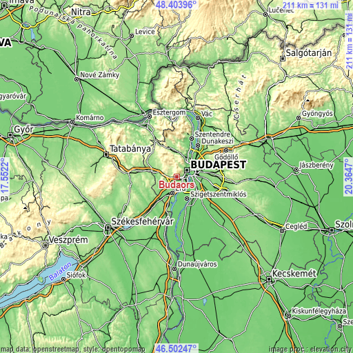
| Width | 6.61 km = 4.1 mi | 13.21 km = 8.2 mi | 211.4 km = 131.4 mi |
| Height | 6.61 km = 4.1 mi | 13.21 km = 8.2 mi | 211.4 km = 131.4 mi |
| ↑Max Latitude | 47.491512° | 47.521198° | 48.40396° |
| Latitude at center | 47.46181° | 47.46181° | 47.46181° |
| ↓Min Latitude | 47.432091° | 47.402355° | 46.50247° |
| ← Min Longitude | 18.914505° | 18.870559° | 17.5522° |
| Longitude center | 18.95845° | 18.95845° | 18.95845° |
| →Max Longitude | 19.002395° | 19.046341° | 20.3647° |
Nearby cities:
Cities around Budaörs sort by population:
• Budapest elevation 75 m
7.4 km,  56°
56°
• Budapest XI. kerület 107 m
6 km,  74°
74°
• Budapest II. kerület 202 m
8 km,  36°
36°
• Budapest VIII. kerület 115 m
8.9 km, 70°
• Józsefváros 110 m
9.1 km, 70°
• Érd 150 m
8.2 km,  204°
204°
• Budapest XII. kerület 168 m
5.4 km,  51°
51°
• Budapest XXII. kerület 104 m
7.3 km,  122°
122°
• Budapest I. kerület 150 m
7.2 km, 57°
• Budakeszi 234 m
5.9 km,  336°
336°
• Törökbálint 174 m
4.9 km,  223°
223°
• Diósd 133 m
5.9 km,  186°
186°
Multilingual:
 En español:
Budaörs elevación 139 m.
 En France:
Budaörs élévation 139 m.


Sources and notes:
- [note 1] Map square and city borders are not equal. Map elevation data is calculated only from area inside that square.
- [src 1] Elevation data from geonames database provided with same terms of usage.
- [src 2] The elevation map of Budaörs is generated using elevation data from NASA's 3 arcsec (90m) resolution SRTM data.
- [src 3] Base (background) map © OpenStreetMap contributors tiles are generated by Geofabrik and OpenTopoMap.
Copyright & License:
This Budaörs Elevation Map is licensed under CC BY-SA. You may reuse any part from this page, if you give a proper credit by linking to this URL:
 More info on terms of use page.