Bugyi elevation
Bugyi (Pest), Hungary elevation is 97 meters and Bugyi elevation in feet is 318 ft above sea level [src 1]. Bugyi is a populated place (feature code) with elevation that is 32 meters (105 ft) smaller than average city elevation in Hungary.
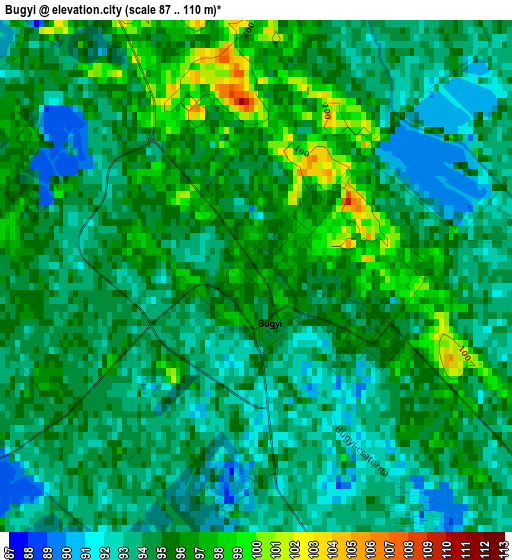
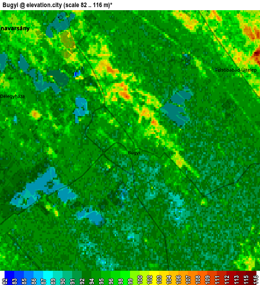
Below is the Elevation map of Bugyi, which displays elevation range with different colors. Scale of the first map is from 87 to 110 m (285 to 361 ft) with average elevation of 94.4 meters (=310 ft) [note 1]
These maps also provides idea of topography and contour of this city, they are displayed at different zoom levels. More info about maps, scale and edge coordinates you can find below images.
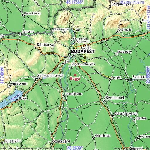
| \ | Map #1 | Map #2 | Topo.Map |
| Scale [m] | 87..110 m | 82..116 m | × |
| Scale [ft] | 285..361 ft | 269..381 ft | × |
| Average | 94.4 m = 310 ft | 94.5 m = 310 ft | × |
| Width | 6.64 km = 4.1 mi | 13.27 km = 8.2 mi | 212.4 km = 132 mi |
| Height | 6.64 km = 4.1 mi | 13.27 km = 8.2 mi | 212.4 km = 132 mi |
| ↑Max Latitude | 47.257314° | 47.287132° | 48.17385° |
| Latitude at center | 47.22748° | 47.22748° | 47.22748° |
| ↓Min Latitude | 47.197629° | 47.167761° | 46.2639° |
| ← Min Longitude | 19.102695° | 19.058749° | 17.74039° |
| Longitude center | 19.14664° | 19.14664° | 19.14664° |
| →Max Longitude | 19.190585° | 19.234531° | 20.55289° |
Nearby cities:
Cities around Bugyi sort by population:
• Dunaharaszti elevation 100 m
14.6 km,  345°
345°
• Dabas 99 m
13.2 km,  110°
110°
• Szigethalom 99 m
15.1 km,  314°
314°
• Ócsa 111 m
10.2 km,  38°
38°
• Kiskunlacháza 97 m
11.2 km,  247°
247°
• Taksony 105 m
12.9 km,  332°
332°
• Dunavarsány 97 m
8.3 km, 313°
• Alsónémedi 102 m
9.8 km,  5°
5°
• Inárcs 114 m
14.1 km,  74°
74°
• Felsőpakony 108 m
14.6 km,  27°
27°
• Délegyháza 96 m
4.5 km,  289°
289°
• Szigetcsép 100 m
13.9 km, 287°
Multilingual:
 En español:
Bugyi elevación 97 m.
 En France:
Bugyi élévation 97 m.


Sources and notes:
- [note 1] Map square and city borders are not equal. Map elevation data is calculated only from area inside that square.
- [src 1] Elevation data from geonames database provided with same terms of usage.
- [src 2] The elevation map of Bugyi is generated using elevation data from NASA's 3 arcsec (90m) resolution SRTM data.
- [src 3] Base (background) map © OpenStreetMap contributors tiles are generated by Geofabrik and OpenTopoMap.
Copyright & License:
This Bugyi Elevation Map is licensed under CC BY-SA. You may reuse any part from this page, if you give a proper credit by linking to this URL:
 More info on terms of use page.