Fertőszentmiklós elevation
Fertőszentmiklós (Győr-Moson-Sopron), Hungary elevation is 126 meters and Fertőszentmiklós elevation in feet is 413 ft above sea level [src 1]. Fertőszentmiklós is a populated place (feature code) with elevation that is 3 meters (10 ft) smaller than average city elevation in Hungary.
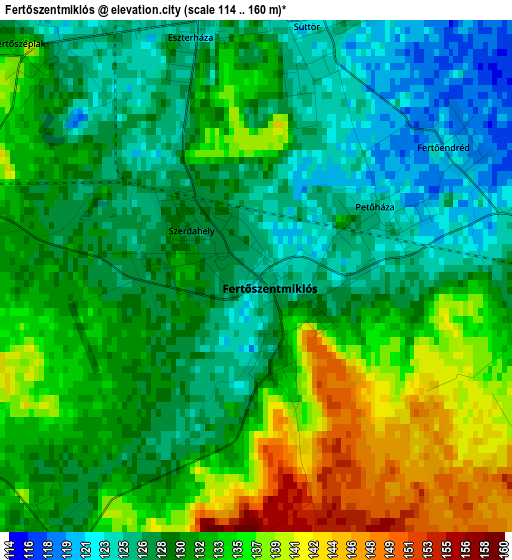
Below is the Elevation map of Fertőszentmiklós, which displays elevation range with different colors. Scale of the first map is from 114 to 160 m (374 to 525 ft) with average elevation of 131 meters (=430 ft) [note 1]
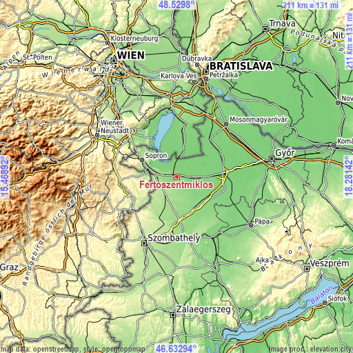
These maps also provides idea of topography and contour of this city, they are displayed at different zoom levels. More info about maps, scale and edge coordinates you can find below images.
| \ | Map #1 | Map #2 | Topo.Map |
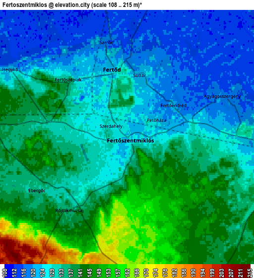
| Scale [m] | 114..160 m | 108..215 m | × |
| Scale [ft] | 374..525 ft | 354..705 ft | × |
| Average | 131 m = 430 ft | 133.9 m = 439 ft | × |
| Width | 6.59 km = 4.1 mi | 13.18 km = 8.2 mi | 210.9 km = 131 mi |
| Height | 6.59 km = 4.1 mi | 13.18 km = 8.2 mi | 210.9 km = 131 mi |
| ↑Max Latitude | 47.61959° | 47.649203° | 48.5298° |
| Latitude at center | 47.58996° | 47.58996° | 47.58996° |
| ↓Min Latitude | 47.560313° | 47.53065° | 46.63294° |
| ← Min Longitude | 16.831225° | 16.787279° | 15.46892° |
| Longitude center | 16.87517° | 16.87517° | 16.87517° |
| →Max Longitude | 16.919115° | 16.963061° | 18.28142° |
Nearby cities:
Cities around Fertőszentmiklós sort by population:
• Sopron elevation 217 m
23.8 km,  296°
296°
• Csorna 118 m
28.2 km,  85°
85°
• Kapuvár 124 m
11.5 km, 88°
• Csepreg 180 m
24.4 km,  210°
210°
• Fertőd 127 m
3.5 km,  354°
354°
• Bük 178 m
24.6 km,  202°
202°
• Beled 131 m
21.4 km,  130°
130°
• Répcelak 140 m
21.6 km,  150°
150°
• Fertőrákos 150 m
22.2 km,  310°
310°
• Farád 116 m
24.4 km, 85°
• Nagycenk 159 m
13.4 km,  276°
276°
• Mihályi 132 m
18.5 km,  117°
117°
Multilingual:
 En español:
Fertőszentmiklós elevación 126 m.
 En France:
Fertőszentmiklós élévation 126 m.
 Auf Deutsch:
St. Niklau höhe über dem Meeresspiegel ist 126 m.

Sources and notes:
- [note 1] Map square and city borders are not equal. Map elevation data is calculated only from area inside that square.
- [src 1] Elevation data from geonames database provided with same terms of usage.
- [src 2] The elevation map of Fertőszentmiklós is generated using elevation data from NASA's 3 arcsec (90m) resolution SRTM data.
- [src 3] Base (background) map © OpenStreetMap contributors tiles are generated by Geofabrik and OpenTopoMap.
Copyright & License:
This Fertőszentmiklós Elevation Map is licensed under CC BY-SA. You may reuse any part from this page, if you give a proper credit by linking to this URL:
 More info on terms of use page.