Gyöngyöspata elevation
Gyöngyöspata (Heves), Hungary elevation is 201 meters and Gyöngyöspata elevation in feet is 659 ft above sea level [src 1]. Gyöngyöspata is a populated place (feature code) with elevation that is 72 meters (236 ft) bigger than average city elevation in Hungary.
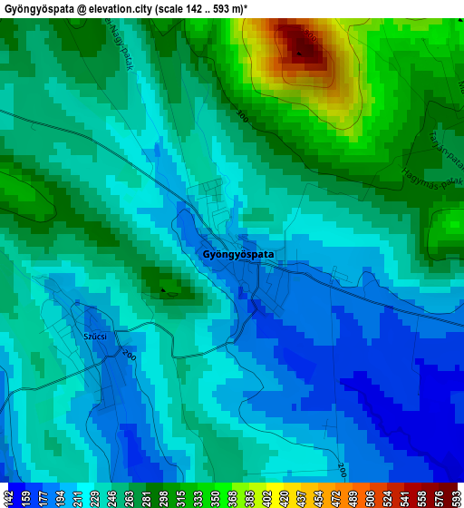
Below is the Elevation map of Gyöngyöspata, which displays elevation range with different colors. Scale of the first map is from 142 to 593 m (466 to 1946 ft) with average elevation of 246.8 meters (=810 ft) [note 1]
These maps also provides idea of topography and contour of this city, they are displayed at different zoom levels. More info about maps, scale and edge coordinates you can find below images.
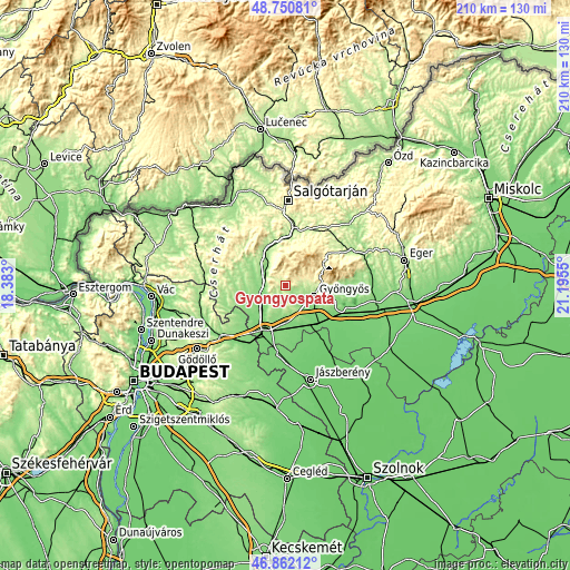
| \ | Map #1 | Topo.Map |
| Scale [m] | 142..593 m | × |
| Scale [ft] | 466..1946 ft | × |
| Average | 246.8 m = 810 ft | × |
| Width | 6.56 km = 4.1 mi | 210 km = 130.5 mi |
| Height | 6.56 km = 4.1 mi | 210 km = 130.5 mi |
| ↑Max Latitude | 47.844552° | 48.75081° |
| Latitude at center | 47.81505° | 47.81505° |
| ↓Min Latitude | 47.785531° | 46.86212° |
| ← Min Longitude | 19.745305° | 18.383° |
| Longitude center | 19.78925° | 19.78925° |
| →Max Longitude | 19.833195° | 21.1955° |
Nearby cities:
Cities around Gyöngyöspata sort by population:
• Gyöngyös elevation 168 m
11 km,  109°
109°
• Lőrinci 124 m
12.3 km,  222°
222°
• Ecséd 159 m
9.3 km,  190°
190°
• Nagyréde 133 m
7.1 km,  141°
141°
• Gyöngyössolymos 238 m
11 km,  88°
88°
• Petőfibánya 152 m
8.4 km,  232°
232°
• Apc 147 m
7.5 km,  251°
251°
• Gyöngyöstarján 198 m
5.8 km, 91°
• Jobbágyi 147 m
8.6 km,  283°
283°
• Zagyvaszántó 131 m
9.8 km,  244°
244°
• Rózsaszentmárton 177 m
5.1 km, 223°
• Szurdokpüspöki 150 m
8.8 km,  304°
304°
Multilingual:
 En español:
Gyöngyöspata elevación 201 m.
 En France:
Gyöngyöspata élévation 201 m.
 Auf Deutsch:
Gyöngyöspata höhe über dem Meeresspiegel ist 201 m.

Sources and notes:
- [note 1] Map square and city borders are not equal. Map elevation data is calculated only from area inside that square.
- [src 1] Elevation data from geonames database provided with same terms of usage.
- [src 2] The elevation map of Gyöngyöspata is generated using elevation data from NASA's 3 arcsec (90m) resolution SRTM data.
- [src 3] Base (background) map © OpenStreetMap contributors tiles are generated by Geofabrik and OpenTopoMap.
Copyright & License:
This Gyöngyöspata Elevation Map is licensed under CC BY-SA. You may reuse any part from this page, if you give a proper credit by linking to this URL:
 More info on terms of use page.