Hort elevation
Hort (Heves), Hungary elevation is 124 meters and Hort elevation in feet is 407 ft above sea level [src 1]. Hort is a populated place (feature code) with elevation that is 5 meters (16 ft) smaller than average city elevation in Hungary.
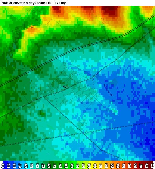
Below is the Elevation map of Hort, which displays elevation range with different colors. Scale of the first map is from 110 to 172 m (361 to 564 ft) with average elevation of 127.1 meters (=417 ft) [note 1]
These maps also provides idea of topography and contour of this city, they are displayed at different zoom levels. More info about maps, scale and edge coordinates you can find below images.
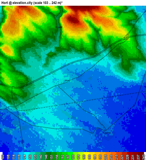
| \ | Map #1 | Map #2 | Topo.Map |
| Scale [m] | 110..172 m | 103..242 m | × |
| Scale [ft] | 361..564 ft | 338..794 ft | × |
| Average | 127.1 m = 417 ft | 139.3 m = 457 ft | × |
| Width | 6.58 km = 4.1 mi | 13.16 km = 8.2 mi | 210.5 km = 130.8 mi |
| Height | 6.58 km = 4.1 mi | 13.16 km = 8.2 mi | 210.5 km = 130.8 mi |
| ↑Max Latitude | 47.720383° | 47.749938° | 48.62882° |
| Latitude at center | 47.69081° | 47.69081° | 47.69081° |
| ↓Min Latitude | 47.661221° | 47.631615° | 46.73562° |
| ← Min Longitude | 19.745355° | 19.701409° | 18.38305° |
| Longitude center | 19.7893° | 19.7893° | 19.7893° |
| →Max Longitude | 19.833245° | 19.877191° | 21.19555° |
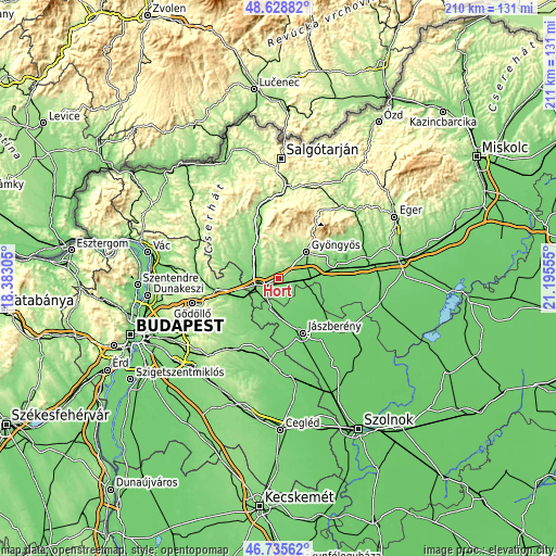
Nearby cities:
Cities around Hort sort by population:
• Hatvan elevation 117 m
8.4 km,  251°
251°
• Lőrinci 124 m
9.5 km,  299°
299°
• Ecséd 159 m
4.9 km,  340°
340°
• Nagyréde 133 m
9.4 km,  27°
27°
• Boldog 112 m
12.4 km,  217°
217°
• Petőfibánya 152 m
11 km,  322°
322°
• Gyöngyöshalász 131 m
11.9 km,  61°
61°
• Csány 115 m
5.6 km,  147°
147°
• Zagyvaszántó 131 m
13 km, 317°
• Heréd 122 m
11.8 km,  278°
278°
• Rózsaszentmárton 177 m
10.7 km, 340°
• Vámosgyörk 106 m
10.5 km,  93°
93°
Multilingual:
 En español:
Hort elevación 124 m.
 En France:
Hort élévation 124 m.


Sources and notes:
- [note 1] Map square and city borders are not equal. Map elevation data is calculated only from area inside that square.
- [src 1] Elevation data from geonames database provided with same terms of usage.
- [src 2] The elevation map of Hort is generated using elevation data from NASA's 3 arcsec (90m) resolution SRTM data.
- [src 3] Base (background) map © OpenStreetMap contributors tiles are generated by Geofabrik and OpenTopoMap.
Copyright & License:
This Hort Elevation Map is licensed under CC BY-SA. You may reuse any part from this page, if you give a proper credit by linking to this URL:
 More info on terms of use page.