Mosonmagyaróvár elevation
Mosonmagyaróvár (Győr-Moson-Sopron), Hungary elevation is 119 meters and Mosonmagyaróvár elevation in feet is 390 ft above sea level [src 1]. Mosonmagyaróvár is a seat of a second-order administrative division (feature code) with elevation that is 10 meters (33 ft) smaller than average city elevation in Hungary.
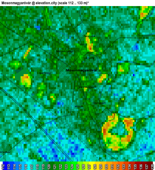
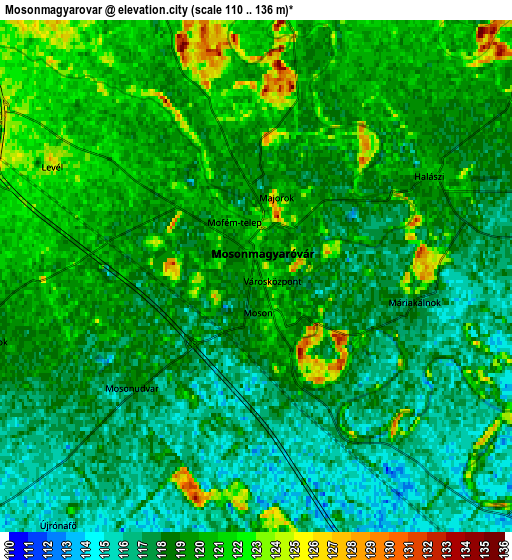
Below is the Elevation map of Mosonmagyaróvár, which displays elevation range with different colors. Scale of the first map is from 112 to 133 m (367 to 436 ft) with average elevation of 118.9 meters (=390 ft) [note 1]
These maps also provides idea of topography and contour of this city, they are displayed at different zoom levels. More info about maps, scale and edge coordinates you can find below images.
| \ | Map #1 | Map #2 | Topo.Map |
| Scale [m] | 112..133 m | 110..136 m | × |
| Scale [ft] | 367..436 ft | 361..446 ft | × |
| Average | 118.9 m = 390 ft | 118.6 m = 389 ft | × |
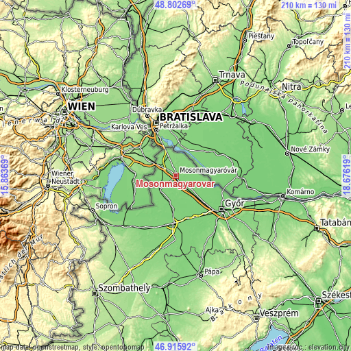
| Width | 6.56 km = 4.1 mi | 13.11 km = 8.1 mi | 209.8 km = 130.4 mi |
| Height | 6.56 km = 4.1 mi | 13.11 km = 8.1 mi | 209.8 km = 130.4 mi |
| ↑Max Latitude | 47.897362° | 47.926817° | 48.80269° |
| Latitude at center | 47.86789° | 47.86789° | 47.86789° |
| ↓Min Latitude | 47.838401° | 47.808896° | 46.91592° |
| ← Min Longitude | 17.225995° | 17.182049° | 15.86369° |
| Longitude center | 17.26994° | 17.26994° | 17.26994° |
| →Max Longitude | 17.313885° | 17.357831° | 18.67619° |
Nearby cities:
Cities around Mosonmagyaróvár sort by population:
• Csorna elevation 118 m
28.5 km,  182°
182°
• Jánossomorja 120 m
13.5 km,  227°
227°
• Lébény 118 m
17.2 km,  148°
148°
• Abda 111 m
28.2 km,  133°
133°
• Halászi 119 m
4.8 km,  60°
60°
• Öttevény 113 m
23 km,  135°
135°
• Kóny 113 m
27.2 km,  166°
166°
• Rajka 128 m
15.3 km,  339°
339°
• Mosonszentmiklós 118 m
19.5 km, 142°
• Kimle 114 m
9.1 km, 128°
• Bősárkány 115 m
20 km, 184°
• Ásványráró 113 m
17.3 km,  105°
105°
Multilingual:
 En español:
Mosonmagyaróvár elevación 119 m.
 En France:
Mosonmagyaróvár élévation 119 m.
 Auf Deutsch:
Mosonmagyaróvár höhe über dem Meeresspiegel ist 119 m.

Sources and notes:
- [note 1] Map square and city borders are not equal. Map elevation data is calculated only from area inside that square.
- [src 1] Elevation data from geonames database provided with same terms of usage.
- [src 2] The elevation map of Mosonmagyaróvár is generated using elevation data from NASA's 3 arcsec (90m) resolution SRTM data.
- [src 3] Base (background) map © OpenStreetMap contributors tiles are generated by Geofabrik and OpenTopoMap.
Copyright & License:
This Mosonmagyaróvár Elevation Map is licensed under CC BY-SA. You may reuse any part from this page, if you give a proper credit by linking to this URL:
 More info on terms of use page.