Parádsasvár elevation
Parádsasvár (Heves), Hungary elevation is 357 meters and Parádsasvár elevation in feet is 1171 ft above sea level [src 1]. Parádsasvár is a populated place (feature code) with elevation that is 228 meters (748 ft) bigger than average city elevation in Hungary.
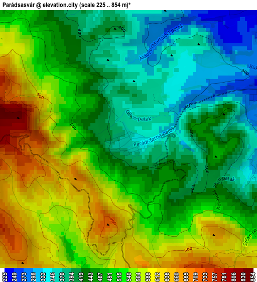
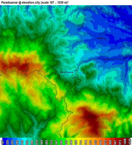
Below is the Elevation map of Parádsasvár, which displays elevation range with different colors. Scale of the first map is from 225 to 854 m (738 to 2802 ft) with average elevation of 485.9 meters (=1594 ft) [note 1]
These maps also provides idea of topography and contour of this city, they are displayed at different zoom levels. More info about maps, scale and edge coordinates you can find below images.
| \ | Map #1 | Map #2 | Topo.Map |
| Scale [m] | 225..854 m | 187..1039 m | × |
| Scale [ft] | 738..2802 ft | 614..3409 ft | × |
| Average | 485.9 m = 1594 ft | 482.1 m = 1582 ft | × |
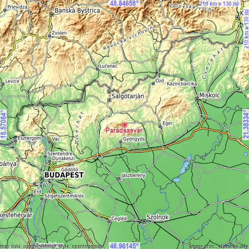
| Width | 6.55 km = 4.1 mi | 13.1 km = 8.1 mi | 209.6 km = 130.2 mi |
| Height | 6.55 km = 4.1 mi | 13.1 km = 8.1 mi | 209.6 km = 130.2 mi |
| ↑Max Latitude | 47.942047° | 47.971476° | 48.84658° |
| Latitude at center | 47.9126° | 47.9126° | 47.9126° |
| ↓Min Latitude | 47.883137° | 47.853657° | 46.96145° |
| ← Min Longitude | 19.933145° | 19.889199° | 18.57084° |
| Longitude center | 19.97709° | 19.97709° | 19.97709° |
| →Max Longitude | 20.021035° | 20.064981° | 21.38334° |
Nearby cities:
Cities around Parádsasvár sort by population:
• Gyöngyös elevation 168 m
14.9 km,  194°
194°
• Bátonyterenye 223 m
12 km,  301°
301°
• Abasár 175 m
13 km,  171°
171°
• Gyöngyössolymos 238 m
11 km,  196°
196°
• Recsk 171 m
10.7 km,  77°
77°
• Pétervására 179 m
14.8 km,  38°
38°
• Gyöngyöstarján 198 m
13.7 km,  216°
216°
• Mátraderecske 214 m
8.9 km,  62°
62°
• Parád 236 m
4.1 km,  73°
73°
• Domoszló 192 m
13.6 km,  130°
130°
• Mátraterenye 228 m
13.5 km,  350°
350°
• Mátranovák 237 m
14 km,  1°
1°
Multilingual:
 En español:
Parádsasvár elevación 357 m.
 En France:
Parádsasvár élévation 357 m.
 Auf Deutsch:
Parádsasvár höhe über dem Meeresspiegel ist 357 m.

Sources and notes:
- [note 1] Map square and city borders are not equal. Map elevation data is calculated only from area inside that square.
- [src 1] Elevation data from geonames database provided with same terms of usage.
- [src 2] The elevation map of Parádsasvár is generated using elevation data from NASA's 3 arcsec (90m) resolution SRTM data.
- [src 3] Base (background) map © OpenStreetMap contributors tiles are generated by Geofabrik and OpenTopoMap.
Copyright & License:
This Parádsasvár Elevation Map is licensed under CC BY-SA. You may reuse any part from this page, if you give a proper credit by linking to this URL:
 More info on terms of use page.