Pécel elevation
Pécel (Pest), Hungary elevation is 160 meters and Pécel elevation in feet is 525 ft above sea level [src 1]. Pécel is a populated place (feature code) with elevation that is 31 meters (102 ft) bigger than average city elevation in Hungary.
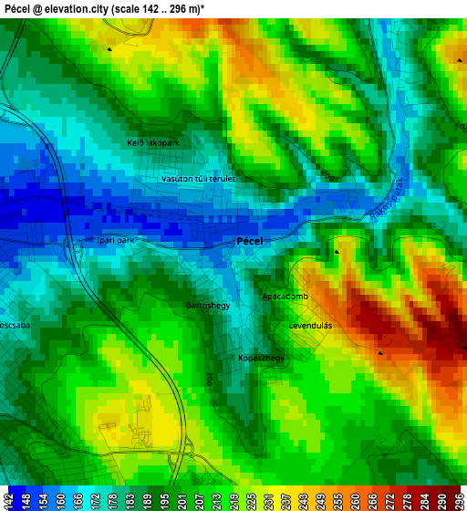
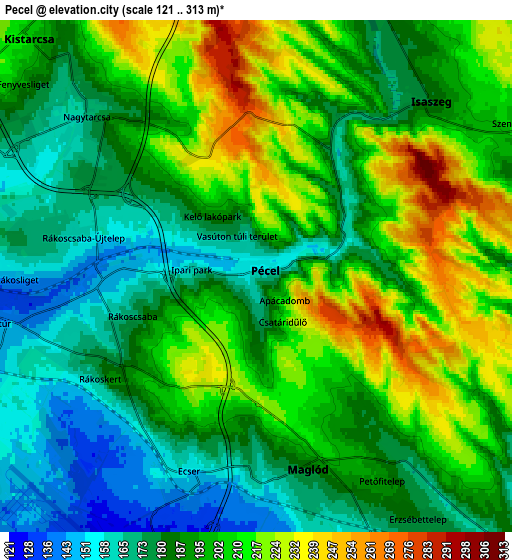
Below is the Elevation map of Pécel, which displays elevation range with different colors. Scale of the first map is from 142 to 296 m (466 to 971 ft) with average elevation of 201.5 meters (=661 ft) [note 1]
These maps also provides idea of topography and contour of this city, they are displayed at different zoom levels. More info about maps, scale and edge coordinates you can find below images.
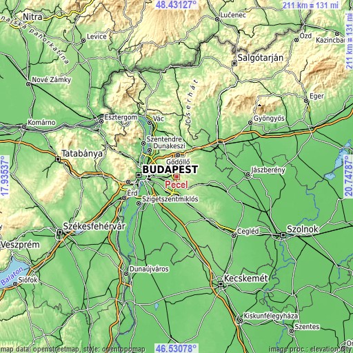
| \ | Map #1 | Map #2 | Topo.Map |
| Scale [m] | 142..296 m | 121..313 m | × |
| Scale [ft] | 466..971 ft | 397..1027 ft | × |
| Average | 201.5 m = 661 ft | 195.1 m = 640 ft | × |
| Width | 6.6 km = 4.1 mi | 13.21 km = 8.2 mi | 211.3 km = 131.3 mi |
| Height | 6.6 km = 4.1 mi | 13.21 km = 8.2 mi | 211.3 km = 131.3 mi |
| ↑Max Latitude | 47.519306° | 47.548976° | 48.43127° |
| Latitude at center | 47.48962° | 47.48962° | 47.48962° |
| ↓Min Latitude | 47.459917° | 47.430197° | 46.53078° |
| ← Min Longitude | 19.297675° | 19.253729° | 17.93537° |
| Longitude center | 19.34162° | 19.34162° | 19.34162° |
| →Max Longitude | 19.385565° | 19.429511° | 20.74787° |
Nearby cities:
Cities around Pécel sort by population:
• Budapest XVII. kerület elevation 137 m
6.7 km,  260°
260°
• Vecsés 120 m
10.1 km,  204°
204°
• Gyömrő 168 m
8.3 km,  147°
147°
• Kistarcsa 207 m
8.8 km,  317°
317°
• Isaszeg 182 m
6.4 km,  45°
45°
• Üllő 126 m
11.4 km,  174°
174°
• Maglód 182 m
5.5 km,  161°
161°
• Kerepes 215 m
9 km,  330°
330°
• Csömör 197 m
10.5 km,  309°
309°
• Mende 159 m
10.8 km,  126°
126°
• Ecser 155 m
5.2 km,  194°
194°
• Nagytarcsa 176 m
6.4 km, 316°
Multilingual:
 En español:
Pécel elevación 160 m.
 En France:
Pécel élévation 160 m.


Sources and notes:
- [note 1] Map square and city borders are not equal. Map elevation data is calculated only from area inside that square.
- [src 1] Elevation data from geonames database provided with same terms of usage.
- [src 2] The elevation map of Pécel is generated using elevation data from NASA's 3 arcsec (90m) resolution SRTM data.
- [src 3] Base (background) map © OpenStreetMap contributors tiles are generated by Geofabrik and OpenTopoMap.
Copyright & License:
This Pécel Elevation Map is licensed under CC BY-SA. You may reuse any part from this page, if you give a proper credit by linking to this URL:
 More info on terms of use page.