Tata elevation
Tata (Komárom-Esztergom), Hungary elevation is 123 meters and Tata elevation in feet is 404 ft above sea level [src 1]. Tata is a seat of a second-order administrative division (feature code) with elevation that is 6 meters (20 ft) smaller than average city elevation in Hungary.
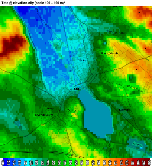
Below is the Elevation map of Tata, which displays elevation range with different colors. Scale of the first map is from 109 to 190 m (358 to 623 ft) with average elevation of 138.6 meters (=455 ft) [note 1]
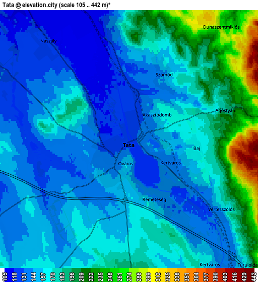
These maps also provides idea of topography and contour of this city, they are displayed at different zoom levels. More info about maps, scale and edge coordinates you can find below images.
| \ | Map #1 | Map #2 | Topo.Map |
| Scale [m] | 109..190 m | 105..442 m | × |
| Scale [ft] | 358..623 ft | 344..1450 ft | × |
| Average | 138.6 m = 455 ft | 164.7 m = 540 ft | × |
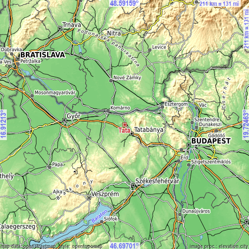
| Width | 6.58 km = 4.1 mi | 13.17 km = 8.2 mi | 210.7 km = 130.9 mi |
| Height | 6.58 km = 4.1 mi | 13.17 km = 8.2 mi | 210.6 km = 130.9 mi |
| ↑Max Latitude | 47.682484° | 47.712061° | 48.59159° |
| Latitude at center | 47.65289° | 47.65289° | 47.65289° |
| ↓Min Latitude | 47.623279° | 47.593652° | 46.69701° |
| ← Min Longitude | 18.274435° | 18.230489° | 16.91213° |
| Longitude center | 18.31838° | 18.31838° | 18.31838° |
| →Max Longitude | 18.362325° | 18.406271° | 19.72463° |
Nearby cities:
Cities around Tata sort by population:
• Tatabánya elevation 146 m
9.4 km,  143°
143°
• Környe 164 m
11.8 km,  179°
179°
• Vértesszőlős 157 m
5.9 km,  126°
126°
• Baj 163 m
3.5 km,  102°
102°
• Kocs 141 m
9.2 km,  236°
236°
• Almásfüzitő 112 m
9.3 km,  332°
332°
• Mocsa 129 m
10.2 km,  280°
280°
• Naszály 117 m
7.2 km,  320°
320°
• Szomód 148 m
3.9 km,  25°
25°
• Tardos 304 m
9.5 km,  83°
83°
• Neszmély 112 m
9.7 km,  18°
18°
• Dunaalmás 128 m
8.4 km,  2°
2°
Multilingual:
 En español:
Tata elevación 123 m.
 En France:
Tata élévation 123 m.


Sources and notes:
- [note 1] Map square and city borders are not equal. Map elevation data is calculated only from area inside that square.
- [src 1] Elevation data from geonames database provided with same terms of usage.
- [src 2] The elevation map of Tata is generated using elevation data from NASA's 3 arcsec (90m) resolution SRTM data.
- [src 3] Base (background) map © OpenStreetMap contributors tiles are generated by Geofabrik and OpenTopoMap.
Copyright & License:
This Tata Elevation Map is licensed under CC BY-SA. You may reuse any part from this page, if you give a proper credit by linking to this URL:
 More info on terms of use page.