Üröm elevation
Üröm (Pest), Hungary elevation is 181 meters and Üröm elevation in feet is 594 ft above sea level [src 1]. Üröm is a populated place (feature code) with elevation that is 52 meters (171 ft) bigger than average city elevation in Hungary.
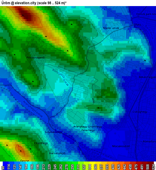
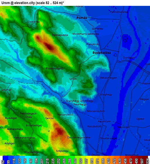
Below is the Elevation map of Üröm, which displays elevation range with different colors. Scale of the first map is from 98 to 524 m (322 to 1719 ft) with average elevation of 185.8 meters (=610 ft) [note 1]
These maps also provides idea of topography and contour of this city, they are displayed at different zoom levels. More info about maps, scale and edge coordinates you can find below images.
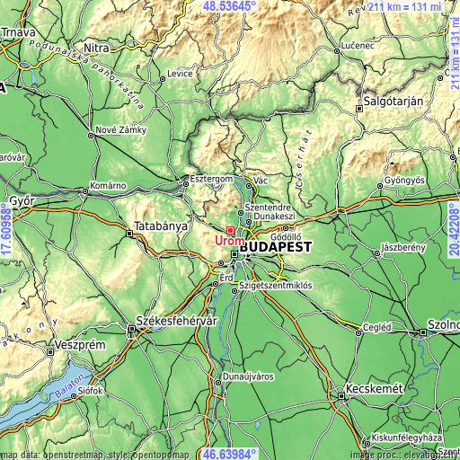
| \ | Map #1 | Map #2 | Topo.Map |
| Scale [m] | 98..524 m | 82..524 m | × |
| Scale [ft] | 322..1719 ft | 269..1719 ft | × |
| Average | 185.8 m = 610 ft | 177.6 m = 583 ft | × |
| Width | 6.59 km = 4.1 mi | 13.18 km = 8.2 mi | 210.9 km = 131 mi |
| Height | 6.59 km = 4.1 mi | 13.18 km = 8.2 mi | 210.9 km = 131 mi |
| ↑Max Latitude | 47.626366° | 47.655975° | 48.53645° |
| Latitude at center | 47.59674° | 47.59674° | 47.59674° |
| ↓Min Latitude | 47.567097° | 47.537438° | 46.63984° |
| ← Min Longitude | 18.971885° | 18.927939° | 17.60958° |
| Longitude center | 19.01583° | 19.01583° | 19.01583° |
| →Max Longitude | 19.059775° | 19.103721° | 20.42208° |
Nearby cities:
Cities around Üröm sort by population:
• Budapest III. kerület elevation 109 m
6.5 km,  160°
160°
• Budapest IV. kerület 109 m
6.7 km,  125°
125°
• Budapest II. kerület 202 m
8.6 km,  176°
176°
• Budapest XV. kerület 111 m
8.5 km,  116°
116°
• Pomáz 125 m
5.1 km,  10°
10°
• Pilisvörösvár 178 m
8.2 km,  283°
283°
• Solymár 193 m
6.3 km,  265°
265°
• Nagykovácsi 139 m
5.9 km,  0°
0°
• Pilisszentiván 209 m
8.8 km, 279°
• Pilisborosjenő 224 m
2.1 km,  305°
305°
• Csobánka 173 m
6.8 km,  323°
323°
• Budakalász 124 m
3.4 km,  49°
49°
Multilingual:
 En español:
Üröm elevación 181 m.
 En France:
Üröm élévation 181 m.


Sources and notes:
- [note 1] Map square and city borders are not equal. Map elevation data is calculated only from area inside that square.
- [src 1] Elevation data from geonames database provided with same terms of usage.
- [src 2] The elevation map of Üröm is generated using elevation data from NASA's 3 arcsec (90m) resolution SRTM data.
- [src 3] Base (background) map © OpenStreetMap contributors tiles are generated by Geofabrik and OpenTopoMap.
Copyright & License:
This Üröm Elevation Map is licensed under CC BY-SA. You may reuse any part from this page, if you give a proper credit by linking to this URL:
 More info on terms of use page.