Blato elevation
Blato (Dubrovačko-Neretvanska, Mljet), Croatia elevation is 50 meters and Blato elevation in feet is 164 ft above sea level [src 1]. Blato is a populated place (feature code) with elevation that is 104 meters (341 ft) smaller than average city elevation in Croatia.
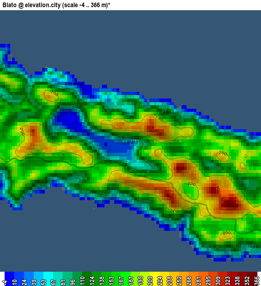
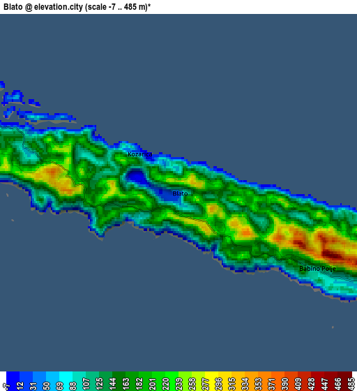
Below is the Elevation map of Blato, which displays elevation range with different colors. Scale of the first map is from -4 to 366 m (-13 to 1201 ft) with average elevation of 143.7 meters (=471 ft) [note 1]
These maps also provides idea of topography and contour of this city, they are displayed at different zoom levels. More info about maps, scale and edge coordinates you can find below images.
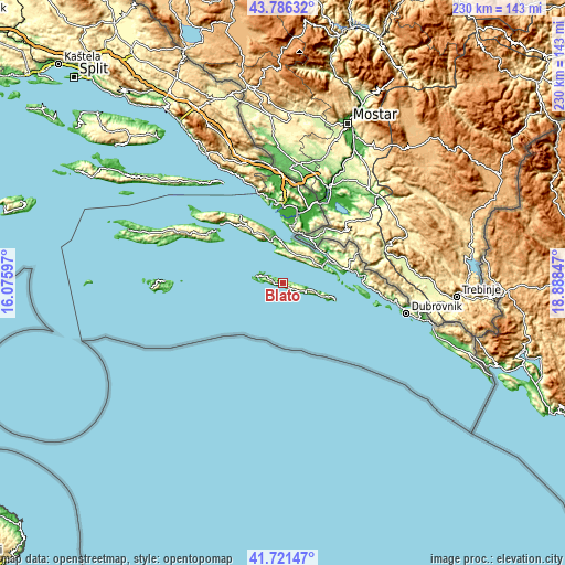
| \ | Map #1 | Map #2 | Topo.Map |
| Scale [m] | -4..366 m | -7..485 m | × |
| Scale [ft] | -13..1201 ft | -23..1591 ft | × |
| Average | 143.7 m = 471 ft | 158.7 m = 521 ft | × |
| Width | 7.17 km = 4.5 mi | 14.35 km = 8.9 mi | 229.6 km = 142.7 mi |
| Height | 7.17 km = 4.5 mi | 14.35 km = 8.9 mi | 229.6 km = 142.7 mi |
| ↑Max Latitude | 42.794755° | 42.826993° | 43.78632° |
| Latitude at center | 42.7625° | 42.7625° | 42.7625° |
| ↓Min Latitude | 42.730228° | 42.697939° | 41.72147° |
| ← Min Longitude | 17.438275° | 17.394329° | 16.07597° |
| Longitude center | 17.48222° | 17.48222° | 17.48222° |
| →Max Longitude | 17.526165° | 17.570111° | 18.88847° |
Nearby cities:
Cities around Blato sort by population:
• Ston elevation 4 m
19.4 km,  64°
64°
• Opuzen 1 m
28.9 km,  13°
13°
• Podgora 249 m
30.4 km,  71°
71°
• Komin 5 m
31.3 km, 8°
• Lumbarda 18 m
31.3 km,  304°
304°
• Slano 8 m
33.5 km,  85°
85°
• Ploče 10 m
32.9 km,  352°
352°
• Trpanj 20 m
32 km,  328°
328°
• Kula Norinska 25 m
31.5 km,  18°
18°
• Vlaka 0 m
26.5 km, 7°
• Janjina 120 m
18.6 km, 346°
• Babino Polje 158 m
7.3 km,  116°
116°
Multilingual:
 En español:
Blato elevación 50 m.
 En France:
Blato élévation 50 m.


Sources and notes:
- [note 1] Map square and city borders are not equal. Map elevation data is calculated only from area inside that square.
- [src 1] Elevation data from geonames database provided with same terms of usage.
- [src 2] The elevation map of Blato is generated using elevation data from NASA's 3 arcsec (90m) resolution SRTM data.
- [src 3] Base (background) map © OpenStreetMap contributors tiles are generated by Geofabrik and OpenTopoMap.
Copyright & License:
This Blato Elevation Map is licensed under CC BY-SA. You may reuse any part from this page, if you give a proper credit by linking to this URL:
 More info on terms of use page.