Imotski elevation
Imotski (Split-Dalmatia, Grad Imotski), Croatia elevation is 400 meters and Imotski elevation in feet is 1312 ft above sea level [src 1]. Imotski is a seat of a second-order administrative division (feature code) with elevation that is 246 meters (807 ft) bigger than average city elevation in Croatia.
Below is the Elevation map of Imotski, which displays elevation range with different colors. Scale of the first map is from 249 to 686 m (817 to 2251 ft) with average elevation of 417.4 meters (=1369 ft) [note 1]
These maps also provides idea of topography and contour of this city, they are displayed at different zoom levels. More info about maps, scale and edge coordinates you can find below images.
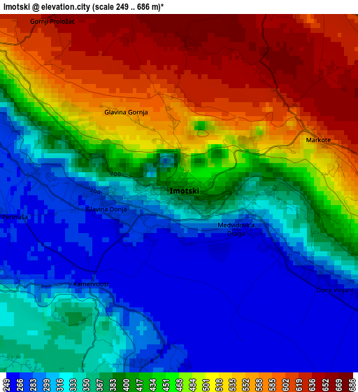
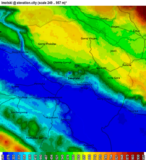
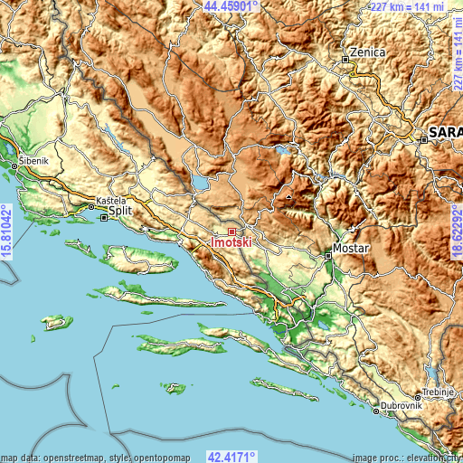
| \ | Map #1 | Map #2 | Topo.Map |
| Scale [m] | 249..686 m | 249..957 m | × |
| Scale [ft] | 817..2251 ft | 817..3140 ft | × |
| Average | 417.4 m = 1369 ft | 464.1 m = 1523 ft | × |
| Width | 7.09 km = 4.4 mi | 14.19 km = 8.8 mi | 227 km = 141.1 mi |
| Height | 7.1 km = 4.4 mi | 14.19 km = 8.8 mi | 227 km = 141.1 mi |
| ↑Max Latitude | 43.478567° | 43.510446° | 44.45901° |
| Latitude at center | 43.44667° | 43.44667° | 43.44667° |
| ↓Min Latitude | 43.414757° | 43.382826° | 42.4171° |
| ← Min Longitude | 17.172725° | 17.128779° | 15.81042° |
| Longitude center | 17.21667° | 17.21667° | 17.21667° |
| →Max Longitude | 17.260615° | 17.304561° | 18.62292° |
Nearby cities:
Cities around Imotski sort by population:
• Makarska elevation 3 m
23.1 km,  223°
223°
• Donji Vinjani 362 m
1.9 km,  91°
91°
• Zmijavci 282 m
4.1 km,  192°
192°
• Runović 384 m
7.9 km,  168°
168°
• Grabovci 684 m
5.3 km,  346°
346°
• Grubine 343 m
4.7 km,  246°
246°
• Zagvozd 472 m
14 km, 247°
• Lovreć 558 m
19.1 km,  283°
283°
• Cista Provo 463 m
22.6 km,  286°
286°
• Lokvičič 456 m
10.3 km, 280°
• Podbablje 454 m
6.7 km,  206°
206°
• Donji Proložac 308 m
5.5 km,  297°
297°
Multilingual:
 En español:
Imotski elevación 400 m.
 En France:
Imotski élévation 400 m.


Sources and notes:
- [note 1] Map square and city borders are not equal. Map elevation data is calculated only from area inside that square.
- [src 1] Elevation data from geonames database provided with same terms of usage.
- [src 2] The elevation map of Imotski is generated using elevation data from NASA's 3 arcsec (90m) resolution SRTM data.
- [src 3] Base (background) map © OpenStreetMap contributors tiles are generated by Geofabrik and OpenTopoMap.
Copyright & License:
This Imotski Elevation Map is licensed under CC BY-SA. You may reuse any part from this page, if you give a proper credit by linking to this URL:
 More info on terms of use page.