Makarska elevation
Makarska (Split-Dalmatia, Grad Makarska), Croatia elevation is 3 meters and Makarska elevation in feet is 10 ft above sea level [src 1]. Makarska is a seat of a second-order administrative division (feature code) with elevation that is 151 meters (495 ft) smaller than average city elevation in Croatia.
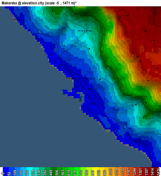
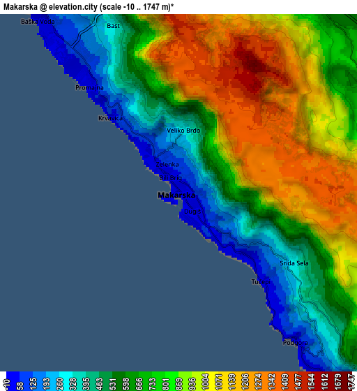
Below is the Elevation map of Makarska, which displays elevation range with different colors. Scale of the first map is from -5 to 1471 m (-16 to 4826 ft) with average elevation of 505 meters (=1657 ft) [note 1]
These maps also provides idea of topography and contour of this city, they are displayed at different zoom levels. More info about maps, scale and edge coordinates you can find below images.
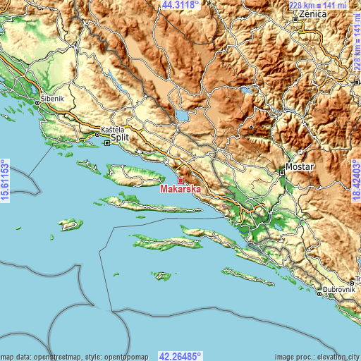
| \ | Map #1 | Map #2 | Topo.Map |
| Scale [m] | -5..1471 m | -10..1747 m | × |
| Scale [ft] | -16..4826 ft | -33..5732 ft | × |
| Average | 505 m = 1657 ft | 777.2 m = 2550 ft | × |
| Width | 7.11 km = 4.4 mi | 14.23 km = 8.8 mi | 227.6 km = 141.4 mi |
| Height | 7.11 km = 4.4 mi | 14.23 km = 8.8 mi | 227.6 km = 141.4 mi |
| ↑Max Latitude | 43.328915° | 43.360874° | 44.3118° |
| Latitude at center | 43.29694° | 43.29694° | 43.29694° |
| ↓Min Latitude | 43.264948° | 43.232939° | 42.26485° |
| ← Min Longitude | 16.973835° | 16.929889° | 15.61153° |
| Longitude center | 17.01778° | 17.01778° | 17.01778° |
| →Max Longitude | 17.061725° | 17.105671° | 18.42403° |
Nearby cities:
Cities around Makarska sort by population:
• Baška Voda elevation 11 m
8.6 km,  320°
320°
• Zmijavci 282 m
19.8 km,  50°
50°
• Tučepi 16 m
4 km,  132°
132°
• Brela 70 m
10.5 km, 319°
• Grubine 343 m
18.9 km,  38°
38°
• Zagvozd 472 m
11.6 km,  15°
15°
• Selca 93 m
13.5 km,  270°
270°
• Šestanovac 248 m
19.5 km,  333°
333°
• Lokvičič 456 m
19.5 km, 17°
• Zadvarje 218 m
18.2 km, 325°
• Podbablje 454 m
16.9 km, 50°
• Podgora 55 m
7.7 km,  141°
141°
Multilingual:
 En español:
Makarska elevación 3 m.
 En France:
Makarska élévation 3 m.


Sources and notes:
- [note 1] Map square and city borders are not equal. Map elevation data is calculated only from area inside that square.
- [src 1] Elevation data from geonames database provided with same terms of usage.
- [src 2] The elevation map of Makarska is generated using elevation data from NASA's 3 arcsec (90m) resolution SRTM data.
- [src 3] Base (background) map © OpenStreetMap contributors tiles are generated by Geofabrik and OpenTopoMap.
Copyright & License:
This Makarska Elevation Map is licensed under CC BY-SA. You may reuse any part from this page, if you give a proper credit by linking to this URL:
 More info on terms of use page.