Ivanec elevation
Ivanec (Varaždinska, Grad Ivanec), Croatia elevation is 230 meters and Ivanec elevation in feet is 755 ft above sea level [src 1]. Ivanec is a seat of a second-order administrative division (feature code) with elevation that is 76 meters (249 ft) bigger than average city elevation in Croatia.
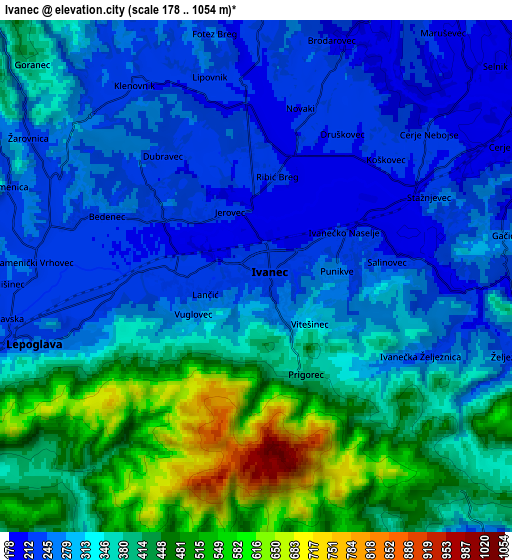
Below is the Elevation map of Ivanec, which displays elevation range with different colors. Scale of the first map is from 200 to 831 m (656 to 2726 ft) with average elevation of 296.9 meters (=974 ft) [note 1]
These maps also provides idea of topography and contour of this city, they are displayed at different zoom levels. More info about maps, scale and edge coordinates you can find below images.

| \ | Map #1 | Map #2 | Topo.Map |
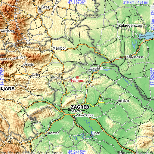
| Scale [m] | 200..831 m | 178..1054 m | × |
| Scale [ft] | 656..2726 ft | 584..3458 ft | × |
| Average | 296.9 m = 974 ft | 341.7 m = 1121 ft | × |
| Width | 6.76 km = 4.2 mi | 13.52 km = 8.4 mi | 216.4 km = 134.5 mi |
| Height | 6.76 km = 4.2 mi | 13.52 km = 8.4 mi | 216.3 km = 134.4 mi |
| ↑Max Latitude | 46.253455° | 46.283834° | 47.18736° |
| Latitude at center | 46.22306° | 46.22306° | 46.22306° |
| ↓Min Latitude | 46.192648° | 46.162219° | 45.24152° |
| ← Min Longitude | 16.076055° | 16.032109° | 14.71375° |
| Longitude center | 16.12° | 16.12° | 16.12° |
| →Max Longitude | 16.163945° | 16.207891° | 17.52625° |
Nearby cities:
Cities around Ivanec sort by population:
• Lepoglava elevation 220 m
6.6 km,  257°
257°
• Vinica 230 m
12.8 km,  10°
10°
• Donje Ladanje 214 m
9.3 km,  22°
22°
• Klenovnik 237 m
6.5 km,  323°
323°
• Tužno 182 m
9.6 km,  67°
67°
• Vidovec 175 m
11.5 km,  54°
54°
• Budinšćina 195 m
12.4 km,  147°
147°
• Novi Golubovec 326 m
12.1 km,  242°
242°
• Bednja 270 m
10.6 km,  274°
274°
• Lobor 280 m
8.8 km,  207°
207°
• Maruševec 211 m
8.8 km,  33°
33°
• Donja Voća 231 m
8.7 km,  352°
352°
Multilingual:
 En español:
Ivanec elevación 230 m.
 En France:
Ivanec élévation 230 m.


Sources and notes:
- [note 1] Map square and city borders are not equal. Map elevation data is calculated only from area inside that square.
- [src 1] Elevation data from geonames database provided with same terms of usage.
- [src 2] The elevation map of Ivanec is generated using elevation data from NASA's 3 arcsec (90m) resolution SRTM data.
- [src 3] Base (background) map © OpenStreetMap contributors tiles are generated by Geofabrik and OpenTopoMap.
Copyright & License:
This Ivanec Elevation Map is licensed under CC BY-SA. You may reuse any part from this page, if you give a proper credit by linking to this URL:
 More info on terms of use page.