Lepoglava elevation
Lepoglava (Varaždinska), Croatia elevation is 220 meters and Lepoglava elevation in feet is 722 ft above sea level [src 1]. Lepoglava is a seat of a second-order administrative division (feature code) with elevation that is 66 meters (217 ft) bigger than average city elevation in Croatia.
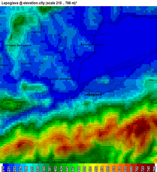
Below is the Elevation map of Lepoglava, which displays elevation range with different colors. Scale of the first map is from 210 to 766 m (689 to 2513 ft) with average elevation of 344.5 meters (=1130 ft) [note 1]
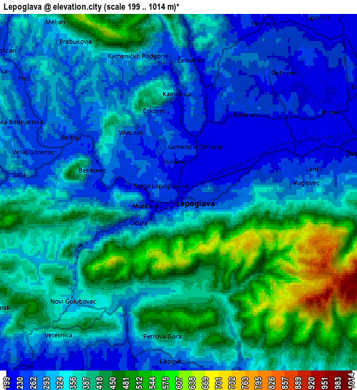
These maps also provides idea of topography and contour of this city, they are displayed at different zoom levels. More info about maps, scale and edge coordinates you can find below images.
| \ | Map #1 | Map #2 | Topo.Map |
| Scale [m] | 210..766 m | 199..1014 m | × |
| Scale [ft] | 689..2513 ft | 653..3327 ft | × |
| Average | 344.5 m = 1130 ft | 353.1 m = 1158 ft | × |
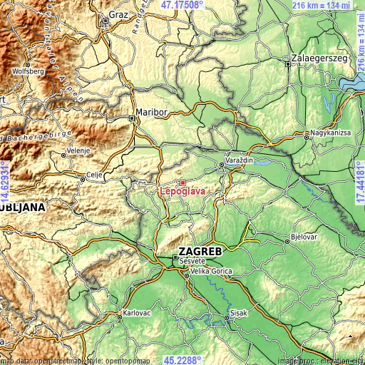
| Width | 6.76 km = 4.2 mi | 13.53 km = 8.4 mi | 216.4 km = 134.5 mi |
| Height | 6.76 km = 4.2 mi | 13.53 km = 8.4 mi | 216.4 km = 134.5 mi |
| ↑Max Latitude | 46.240962° | 46.271348° | 47.17508° |
| Latitude at center | 46.21056° | 46.21056° | 46.21056° |
| ↓Min Latitude | 46.180141° | 46.149705° | 45.2288° |
| ← Min Longitude | 15.991615° | 15.947669° | 14.62931° |
| Longitude center | 16.03556° | 16.03556° | 16.03556° |
| →Max Longitude | 16.079505° | 16.123451° | 17.44181° |
Nearby cities:
Cities around Lepoglava sort by population:
• Ivanec elevation 230 m
6.6 km,  77°
77°
• Krapina 237 m
13.3 km,  245°
245°
• Zlatar 180 m
13.2 km,  168°
168°
• Radoboj 257 m
9.9 km,  240°
240°
• Mihovljan 227 m
9.9 km,  209°
209°
• Klenovnik 237 m
7.1 km,  21°
21°
• Mače 163 m
12.9 km,  180°
180°
• Donja Voća 231 m
11.4 km,  28°
28°
• Gornje Jesenje 347 m
9.5 km,  267°
267°
• Lobor 280 m
6.9 km,  158°
158°
• Novi Golubovec 326 m
6 km,  224°
224°
• Bednja 270 m
4.6 km,  298°
298°
Multilingual:
 En español:
Lepoglava elevación 220 m.
 En France:
Lepoglava élévation 220 m.
 Auf Deutsch:
Lepoglava höhe über dem Meeresspiegel ist 220 m.

Sources and notes:
- [note 1] Map square and city borders are not equal. Map elevation data is calculated only from area inside that square.
- [src 1] Elevation data from geonames database provided with same terms of usage.
- [src 2] The elevation map of Lepoglava is generated using elevation data from NASA's 3 arcsec (90m) resolution SRTM data.
- [src 3] Base (background) map © OpenStreetMap contributors tiles are generated by Geofabrik and OpenTopoMap.
Copyright & License:
This Lepoglava Elevation Map is licensed under CC BY-SA. You may reuse any part from this page, if you give a proper credit by linking to this URL:
 More info on terms of use page.