Našice elevation
Našice (Osječko-Baranjska, Grad Našice), Croatia elevation is 153 meters and Našice elevation in feet is 502 ft above sea level [src 1]. Našice is a seat of a second-order administrative division (feature code) with elevation that is 1 meters (3 ft) smaller than average city elevation in Croatia.
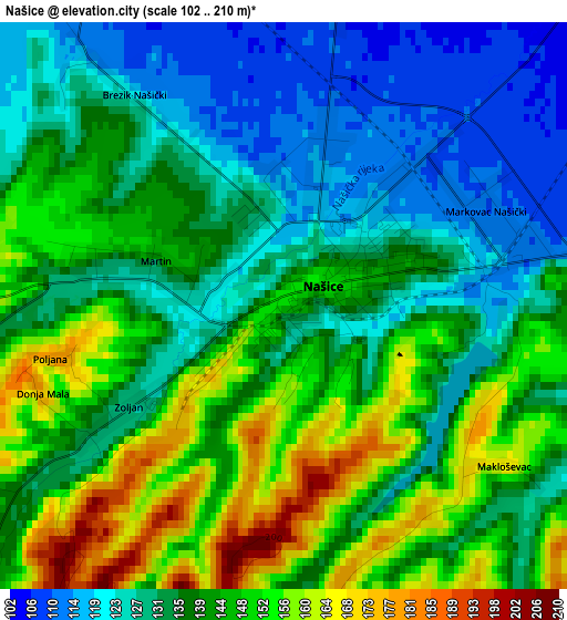
Below is the Elevation map of Našice, which displays elevation range with different colors. Scale of the first map is from 102 to 210 m (335 to 689 ft) with average elevation of 138.9 meters (=456 ft) [note 1]
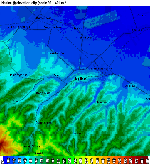
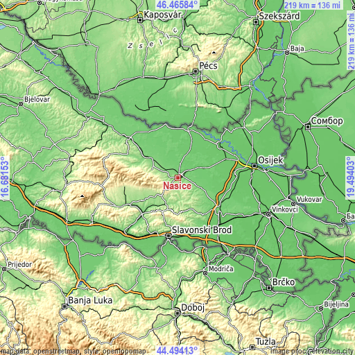
These maps also provides idea of topography and contour of this city, they are displayed at different zoom levels. More info about maps, scale and edge coordinates you can find below images.
| \ | Map #1 | Map #2 | Topo.Map |
| Scale [m] | 102..210 m | 92..401 m | × |
| Scale [ft] | 335..689 ft | 302..1316 ft | × |
| Average | 138.9 m = 456 ft | 146 m = 479 ft | × |
| Width | 6.85 km = 4.3 mi | 13.7 km = 8.5 mi | 219.2 km = 136.2 mi |
| Height | 6.85 km = 4.3 mi | 13.7 km = 8.5 mi | 219.2 km = 136.2 mi |
| ↑Max Latitude | 45.519409° | 45.550192° | 46.46584° |
| Latitude at center | 45.48861° | 45.48861° | 45.48861° |
| ↓Min Latitude | 45.457794° | 45.42696° | 44.49413° |
| ← Min Longitude | 18.043835° | 17.999889° | 16.68153° |
| Longitude center | 18.08778° | 18.08778° | 18.08778° |
| →Max Longitude | 18.131725° | 18.175671° | 19.49403° |
Nearby cities:
Cities around Našice sort by population:
• Orahovica elevation 171 m
16.8 km,  289°
289°
• Feričanci 127 m
9.8 km,  297°
297°
• Koška 95 m
16.7 km,  67°
67°
• Markovac Našički 112 m
3 km,  78°
78°
• Jelisavac 100 m
7 km,  49°
49°
• Velimirovac 104 m
4.2 km,  23°
23°
• Martin 133 m
1.7 km,  283°
283°
• Zdenci 109 m
15.5 km,  316°
316°
• Podgorač 129 m
11 km,  107°
107°
• Ðurđenovac 112 m
6.9 km,  331°
331°
• Čaglin 138 m
17.2 km,  206°
206°
• Donja Motičina 132 m
5 km, 277°
Multilingual:
 En español:
Našice elevación 153 m.
 En France:
Našice élévation 153 m.


Sources and notes:
- [note 1] Map square and city borders are not equal. Map elevation data is calculated only from area inside that square.
- [src 1] Elevation data from geonames database provided with same terms of usage.
- [src 2] The elevation map of Našice is generated using elevation data from NASA's 3 arcsec (90m) resolution SRTM data.
- [src 3] Base (background) map © OpenStreetMap contributors tiles are generated by Geofabrik and OpenTopoMap.
Copyright & License:
This Našice Elevation Map is licensed under CC BY-SA. You may reuse any part from this page, if you give a proper credit by linking to this URL:
 More info on terms of use page.