Opatija elevation
Opatija (Primorsko-Goranska, Grad Opatija), Croatia elevation is 59 meters and Opatija elevation in feet is 194 ft above sea level [src 1]. Opatija is a seat of a second-order administrative division (feature code) with elevation that is 95 meters (312 ft) smaller than average city elevation in Croatia.
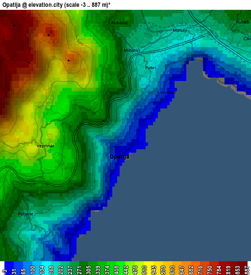
Below is the Elevation map of Opatija, which displays elevation range with different colors. Scale of the first map is from -3 to 887 m (-10 to 2910 ft) with average elevation of 329 meters (=1079 ft) [note 1]
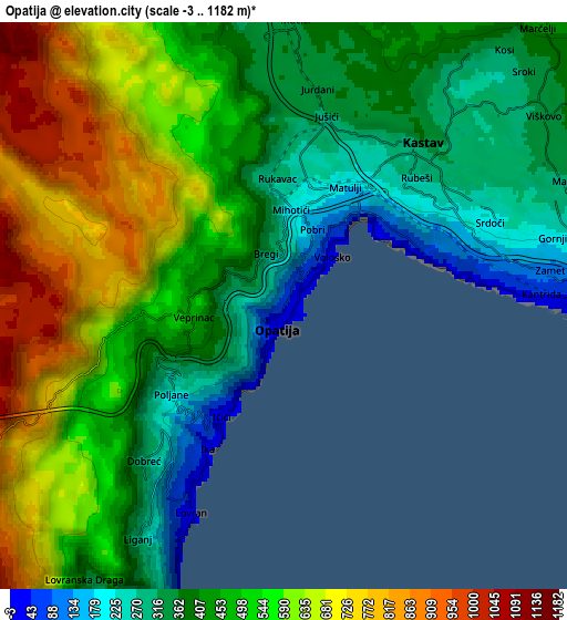
These maps also provides idea of topography and contour of this city, they are displayed at different zoom levels. More info about maps, scale and edge coordinates you can find below images.
| \ | Map #1 | Map #2 | Topo.Map |
| Scale [m] | -3..887 m | -3..1182 m | × |
| Scale [ft] | -10..2910 ft | -10..3878 ft | × |
| Average | 329 m = 1079 ft | 498.5 m = 1635 ft | × |
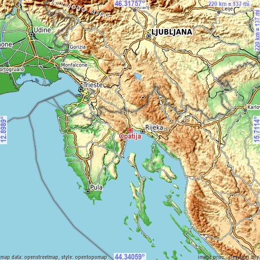
| Width | 6.87 km = 4.3 mi | 13.74 km = 8.5 mi | 219.8 km = 136.6 mi |
| Height | 6.87 km = 4.3 mi | 13.74 km = 8.5 mi | 219.8 km = 136.6 mi |
| ↑Max Latitude | 45.368592° | 45.399457° | 46.31757° |
| Latitude at center | 45.33771° | 45.33771° | 45.33771° |
| ↓Min Latitude | 45.306811° | 45.275896° | 44.34059° |
| ← Min Longitude | 14.261205° | 14.217259° | 12.8989° |
| Longitude center | 14.30515° | 14.30515° | 14.30515° |
| →Max Longitude | 14.349095° | 14.393041° | 15.7114° |
Nearby cities:
Cities around Opatija sort by population:
• Rijeka elevation 12 m
10.8 km,  96°
96°
• Drenova 278 m
9.9 km,  82°
82°
• Marinići 319 m
7.6 km,  66°
66°
• Matulji 173 m
3.1 km,  30°
30°
• Lovran 26 m
5.6 km,  205°
205°
• Viškovo 333 m
7.5 km,  55°
55°
• Marčelji 398 m
9.2 km,  45°
45°
• Kastav 362 m
5.4 km,  39°
39°
• Rubeši 290 m
4.7 km, 45°
• Mihotići 228 m
2.6 km,  0°
0°
• Jelenje 315 m
12.6 km, 64°
• Mošćenička Draga 5 m
11.9 km,  200°
200°
Multilingual:
 En español:
Opatija elevación 59 m.
 En France:
Opatija élévation 59 m.


Sources and notes:
- [note 1] Map square and city borders are not equal. Map elevation data is calculated only from area inside that square.
- [src 1] Elevation data from geonames database provided with same terms of usage.
- [src 2] The elevation map of Opatija is generated using elevation data from NASA's 3 arcsec (90m) resolution SRTM data.
- [src 3] Base (background) map © OpenStreetMap contributors tiles are generated by Geofabrik and OpenTopoMap.
Copyright & License:
This Opatija Elevation Map is licensed under CC BY-SA. You may reuse any part from this page, if you give a proper credit by linking to this URL:
 More info on terms of use page.