Slatina elevation
Slatina (Virovitičk-Podravska, Grad Slatina), Croatia elevation is 124 meters and Slatina elevation in feet is 407 ft above sea level [src 1]. Slatina is a seat of a second-order administrative division (feature code) with elevation that is 30 meters (98 ft) smaller than average city elevation in Croatia.
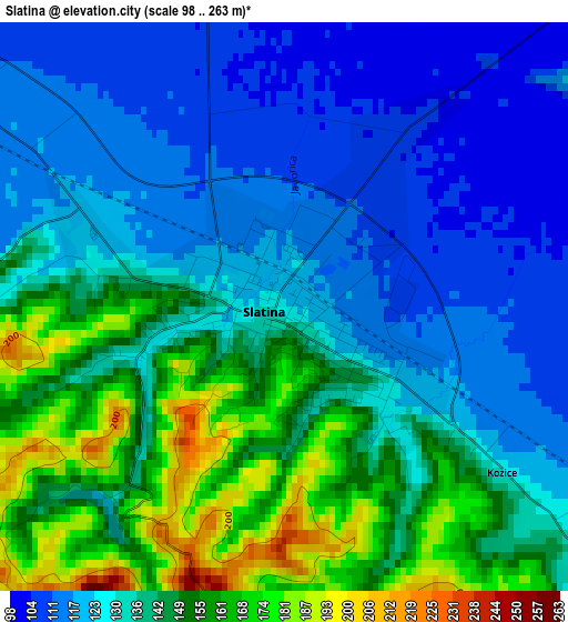
Below is the Elevation map of Slatina, which displays elevation range with different colors. Scale of the first map is from 98 to 263 m (322 to 863 ft) with average elevation of 136.2 meters (=447 ft) [note 1]
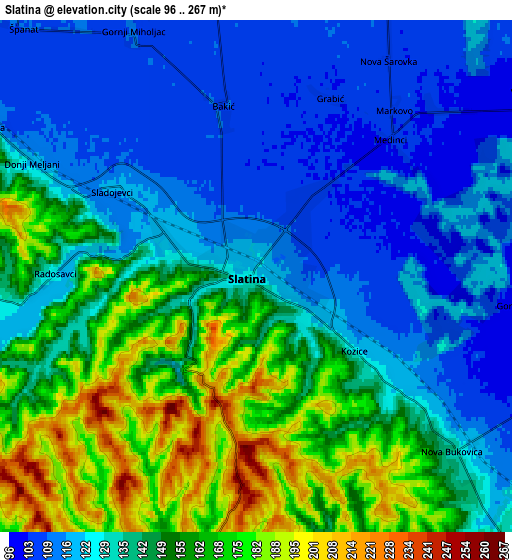
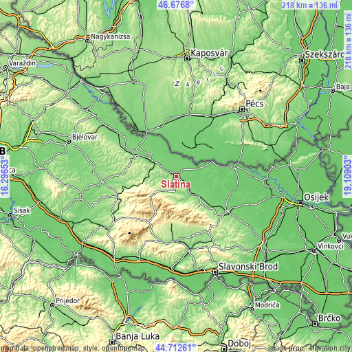
These maps also provides idea of topography and contour of this city, they are displayed at different zoom levels. More info about maps, scale and edge coordinates you can find below images.
| \ | Map #1 | Map #2 | Topo.Map |
| Scale [m] | 98..263 m | 96..267 m | × |
| Scale [ft] | 322..863 ft | 315..876 ft | × |
| Average | 136.2 m = 447 ft | 139.9 m = 459 ft | × |
| Width | 6.82 km = 4.2 mi | 13.65 km = 8.5 mi | 218.4 km = 135.7 mi |
| Height | 6.82 km = 4.2 mi | 13.65 km = 8.5 mi | 218.4 km = 135.7 mi |
| ↑Max Latitude | 45.734012° | 45.764677° | 46.6768° |
| Latitude at center | 45.70333° | 45.70333° | 45.70333° |
| ↓Min Latitude | 45.672631° | 45.641916° | 44.71261° |
| ← Min Longitude | 17.658835° | 17.614889° | 16.29653° |
| Longitude center | 17.70278° | 17.70278° | 17.70278° |
| →Max Longitude | 17.746725° | 17.790671° | 19.10903° |
Nearby cities:
Cities around Slatina sort by population:
• Orahovica elevation 171 m
23 km,  142°
142°
• Suhopolje 117 m
19.1 km,  304°
304°
• Čačinci 115 m
17.1 km,  130°
130°
• Voćin 237 m
15.3 km,  231°
231°
• Zdenci 109 m
23 km,  123°
123°
• Gradina 121 m
22.7 km,  318°
318°
• Mikleuš 137 m
12.3 km, 140°
• Ðulovac 244 m
21.3 km,  258°
258°
• Crnac 94 m
18.2 km,  92°
92°
• Čađavica 103 m
12.6 km,  68°
68°
• Sopje 101 m
11.3 km,  15°
15°
• Nova Bukovica 131 m
6.6 km, 130°
Multilingual:
 En español:
Slatina elevación 124 m.
 En France:
Slatina élévation 124 m.


Sources and notes:
- [note 1] Map square and city borders are not equal. Map elevation data is calculated only from area inside that square.
- [src 1] Elevation data from geonames database provided with same terms of usage.
- [src 2] The elevation map of Slatina is generated using elevation data from NASA's 3 arcsec (90m) resolution SRTM data.
- [src 3] Base (background) map © OpenStreetMap contributors tiles are generated by Geofabrik and OpenTopoMap.
Copyright & License:
This Slatina Elevation Map is licensed under CC BY-SA. You may reuse any part from this page, if you give a proper credit by linking to this URL:
 More info on terms of use page.