Popovača elevation
Popovača (Sisačko-Moslavačka), Croatia elevation is 127 meters and Popovača elevation in feet is 417 ft above sea level [src 1]. Popovača is a seat of a second-order administrative division (feature code) with elevation that is 27 meters (89 ft) smaller than average city elevation in Croatia.
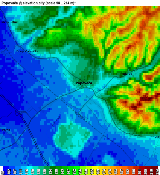
Below is the Elevation map of Popovača, which displays elevation range with different colors. Scale of the first map is from 98 to 214 m (322 to 702 ft) with average elevation of 128.7 meters (=422 ft) [note 1]
These maps also provides idea of topography and contour of this city, they are displayed at different zoom levels. More info about maps, scale and edge coordinates you can find below images.
| \ | Map #1 | Map #2 | Topo.Map |
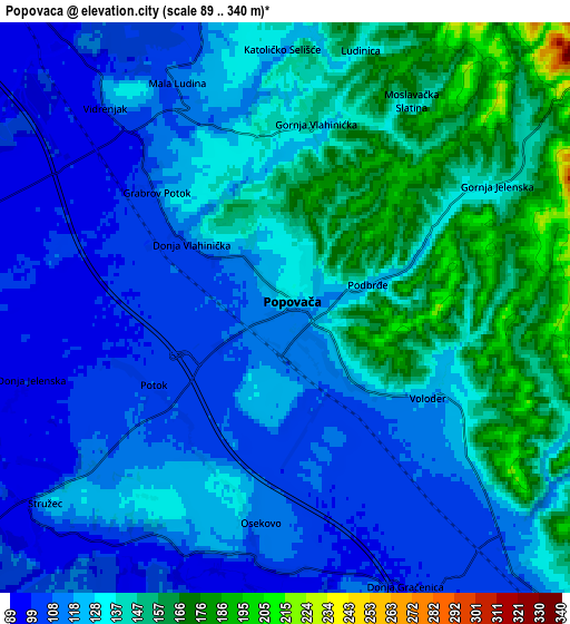
| Scale [m] | 98..214 m | 89..340 m | × |
| Scale [ft] | 322..702 ft | 292..1115 ft | × |
| Average | 128.7 m = 422 ft | 128.1 m = 420 ft | × |
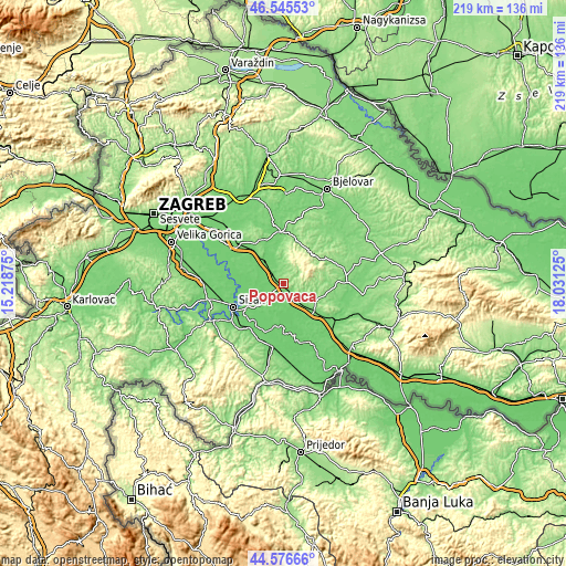
| Width | 6.84 km = 4.3 mi | 13.68 km = 8.5 mi | 218.9 km = 136 mi |
| Height | 6.84 km = 4.3 mi | 13.68 km = 8.5 mi | 218.9 km = 136 mi |
| ↑Max Latitude | 45.600475° | 45.631213° | 46.54553° |
| Latitude at center | 45.56972° | 45.56972° | 45.56972° |
| ↓Min Latitude | 45.538948° | 45.508159° | 44.57666° |
| ← Min Longitude | 16.581055° | 16.537109° | 15.21875° |
| Longitude center | 16.625° | 16.625° | 16.625° |
| →Max Longitude | 16.668945° | 16.712891° | 18.03125° |
Nearby cities:
Cities around Popovača sort by population:
• Sisak elevation 108 m
22.4 km,  239°
239°
• Kutina 104 m
16.1 km,  130°
130°
• Čazma 138 m
19.9 km,  357°
357°
• Križ 121 m
13.2 km,  323°
323°
• Voloder 129 m
4.8 km,  119°
119°
• Repušnica 110 m
11.9 km,  136°
136°
• Budaševo 94 m
18.1 km,  234°
234°
• Sunja 101 m
22.8 km,  191°
191°
• Novoselec 99 m
11.5 km, 323°
• Ivanić-Grad 103 m
23.5 km,  310°
310°
• Martinska Ves 100 m
19.4 km,  274°
274°
• Velika Ludina 132 m
3.9 km,  329°
329°
Multilingual:
 En español:
Popovača elevación 127 m.
 En France:
Popovača élévation 127 m.
 Auf Deutsch:
Popovača höhe über dem Meeresspiegel ist 127 m.

Sources and notes:
- [note 1] Map square and city borders are not equal. Map elevation data is calculated only from area inside that square.
- [src 1] Elevation data from geonames database provided with same terms of usage.
- [src 2] The elevation map of Popovača is generated using elevation data from NASA's 3 arcsec (90m) resolution SRTM data.
- [src 3] Base (background) map © OpenStreetMap contributors tiles are generated by Geofabrik and OpenTopoMap.
Copyright & License:
This Popovača Elevation Map is licensed under CC BY-SA. You may reuse any part from this page, if you give a proper credit by linking to this URL:
 More info on terms of use page.