Guaimaca elevation
Guaimaca (Francisco Morazán), Honduras elevation is 884 meters and Guaimaca elevation in feet is 2900 ft above sea level [src 1]. Guaimaca is a populated place (feature code) with elevation that is 341 meters (1119 ft) bigger than average city elevation in Honduras.
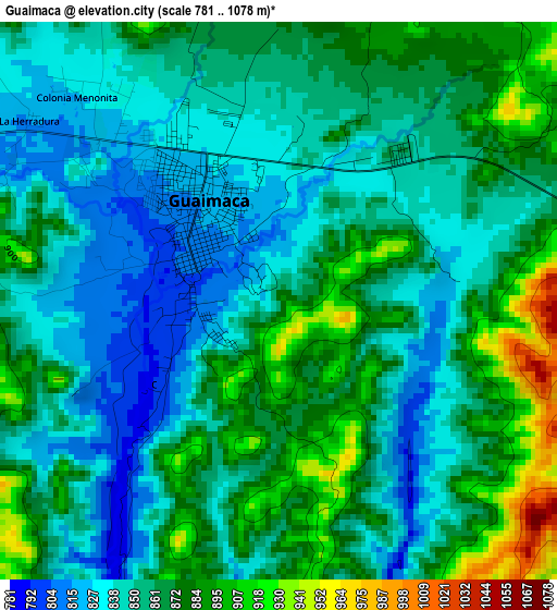
Below is the Elevation map of Guaimaca, which displays elevation range with different colors. Scale of the first map is from 781 to 1078 m (2562 to 3537 ft) with average elevation of 860.1 meters (=2822 ft) [note 1]
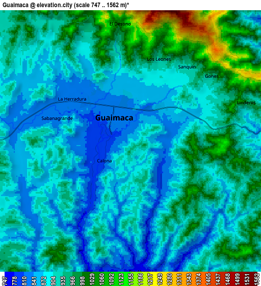
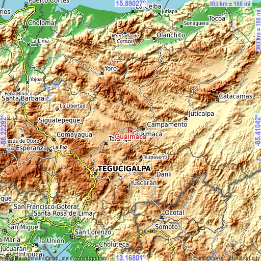
These maps also provides idea of topography and contour of this city, they are displayed at different zoom levels. More info about maps, scale and edge coordinates you can find below images.
| \ | Map #1 | Map #2 | Topo.Map |
| Scale [m] | 781..1078 m | 747..1562 m | × |
| Scale [ft] | 2562..3537 ft | 2451..5125 ft | × |
| Average | 860.1 m = 2822 ft | 923.5 m = 3030 ft | × |
| Width | 9.46 km = 5.9 mi | 18.92 km = 11.8 mi | 302.7 km = 188.1 mi |
| Height | 9.46 km = 5.9 mi | 18.92 km = 11.8 mi | 302.7 km = 188.1 mi |
| ↑Max Latitude | 14.575865° | 14.618392° | 15.89027° |
| Latitude at center | 14.53333° | 14.53333° | 14.53333° |
| ↓Min Latitude | 14.490787° | 14.448235° | 13.16801° |
| ← Min Longitude | -86.860615° | -86.904561° | -88.22292° |
| Longitude center | -86.81667° | -86.81667° | -86.81667° |
| →Max Longitude | -86.772725° | -86.728779° | -85.41042° |
Nearby cities:
Cities around Guaimaca sort by population:
• Talanga elevation 810 m
32.3 km,  242°
242°
• Campamento 713 m
18 km,  84°
84°
• La Ermita 770 m
27.9 km,  254°
254°
• Orica 856 m
23.4 km,  322°
322°
• San Ignacio 700 m
26.7 km,  299°
299°
• Guayape 925 m
20.5 km,  354°
354°
• El Pedernal 673 m
37.2 km, 299°
• Concordia 712 m
20.2 km,  62°
62°
• El Escanito 609 m
33.9 km, 295°
• El Guante 881 m
30.6 km,  273°
273°
• Cedros 927 m
33.1 km,  282°
282°
• El Escaño de Tepale 757 m
36.1 km,  311°
311°
Multilingual:
 En español:
Guaimaca elevación 884 m.
 En France:
Guaimaca élévation 884 m.
 Auf Deutsch:
Guaimaca höhe über dem Meeresspiegel ist 884 m.

Sources and notes:
- [note 1] Map square and city borders are not equal. Map elevation data is calculated only from area inside that square.
- [src 1] Elevation data from geonames database provided with same terms of usage.
- [src 2] The elevation map of Guaimaca is generated using elevation data from NASA's 3 arcsec (90m) resolution SRTM data.
- [src 3] Base (background) map © OpenStreetMap contributors tiles are generated by Geofabrik and OpenTopoMap.
Copyright & License:
This Guaimaca Elevation Map is licensed under CC BY-SA. You may reuse any part from this page, if you give a proper credit by linking to this URL:
 More info on terms of use page.