Talanga elevation
Talanga (Francisco Morazán), Honduras elevation is 810 meters and Talanga elevation in feet is 2657 ft above sea level [src 1]. Talanga is a populated place (feature code) with elevation that is 267 meters (876 ft) bigger than average city elevation in Honduras.
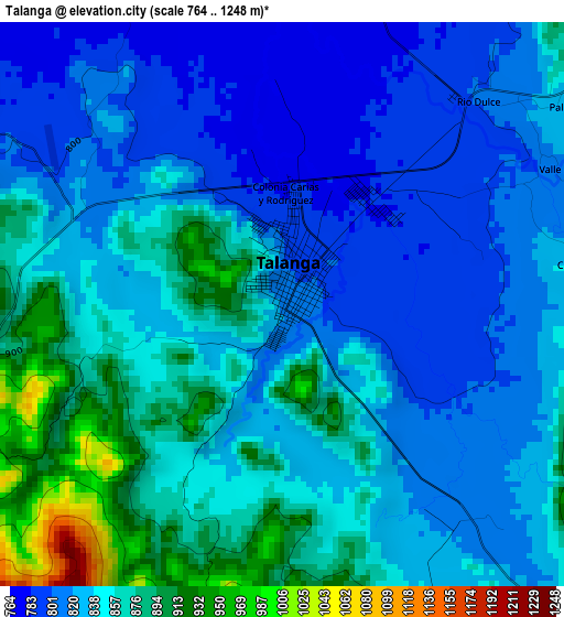
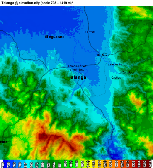
Below is the Elevation map of Talanga, which displays elevation range with different colors. Scale of the first map is from 764 to 1248 m (2507 to 4094 ft) with average elevation of 840.6 meters (=2758 ft) [note 1]
These maps also provides idea of topography and contour of this city, they are displayed at different zoom levels. More info about maps, scale and edge coordinates you can find below images.
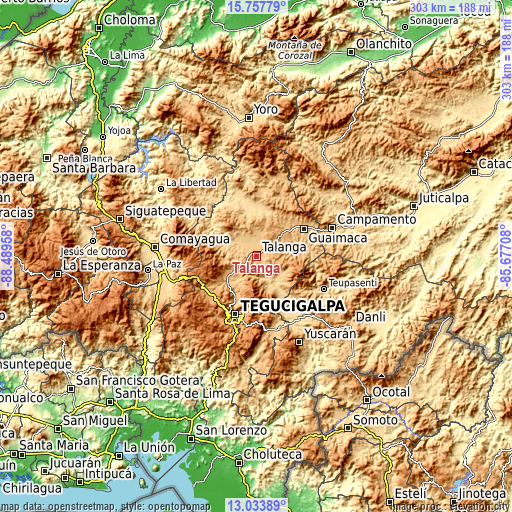
| \ | Map #1 | Map #2 | Topo.Map |
| Scale [m] | 764..1248 m | 708..1419 m | × |
| Scale [ft] | 2507..4094 ft | 2323..4656 ft | × |
| Average | 840.6 m = 2758 ft | 908.8 m = 2982 ft | × |
| Width | 9.47 km = 5.9 mi | 18.93 km = 11.8 mi | 302.9 km = 188.2 mi |
| Height | 9.47 km = 5.9 mi | 18.93 km = 11.8 mi | 302.9 km = 188.2 mi |
| ↑Max Latitude | 14.442561° | 14.485113° | 15.75779° |
| Latitude at center | 14.4° | 14.4° | 14.4° |
| ↓Min Latitude | 14.357431° | 14.314854° | 13.03389° |
| ← Min Longitude | -87.127275° | -87.171221° | -88.48958° |
| Longitude center | -87.08333° | -87.08333° | -87.08333° |
| →Max Longitude | -87.039385° | -86.995439° | -85.67708° |
Nearby cities:
Cities around Talanga sort by population:
• Villa de San Francisco elevation 777 m
28.8 km,  154°
154°
• Valle de Ángeles 1278 m
28.3 km,  169°
169°
• San Juan de Flores 742 m
15.8 km,  160°
160°
• La Ermita 770 m
7.6 km,  13°
13°
• San Ignacio 700 m
28.3 km, 10°
• Río Abajo 1027 m
29.7 km,  208°
208°
• El Suyatal 806 m
19.3 km,  312°
312°
• Cofradía 1131 m
23.1 km, 207°
• El Escanito 609 m
29.7 km,  356°
356°
• El Guante 881 m
16.8 km,  353°
353°
• Cedros 927 m
22.5 km, 350°
• Agalteca 724 m
20.5 km,  285°
285°
Multilingual:
 En español:
Talanga elevación 810 m.
 En France:
Talanga élévation 810 m.


Sources and notes:
- [note 1] Map square and city borders are not equal. Map elevation data is calculated only from area inside that square.
- [src 1] Elevation data from geonames database provided with same terms of usage.
- [src 2] The elevation map of Talanga is generated using elevation data from NASA's 3 arcsec (90m) resolution SRTM data.
- [src 3] Base (background) map © OpenStreetMap contributors tiles are generated by Geofabrik and OpenTopoMap.
Copyright & License:
This Talanga Elevation Map is licensed under CC BY-SA. You may reuse any part from this page, if you give a proper credit by linking to this URL:
 More info on terms of use page.