Langue elevation
Langue (Valle), Honduras elevation is 151 meters and Langue elevation in feet is 495 ft above sea level [src 1]. Langue is a populated place (feature code) with elevation that is 392 meters (1286 ft) smaller than average city elevation in Honduras.
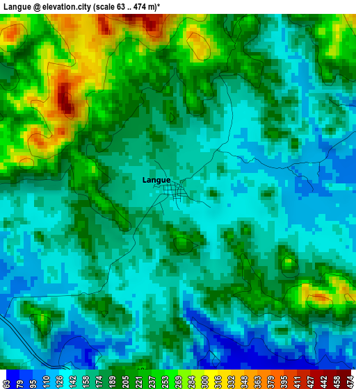
Below is the Elevation map of Langue, which displays elevation range with different colors. Scale of the first map is from 63 to 474 m (207 to 1555 ft) with average elevation of 181.3 meters (=595 ft) [note 1]
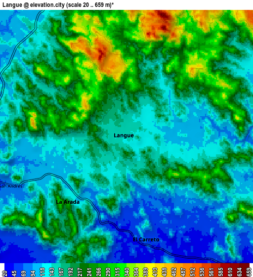
These maps also provides idea of topography and contour of this city, they are displayed at different zoom levels. More info about maps, scale and edge coordinates you can find below images.
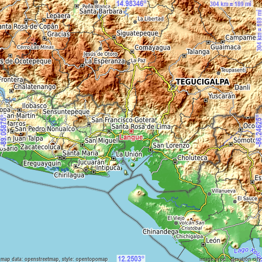
| \ | Map #1 | Map #2 | Topo.Map |
| Scale [m] | 63..474 m | 20..659 m | × |
| Scale [ft] | 207..1555 ft | 66..2162 ft | × |
| Average | 181.3 m = 595 ft | 186.6 m = 612 ft | × |
| Width | 9.5 km = 5.9 mi | 19 km = 11.8 mi | 303.9 km = 188.8 mi |
| Height | 9.5 km = 5.9 mi | 19 km = 11.8 mi | 303.9 km = 188.8 mi |
| ↑Max Latitude | 13.663536° | 13.706233° | 14.98346° |
| Latitude at center | 13.62083° | 13.62083° | 13.62083° |
| ↓Min Latitude | 13.578117° | 13.535396° | 12.2503° |
| ← Min Longitude | -87.696445° | -87.740391° | -89.05875° |
| Longitude center | -87.6525° | -87.6525° | -87.6525° |
| →Max Longitude | -87.608555° | -87.564609° | -86.24625° |
Nearby cities:
Cities around Langue sort by population:
• Nacaome elevation 36 m
20.2 km,  117°
117°
• La Alianza 26 m
14.4 km,  212°
212°
• Agua Fría 15 m
20.1 km,  147°
147°
• El Tular 18 m
22.7 km,  139°
139°
• El Guapinol 751 m
25.8 km,  51°
51°
• Jícaro Galán 55 m
25.1 km,  113°
113°
• Goascorán 103 m
5.7 km, 137°
• San Francisco de Coray 164 m
13.7 km,  70°
70°
• El Cubolero 5 m
17.2 km,  185°
185°
• Reitoca 304 m
30.5 km,  41°
41°
• Aramecina 136 m
14.9 km,  335°
335°
• San Antonio del Norte 301 m
29.8 km,  349°
349°
Multilingual:
 En español:
Langue elevación 151 m.
 En France:
Langue élévation 151 m.


Sources and notes:
- [note 1] Map square and city borders are not equal. Map elevation data is calculated only from area inside that square.
- [src 1] Elevation data from geonames database provided with same terms of usage.
- [src 2] The elevation map of Langue is generated using elevation data from NASA's 3 arcsec (90m) resolution SRTM data.
- [src 3] Base (background) map © OpenStreetMap contributors tiles are generated by Geofabrik and OpenTopoMap.
Copyright & License:
This Langue Elevation Map is licensed under CC BY-SA. You may reuse any part from this page, if you give a proper credit by linking to this URL:
 More info on terms of use page.