Akraifnía elevation
Akraifnía (Central Greece, Nomós Voiotías), Greece elevation is 191 meters and Akraifnía elevation in feet is 627 ft above sea level [src 1]. Akraifnía is a populated place (feature code) with elevation that is 40 meters (131 ft) bigger than average city elevation in Greece.
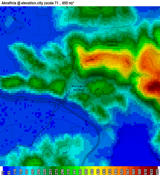
Below is the Elevation map of Akraifnía, which displays elevation range with different colors. Scale of the first map is from 71 to 655 m (233 to 2149 ft) with average elevation of 196 meters (=643 ft) [note 1]
These maps also provides idea of topography and contour of this city, they are displayed at different zoom levels. More info about maps, scale and edge coordinates you can find below images.
| \ | Map #1 | Topo.Map |
| Scale [m] | 71..655 m | × |
| Scale [ft] | 233..2149 ft | × |
| Average | 196 m = 643 ft | × |
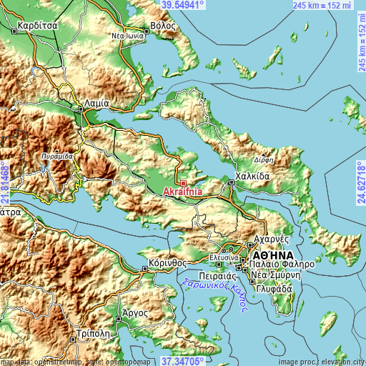
| Width | 7.65 km = 4.8 mi | 244.9 km = 152.2 mi |
| Height | 7.65 km = 4.8 mi | 244.9 km = 152.2 mi |
| ↑Max Latitude | 38.491034° | 39.54941° |
| Latitude at center | 38.45663° | 38.45663° |
| ↓Min Latitude | 38.422209° | 37.34705° |
| ← Min Longitude | 23.176985° | 21.81468° |
| Longitude center | 23.22093° | 23.22093° |
| →Max Longitude | 23.264875° | 24.62718° |
Nearby cities:
Cities around Akraifnía sort by population:
• Thívai elevation 170 m
16.9 km,  149°
149°
• Orchomenós 104 m
21.4 km,  280°
280°
• Vágia 214 m
15.9 km,  193°
193°
• Alíartos 183 m
14.5 km,  226°
226°
• Malesína 215 m
18.4 km,  3°
3°
• Erythrés 389 m
28 km,  161°
161°
• Ágios Geórgios 220 m
26.1 km,  254°
254°
• Martínon 231 m
12.4 km,  357°
357°
• Kaparéllion 326 m
24.4 km,  181°
181°
• Thespiés 380 m
18.2 km,  199°
199°
• Loukísia 163 m
19.9 km,  82°
82°
• Árma 256 m
25.9 km,  116°
116°
Multilingual:
 En español:
Akraifnía elevación 191 m.
 En France:
Akraifnía élévation 191 m.
 Auf Deutsch:
Akraifnía höhe über dem Meeresspiegel ist 191 m.

Sources and notes:
- [note 1] Map square and city borders are not equal. Map elevation data is calculated only from area inside that square.
- [src 1] Elevation data from geonames database provided with same terms of usage.
- [src 2] The elevation map of Akraifnía is generated using elevation data from NASA's 3 arcsec (90m) resolution SRTM data.
- [src 3] Base (background) map © OpenStreetMap contributors tiles are generated by Geofabrik and OpenTopoMap.
Copyright & License:
This Akraifnía Elevation Map is licensed under CC BY-SA. You may reuse any part from this page, if you give a proper credit by linking to this URL:
 More info on terms of use page.