Thívai elevation
Thívai (Central Greece, Nomós Voiotías), Greece elevation is 170 meters and Thívai elevation in feet is 558 ft above sea level [src 1]. Thívai is a populated place (feature code) with elevation that is 19 meters (62 ft) bigger than average city elevation in Greece.
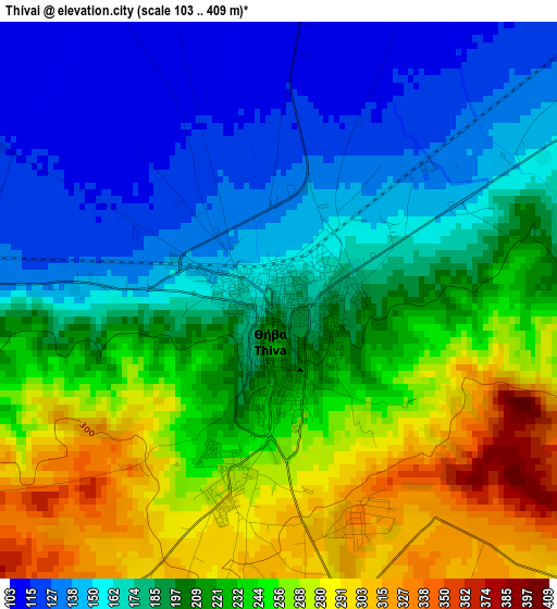
Below is the Elevation map of Thívai, which displays elevation range with different colors. Scale of the first map is from 103 to 409 m (338 to 1342 ft) with average elevation of 206.2 meters (=677 ft) [note 1]
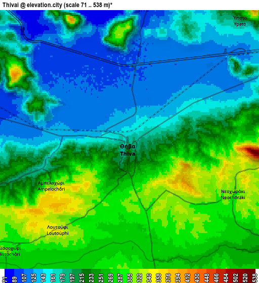
These maps also provides idea of topography and contour of this city, they are displayed at different zoom levels. More info about maps, scale and edge coordinates you can find below images.
| \ | Map #1 | Map #2 | Topo.Map |
| Scale [m] | 103..409 m | 71..538 m | × |
| Scale [ft] | 338..1342 ft | 233..1765 ft | × |
| Average | 206.2 m = 677 ft | 214.4 m = 703 ft | × |
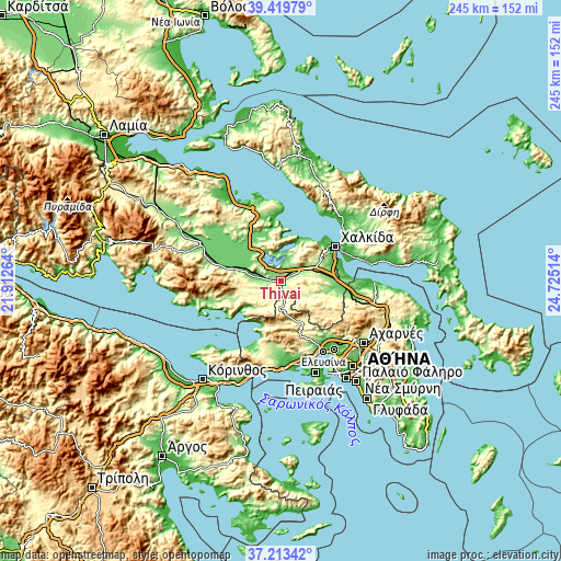
| Width | 7.67 km = 4.8 mi | 15.33 km = 9.5 mi | 245.3 km = 152.4 mi |
| Height | 7.67 km = 4.8 mi | 15.33 km = 9.5 mi | 245.3 km = 152.4 mi |
| ↑Max Latitude | 38.359467° | 38.393918° | 39.41979° |
| Latitude at center | 38.325° | 38.325° | 38.325° |
| ↓Min Latitude | 38.290516° | 38.256017° | 37.21342° |
| ← Min Longitude | 23.274945° | 23.230999° | 21.91264° |
| Longitude center | 23.31889° | 23.31889° | 23.31889° |
| →Max Longitude | 23.362835° | 23.406781° | 24.72514° |
Nearby cities:
Cities around Thívai sort by population:
• Vágia elevation 214 m
12.4 km,  266°
266°
• Alíartos 183 m
19.6 km,  283°
283°
• Schimatári 172 m
23.2 km,  83°
83°
• Erythrés 389 m
12 km,  178°
178°
• Kaparéllion 326 m
13.4 km,  223°
223°
• Thespiés 380 m
14.9 km,  260°
260°
• Asopía 312 m
16.2 km,  100°
100°
• Áyios Thomás 242 m
24.2 km, 102°
• Vília 508 m
17.6 km,  174°
174°
• Akraifnía 191 m
16.9 km,  329°
329°
• Loukísia 163 m
20.5 km,  33°
33°
• Árma 256 m
14.9 km, 78°
Multilingual:
 En español:
Tebas elevación 170 m.
 En France:
Thèbes élévation 170 m.


Sources and notes:
- [note 1] Map square and city borders are not equal. Map elevation data is calculated only from area inside that square.
- [src 1] Elevation data from geonames database provided with same terms of usage.
- [src 2] The elevation map of Thívai is generated using elevation data from NASA's 3 arcsec (90m) resolution SRTM data.
- [src 3] Base (background) map © OpenStreetMap contributors tiles are generated by Geofabrik and OpenTopoMap.
Copyright & License:
This Thívai Elevation Map is licensed under CC BY-SA. You may reuse any part from this page, if you give a proper credit by linking to this URL:
 More info on terms of use page.