Kalamata elevation
Kalamata (Peloponnese, Nomós Messinías), Greece elevation is 26 meters and Kalamata elevation in feet is 85 ft above sea level [src 1]. Kalamata is a seat of a second-order administrative division (feature code) with elevation that is 125 meters (410 ft) smaller than average city elevation in Greece.
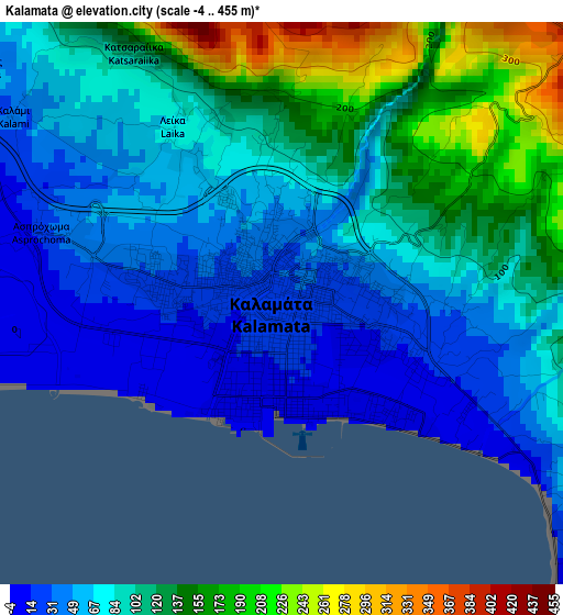
Below is the Elevation map of Kalamata, which displays elevation range with different colors. Scale of the first map is from -4 to 455 m (-13 to 1493 ft) with average elevation of 90.6 meters (=297 ft) [note 1]
These maps also provides idea of topography and contour of this city, they are displayed at different zoom levels. More info about maps, scale and edge coordinates you can find below images.
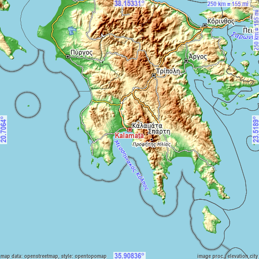
| \ | Map #1 | Map #2 | Topo.Map |
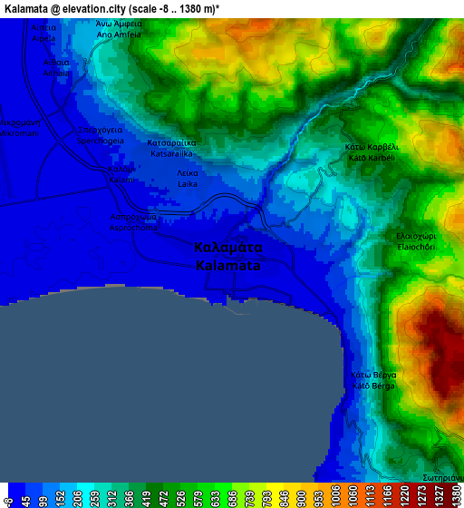
| Scale [m] | -4..455 m | -8..1380 m | × |
| Scale [ft] | -13..1493 ft | -26..4528 ft | × |
| Average | 90.6 m = 297 ft | 348.7 m = 1144 ft | × |
| Width | 7.8 km = 4.8 mi | 15.6 km = 9.7 mi | 249.6 km = 155.1 mi |
| Height | 7.8 km = 4.8 mi | 15.6 km = 9.7 mi | 249.6 km = 155.1 mi |
| ↑Max Latitude | 37.0742° | 37.109254° | 38.15331° |
| Latitude at center | 37.03913° | 37.03913° | 37.03913° |
| ↓Min Latitude | 37.004044° | 36.968941° | 35.90836° |
| ← Min Longitude | 22.068705° | 22.024759° | 20.7064° |
| Longitude center | 22.11265° | 22.11265° | 22.11265° |
| →Max Longitude | 22.156595° | 22.200541° | 23.5189° |
Nearby cities:
Cities around Kalamata sort by population:
• Spárti elevation 206 m
28.4 km,  82°
82°
• Messíni 21 m
9.4 km,  278°
278°
• Paralía Vérgas 26 m
5.3 km,  132°
132°
• Koróni 40 m
30.4 km,  206°
206°
• Magoúla 239 m
26.3 km, 80°
• Vlachópoulo 430 m
28.5 km,  268°
268°
• Meligalás 82 m
23.6 km,  326°
326°
• Thouría 25 m
7.5 km,  311°
311°
• Arfará 90 m
14.3 km,  335°
335°
• Áris 23 m
11.7 km,  304°
304°
• Sperchógeia 54 m
5.9 km, 311°
• Kardamýli 15 m
19.9 km,  147°
147°
Multilingual:
 En español:
Kalamata elevación 26 m.
 En France:
Kalamata élévation 26 m.


Sources and notes:
- [note 1] Map square and city borders are not equal. Map elevation data is calculated only from area inside that square.
- [src 1] Elevation data from geonames database provided with same terms of usage.
- [src 2] The elevation map of Kalamata is generated using elevation data from NASA's 3 arcsec (90m) resolution SRTM data.
- [src 3] Base (background) map © OpenStreetMap contributors tiles are generated by Geofabrik and OpenTopoMap.
Copyright & License:
This Kalamata Elevation Map is licensed under CC BY-SA. You may reuse any part from this page, if you give a proper credit by linking to this URL:
 More info on terms of use page.