Kardítsa elevation
Kardítsa (Thessaly, Nomós Kardhítsas), Greece elevation is 111 meters and Kardítsa elevation in feet is 364 ft above sea level [src 1]. Kardítsa is a seat of a second-order administrative division (feature code) with elevation that is 40 meters (131 ft) smaller than average city elevation in Greece.
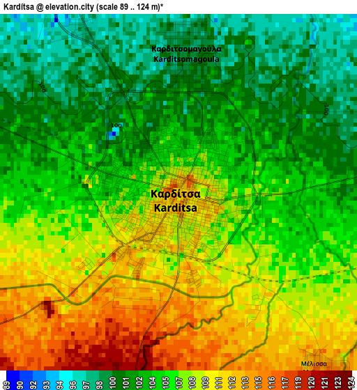
Below is the Elevation map of Kardítsa, which displays elevation range with different colors. Scale of the first map is from 89 to 124 m (292 to 407 ft) with average elevation of 105.8 meters (=347 ft) [note 1]
These maps also provides idea of topography and contour of this city, they are displayed at different zoom levels. More info about maps, scale and edge coordinates you can find below images.
| \ | Map #1 | Map #2 | Topo.Map |
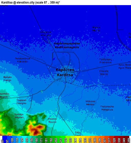
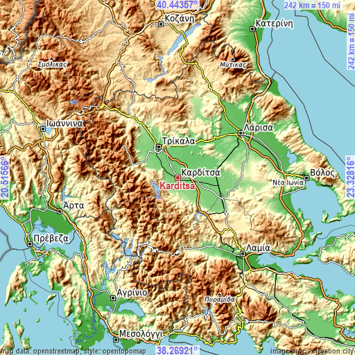
| Scale [m] | 89..124 m | 87..359 m | × |
| Scale [ft] | 292..407 ft | 285..1178 ft | × |
| Average | 105.8 m = 347 ft | 112.4 m = 369 ft | × |
| Width | 7.56 km = 4.7 mi | 15.11 km = 9.4 mi | 241.8 km = 150.2 mi |
| Height | 7.56 km = 4.7 mi | 15.11 km = 9.4 mi | 241.8 km = 150.2 mi |
| ↑Max Latitude | 39.398817° | 39.432767° | 40.44357° |
| Latitude at center | 39.36485° | 39.36485° | 39.36485° |
| ↓Min Latitude | 39.330867° | 39.296867° | 38.26921° |
| ← Min Longitude | 21.877965° | 21.834019° | 20.51566° |
| Longitude center | 21.92191° | 21.92191° | 21.92191° |
| →Max Longitude | 21.965855° | 22.009801° | 23.32816° |
Nearby cities:
Cities around Kardítsa sort by population:
• Karditsomagoúla elevation 99 m
2.9 km,  2°
2°
• Agnanteró 97 m
14.9 km,  334°
334°
• Proástio 93 m
13.7 km,  353°
353°
• Mitrópoli 150 m
7.8 km,  248°
248°
• Artesianó 97 m
4.7 km, 332°
• Kallifóni 145 m
10.3 km,  160°
160°
• Makrychóri 94 m
9.1 km,  24°
24°
• Kallíthiro 166 m
9.4 km,  188°
188°
• Karpochóri 111 m
8.3 km,  112°
112°
• Magoúla 102 m
14.2 km,  314°
314°
• Agía Triáda 94 m
11.2 km, 349°
• Morfovoúni 822 m
14.8 km,  264°
264°
Multilingual:
 En español:
Karditsa elevación 111 m.
 En France:
Kardítsa élévation 111 m.
 Auf Deutsch:
Karditsa höhe über dem Meeresspiegel ist 111 m.

Sources and notes:
- [note 1] Map square and city borders are not equal. Map elevation data is calculated only from area inside that square.
- [src 1] Elevation data from geonames database provided with same terms of usage.
- [src 2] The elevation map of Kardítsa is generated using elevation data from NASA's 3 arcsec (90m) resolution SRTM data.
- [src 3] Base (background) map © OpenStreetMap contributors tiles are generated by Geofabrik and OpenTopoMap.
Copyright & License:
This Kardítsa Elevation Map is licensed under CC BY-SA. You may reuse any part from this page, if you give a proper credit by linking to this URL:
 More info on terms of use page.