Chaïdári elevation
Chaïdári (Attica, Nomarchía Athínas), Greece elevation is 92 meters and Chaïdári elevation in feet is 302 ft above sea level [src 1]. Chaïdári is a seat of a third-order administrative division (feature code) with elevation that is 59 meters (194 ft) smaller than average city elevation in Greece.
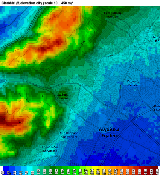
Below is the Elevation map of Chaïdári, which displays elevation range with different colors. Scale of the first map is from 10 to 450 m (33 to 1476 ft) with average elevation of 130.2 meters (=427 ft) [note 1]
These maps also provides idea of topography and contour of this city, they are displayed at different zoom levels. More info about maps, scale and edge coordinates you can find below images.
| \ | Map #1 | Map #2 | Topo.Map |
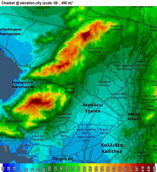
| Scale [m] | 10..450 m | -58..456 m | × |
| Scale [ft] | 33..1476 ft | -190..1496 ft | × |
| Average | 130.2 m = 427 ft | 106.2 m = 348 ft | × |
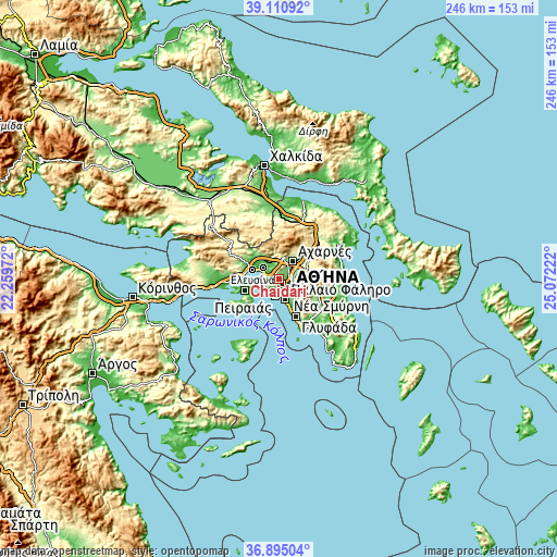
| Width | 7.7 km = 4.8 mi | 15.4 km = 9.6 mi | 246.4 km = 153.1 mi |
| Height | 7.7 km = 4.8 mi | 15.4 km = 9.6 mi | 246.4 km = 153.1 mi |
| ↑Max Latitude | 38.045966° | 38.080565° | 39.11092° |
| Latitude at center | 38.01135° | 38.01135° | 38.01135° |
| ↓Min Latitude | 37.976718° | 37.942069° | 36.89504° |
| ← Min Longitude | 23.622025° | 23.578079° | 22.25972° |
| Longitude center | 23.66597° | 23.66597° | 23.66597° |
| →Max Longitude | 23.709915° | 23.753861° | 25.07222° |
Nearby cities:
Cities around Chaïdári sort by population:
• Peristéri elevation 66 m
2.3 km,  78°
78°
• Níkaia 30 m
5.2 km,  195°
195°
• Ílion 90 m
3.9 km,  50°
50°
• Aigáleo 24 m
3.5 km,  153°
153°
• Korydallós 93 m
3.4 km,  209°
209°
• Petroúpolis 144 m
3.8 km,  26°
26°
• Ágioi Anárgyroi 84 m
5.5 km,  67°
67°
• Agía Varvára 58 m
2.5 km,  191°
191°
• Agios Ioannis Rentis 13 m
5.2 km,  180°
180°
• Távros 23 m
5 km, 154°
• Néa Chalkidóna 82 m
5.9 km, 72°
• Skarmagkás 20 m
5.5 km,  269°
269°
Multilingual:
 En español:
Chaïdári elevación 92 m.
 En France:
Chaïdári élévation 92 m.


Sources and notes:
- [note 1] Map square and city borders are not equal. Map elevation data is calculated only from area inside that square.
- [src 1] Elevation data from geonames database provided with same terms of usage.
- [src 2] The elevation map of Chaïdári is generated using elevation data from NASA's 3 arcsec (90m) resolution SRTM data.
- [src 3] Base (background) map © OpenStreetMap contributors tiles are generated by Geofabrik and OpenTopoMap.
Copyright & License:
This Chaïdári Elevation Map is licensed under CC BY-SA. You may reuse any part from this page, if you give a proper credit by linking to this URL:
 More info on terms of use page.