Pallíni elevation
Pallíni (Attica, Nomarchía Anatolikís Attikís), Greece elevation is 199 meters and Pallíni elevation in feet is 653 ft above sea level [src 1]. Pallíni is a populated place (feature code) with elevation that is 48 meters (157 ft) bigger than average city elevation in Greece.
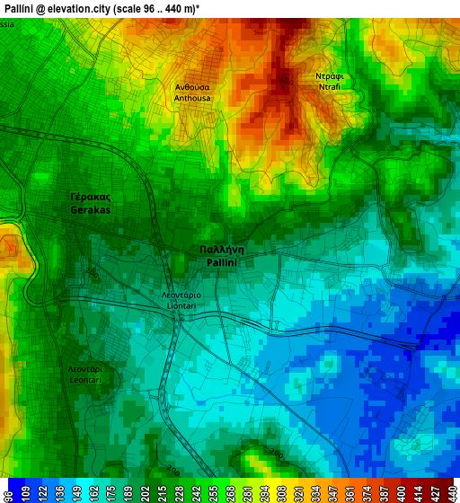
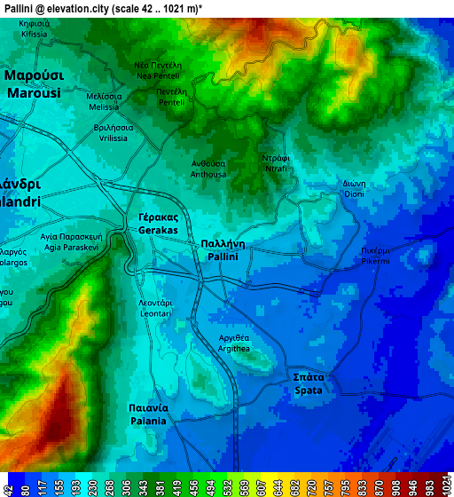
Below is the Elevation map of Pallíni, which displays elevation range with different colors. Scale of the first map is from 96 to 440 m (315 to 1444 ft) with average elevation of 220.1 meters (=722 ft) [note 1]
These maps also provides idea of topography and contour of this city, they are displayed at different zoom levels. More info about maps, scale and edge coordinates you can find below images.
| \ | Map #1 | Map #2 | Topo.Map |
| Scale [m] | 96..440 m | 42..1021 m | × |
| Scale [ft] | 315..1444 ft | 138..3350 ft | × |
| Average | 220.1 m = 722 ft | 270.7 m = 888 ft | × |
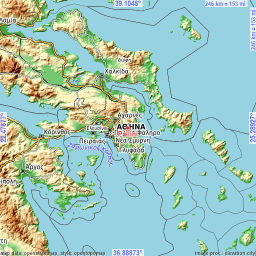
| Width | 7.7 km = 4.8 mi | 15.4 km = 9.6 mi | 246.4 km = 153.1 mi |
| Height | 7.7 km = 4.8 mi | 15.4 km = 9.6 mi | 246.4 km = 153.1 mi |
| ↑Max Latitude | 38.039759° | 38.074361° | 39.1048° |
| Latitude at center | 38.00514° | 38.00514° | 38.00514° |
| ↓Min Latitude | 37.970505° | 37.935853° | 36.88873° |
| ← Min Longitude | 23.839075° | 23.795129° | 22.47677° |
| Longitude center | 23.88302° | 23.88302° | 23.88302° |
| →Max Longitude | 23.926965° | 23.970911° | 25.28927° |
Nearby cities:
Cities around Pallíni sort by population:
• Agía Paraskeví elevation 216 m
4.5 km,  286°
286°
• Vrilissia 232 m
5.7 km,  304°
304°
• Gérakas 250 m
3 km,  311°
311°
• Paianía 183 m
6.1 km,  204°
204°
• Spáta 142 m
5.6 km,  149°
149°
• Leondárion 207 m
3.2 km,  230°
230°
• Pentéli 450 m
5.2 km,  343°
343°
• Dhráfi 268 m
3 km,  46°
46°
• Anthoúsa 316 m
2.3 km,  345°
345°
• Dióni 201 m
4.8 km,  65°
65°
• Pikérmi 106 m
5.1 km,  94°
94°
• Argithéa 224 m
3.4 km,  176°
176°
Multilingual:
 En español:
Pallíni elevación 199 m.
 En France:
Pallíni élévation 199 m.


Sources and notes:
- [note 1] Map square and city borders are not equal. Map elevation data is calculated only from area inside that square.
- [src 1] Elevation data from geonames database provided with same terms of usage.
- [src 2] The elevation map of Pallíni is generated using elevation data from NASA's 3 arcsec (90m) resolution SRTM data.
- [src 3] Base (background) map © OpenStreetMap contributors tiles are generated by Geofabrik and OpenTopoMap.
Copyright & License:
This Pallíni Elevation Map is licensed under CC BY-SA. You may reuse any part from this page, if you give a proper credit by linking to this URL:
 More info on terms of use page.