Mbini elevation
Mbini (Litoral), Equatorial Guinea elevation is 13 meters and Mbini elevation in feet is 43 ft above sea level [src 1]. Mbini is a populated place (feature code) with elevation that is 333 meters (1093 ft) smaller than average city elevation in Equatorial Guinea.
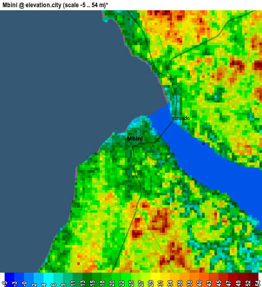
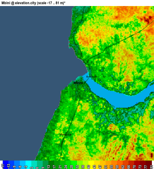
Below is the Elevation map of Mbini, which displays elevation range with different colors. Scale of the first map is from -5 to 54 m (-16 to 177 ft) with average elevation of 22 meters (=72 ft) [note 1]
These maps also provides idea of topography and contour of this city, they are displayed at different zoom levels. More info about maps, scale and edge coordinates you can find below images.
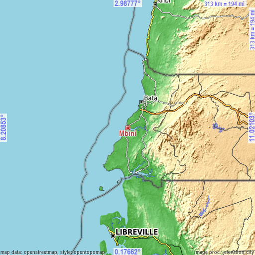
| \ | Map #1 | Map #2 | Topo.Map |
| Scale [m] | -5..54 m | -17..81 m | × |
| Scale [ft] | -16..177 ft | -56..266 ft | × |
| Average | 22 m = 72 ft | 30 m = 98 ft | × |
| Width | 9.77 km = 6.1 mi | 19.54 km = 12.1 mi | 312.6 km = 194.2 mi |
| Height | 9.77 km = 6.1 mi | 19.54 km = 12.1 mi | 312.6 km = 194.2 mi |
| ↑Max Latitude | 1.626598° | 1.670525° | 2.98777° |
| Latitude at center | 1.58267° | 1.58267° | 1.58267° |
| ↓Min Latitude | 1.538741° | 1.494811° | 0.17662° |
| ← Min Longitude | 9.570835° | 9.526889° | 8.20853° |
| Longitude center | 9.61478° | 9.61478° | 9.61478° |
| →Max Longitude | 9.658725° | 9.702671° | 11.02103° |
Nearby cities:
Cities around Mbini sort by population:
• Bata elevation 13 m
35.5 km,  28°
28°
• Añisoc 456 m
132.1 km,  76°
76°
• Evinayong 669 m
105.3 km,  98°
98°
• Mikomeseng 542 m
126.9 km,  60°
60°
• Cogo 4 m
56.1 km,  171°
171°
• Ayene 443 m
123.3 km, 75°
• Machinda 174 m
50.1 km,  48°
48°
• Acurenam 661 m
130.2 km,  118°
118°
• Bicurga 641 m
94.7 km,  90°
90°
• Ncue 399 m
106.6 km, 63°
• Bitica 28 m
17.4 km,  176°
176°
• Río Campo 28 m
87.1 km,  15°
15°
Multilingual:
 En español:
Mbini elevación 13 m.
 En France:
Mbini élévation 13 m.


Sources and notes:
- [note 1] Map square and city borders are not equal. Map elevation data is calculated only from area inside that square.
- [src 1] Elevation data from geonames database provided with same terms of usage.
- [src 2] The elevation map of Mbini is generated using elevation data from NASA's 3 arcsec (90m) resolution SRTM data.
- [src 3] Base (background) map © OpenStreetMap contributors tiles are generated by Geofabrik and OpenTopoMap.
Copyright & License:
This Mbini Elevation Map is licensed under CC BY-SA. You may reuse any part from this page, if you give a proper credit by linking to this URL:
 More info on terms of use page.