Aburi elevation
Aburi (Eastern), Ghana elevation is 447 meters and Aburi elevation in feet is 1467 ft above sea level [src 1]. Aburi is a populated place (feature code) with elevation that is 277 meters (909 ft) bigger than average city elevation in Ghana.
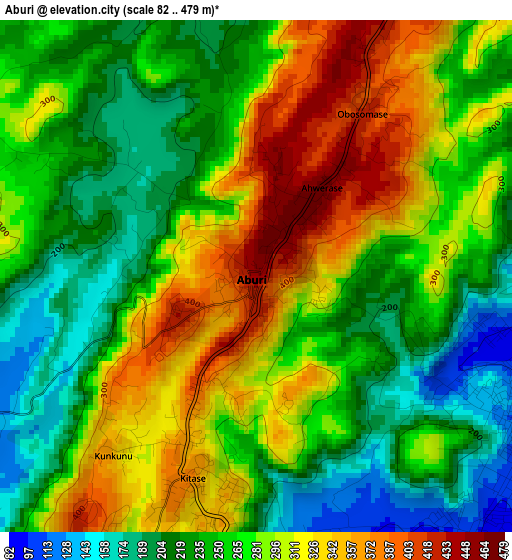
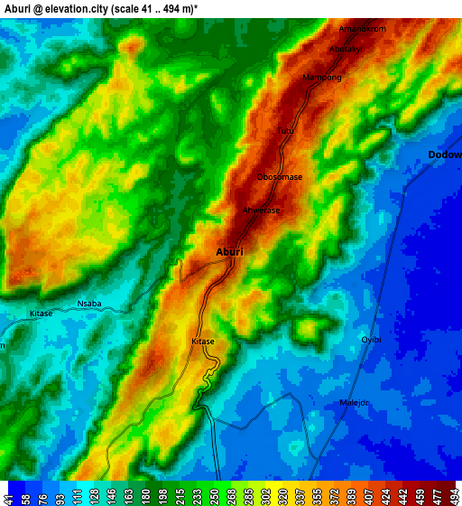
Below is the Elevation map of Aburi, which displays elevation range with different colors. Scale of the first map is from 82 to 479 m (269 to 1572 ft) with average elevation of 271.2 meters (=890 ft) [note 1]
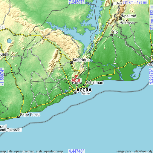
These maps also provides idea of topography and contour of this city, they are displayed at different zoom levels. More info about maps, scale and edge coordinates you can find below images.
| \ | Map #1 | Map #2 | Topo.Map |
| Scale [m] | 82..479 m | 41..494 m | × |
| Scale [ft] | 269..1572 ft | 135..1621 ft | × |
| Average | 271.2 m = 890 ft | 209 m = 686 ft | × |
| Width | 9.72 km = 6 mi | 19.44 km = 12.1 mi | 311.1 km = 193.3 mi |
| Height | 9.72 km = 6 mi | 19.44 km = 12.1 mi | 311.1 km = 193.3 mi |
| ↑Max Latitude | 5.891735° | 5.935446° | 7.24507° |
| Latitude at center | 5.84802° | 5.84802° | 5.84802° |
| ↓Min Latitude | 5.804302° | 5.76058° | 4.44748° |
| ← Min Longitude | -0.218435° | -0.262381° | -1.58074° |
| Longitude center | -0.17449° | -0.17449° | -0.17449° |
| →Max Longitude | -0.130545° | -0.086599° | 1.23176° |
Nearby cities:
Cities around Aburi sort by population:
• Accra elevation 33 m
32.6 km,  184°
184°
• Atsiaman 45 m
23.8 km,  225°
225°
• Tema 27 m
26.4 km,  138°
138°
• Teshi Old Town 13 m
30.3 km,  165°
165°
• Medina Estates 86 m
20.3 km, 176°
• Koforidua 172 m
28.9 km,  341°
341°
• Nungua 28 m
29.5 km,  158°
158°
• Suhum 182 m
37.3 km,  305°
305°
• Dome 35 m
23 km,  197°
197°
• Gbawe 31 m
33.7 km,  206°
206°
• Nsawam 61 m
19.9 km,  257°
257°
• Akropong 454 m
17.2 km,  34°
34°
Multilingual:
 En español:
Aburi elevación 447 m.
 En France:
Aburi élévation 447 m.


Sources and notes:
- [note 1] Map square and city borders are not equal. Map elevation data is calculated only from area inside that square.
- [src 1] Elevation data from geonames database provided with same terms of usage.
- [src 2] The elevation map of Aburi is generated using elevation data from NASA's 3 arcsec (90m) resolution SRTM data.
- [src 3] Base (background) map © OpenStreetMap contributors tiles are generated by Geofabrik and OpenTopoMap.
Copyright & License:
This Aburi Elevation Map is licensed under CC BY-SA. You may reuse any part from this page, if you give a proper credit by linking to this URL:
 More info on terms of use page.