Bibiani elevation
Bibiani (Western), Ghana elevation is 223 meters and Bibiani elevation in feet is 732 ft above sea level [src 1]. Bibiani is a populated place (feature code) with elevation that is 53 meters (174 ft) bigger than average city elevation in Ghana.
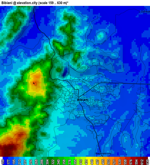
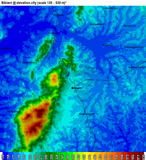
Below is the Elevation map of Bibiani, which displays elevation range with different colors. Scale of the first map is from 159 to 630 m (522 to 2067 ft) with average elevation of 239.2 meters (=785 ft) [note 1]
These maps also provides idea of topography and contour of this city, they are displayed at different zoom levels. More info about maps, scale and edge coordinates you can find below images.
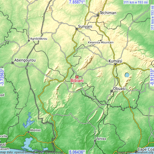
| \ | Map #1 | Map #2 | Topo.Map |
| Scale [m] | 159..630 m | 139..630 m | × |
| Scale [ft] | 522..2067 ft | 456..2067 ft | × |
| Average | 239.2 m = 785 ft | 212.7 m = 698 ft | × |
| Width | 9.71 km = 6 mi | 19.42 km = 12.1 mi | 310.7 km = 193.1 mi |
| Height | 9.71 km = 6 mi | 19.42 km = 12.1 mi | 310.7 km = 193.1 mi |
| ↑Max Latitude | 6.507124° | 6.550784° | 7.85871° |
| Latitude at center | 6.46346° | 6.46346° | 6.46346° |
| ↓Min Latitude | 6.419792° | 6.376121° | 5.06436° |
| ← Min Longitude | -2.363325° | -2.407271° | -3.72563° |
| Longitude center | -2.31938° | -2.31938° | -2.31938° |
| →Max Longitude | -2.275435° | -2.231489° | -0.91313° |
Nearby cities:
Cities around Bibiani sort by population:
• Kumasi elevation 270 m
80.7 km,  71°
71°
• Obuase 233 m
77.6 km,  111°
111°
• Sunyani 298 m
97.5 km,  359°
359°
• Berekum 330 m
113.9 km,  345°
345°
• Tafo 291 m
83.5 km, 69°
• Prestea 69 m
116.1 km,  170°
170°
• Dunkwa 118 m
82 km,  133°
133°
• Duayaw-Nkwanta 304 m
82.7 km,  17°
17°
• Bechem 296 m
76.9 km,  25°
25°
• Bekwai 231 m
81.8 km,  90°
90°
• Mamponteng 274 m
90.1 km, 70°
• Wassa-Akropong 86 m
79.6 km,  160°
160°
Multilingual:
 En español:
Bibiani elevación 223 m.
 En France:
Bibiani élévation 223 m.


Sources and notes:
- [note 1] Map square and city borders are not equal. Map elevation data is calculated only from area inside that square.
- [src 1] Elevation data from geonames database provided with same terms of usage.
- [src 2] The elevation map of Bibiani is generated using elevation data from NASA's 3 arcsec (90m) resolution SRTM data.
- [src 3] Base (background) map © OpenStreetMap contributors tiles are generated by Geofabrik and OpenTopoMap.
Copyright & License:
This Bibiani Elevation Map is licensed under CC BY-SA. You may reuse any part from this page, if you give a proper credit by linking to this URL:
 More info on terms of use page.