Khoni elevation
Khoni (Imereti), Georgia elevation is 118 meters and Khoni elevation in feet is 387 ft above sea level [src 1]. Khoni is a populated place (feature code) with elevation that is 422 meters (1385 ft) smaller than average city elevation in Georgia.
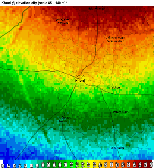
Below is the Elevation map of Khoni, which displays elevation range with different colors. Scale of the first map is from 85 to 140 m (279 to 459 ft) with average elevation of 113 meters (=371 ft) [note 1]
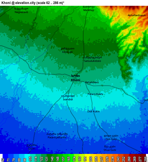
These maps also provides idea of topography and contour of this city, they are displayed at different zoom levels. More info about maps, scale and edge coordinates you can find below images.
| \ | Map #1 | Map #2 | Topo.Map |
| Scale [m] | 85..140 m | 62..286 m | × |
| Scale [ft] | 279..459 ft | 203..938 ft | × |
| Average | 113 m = 371 ft | 114 m = 374 ft | × |
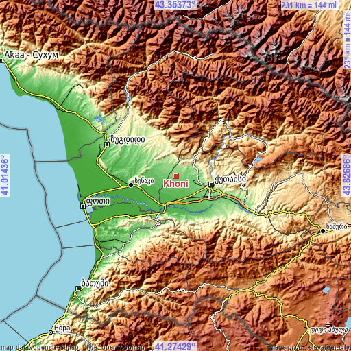
| Width | 7.23 km = 4.5 mi | 14.45 km = 9 mi | 231.2 km = 143.7 mi |
| Height | 7.23 km = 4.5 mi | 14.45 km = 9 mi | 231.2 km = 143.7 mi |
| ↑Max Latitude | 42.355083° | 42.38755° | 43.35373° |
| Latitude at center | 42.3226° | 42.3226° | 42.3226° |
| ↓Min Latitude | 42.2901° | 42.257583° | 41.27429° |
| ← Min Longitude | 42.376665° | 42.332719° | 41.01436° |
| Longitude center | 42.42061° | 42.42061° | 42.42061° |
| →Max Longitude | 42.464555° | 42.508501° | 43.82686° |
Nearby cities:
Cities around Khoni sort by population:
• Kutaisi elevation 153 m
23.3 km,  105°
105°
• Samtredia 23 m
20.1 km,  200°
200°
• Senak’i 36 m
29.6 km,  258°
258°
• Tsqaltubo 142 m
14.7 km,  81°
81°
• Tsalenjikha 179 m
42.6 km,  317°
317°
• Abasha 26 m
20.7 km,  232°
232°
• Mart’vili 194 m
10.8 km,  341°
341°
• Khobi 15 m
42.9 km,  268°
268°
• Kveda Chkhorots’q’u 125 m
31.9 km,  303°
303°
• Vani 70 m
27.9 km,  162°
162°
• K’ulashi 38 m
14.7 km,  205°
205°
• Lanchkhuti 22 m
41.1 km, 231°
Multilingual:
 En español:
Khoni elevación 118 m.
 En France:
Khoni élévation 118 m.


Sources and notes:
- [note 1] Map square and city borders are not equal. Map elevation data is calculated only from area inside that square.
- [src 1] Elevation data from geonames database provided with same terms of usage.
- [src 2] The elevation map of Khoni is generated using elevation data from NASA's 3 arcsec (90m) resolution SRTM data.
- [src 3] Base (background) map © OpenStreetMap contributors tiles are generated by Geofabrik and OpenTopoMap.
Copyright & License:
This Khoni Elevation Map is licensed under CC BY-SA. You may reuse any part from this page, if you give a proper credit by linking to this URL:
 More info on terms of use page.