Chopwell elevation
Chopwell (England, Gateshead), United Kingdom elevation is 147 meters and Chopwell elevation in feet is 482 ft above sea level [src 1]. Chopwell is a populated place (feature code) with elevation that is 75 meters (246 ft) bigger than average city elevation in United Kingdom.
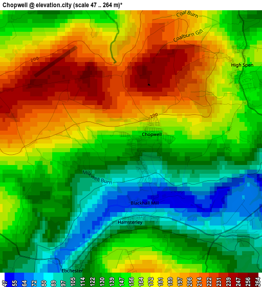
Below is the Elevation map of Chopwell, which displays elevation range with different colors. Scale of the first map is from 47 to 264 m (154 to 866 ft) with average elevation of 154 meters (=505 ft) [note 1]
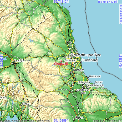
These maps also provides idea of topography and contour of this city, they are displayed at different zoom levels. More info about maps, scale and edge coordinates you can find below images.
| \ | Map #1 | Topo.Map |
| Scale [m] | 47..264 m | × |
| Scale [ft] | 154..866 ft | × |
| Average | 154 m = 505 ft | × |
| Width | 5.62 km = 3.5 mi | 179.7 km = 111.7 mi |
| Height | 5.62 km = 3.5 mi | 179.7 km = 111.7 mi |
| ↑Max Latitude | 54.94322° | 55.71812° |
| Latitude at center | 54.91797° | 54.91797° |
| ↓Min Latitude | 54.892705° | 54.10159° |
| ← Min Longitude | -1.864075° | -3.22638° |
| Longitude center | -1.82013° | -1.82013° |
| →Max Longitude | -1.776185° | -0.41388° |
Nearby cities:
Cities around Chopwell sort by population:
• Newburn elevation 40 m
9.1 km,  32°
32°
• Consett 272 m
7.1 km,  185°
185°
• Blaydon-on-Tyne 10 m
8.5 km,  52°
52°
• Prudhoe 99 m
5.2 km,  337°
337°
• Annfield Plain 237 m
8.5 km,  142°
142°
• Rowlands Gill 58 m
4.8 km,  88°
88°
• Burnopfield 182 m
6.2 km,  102°
102°
• Stocksfield 74 m
5.9 km,  294°
294°
• Tanfield 191 m
7.4 km,  112°
112°
• Wylam 26 m
6.5 km,  359°
359°
• Heddon on the Wall 132 m
8.9 km,  10°
10°
• Horsley 93 m
7.5 km,  345°
345°
Multilingual:
 En español:
Chopwell elevación 147 m.
 En France:
Chopwell élévation 147 m.
 Auf Deutsch:
Chopwell höhe über dem Meeresspiegel ist 147 m.

Sources and notes:
- [note 1] Map square and city borders are not equal. Map elevation data is calculated only from area inside that square.
- [src 1] Elevation data from geonames database provided with same terms of usage.
- [src 2] The elevation map of Chopwell is generated using elevation data from NASA's 3 arcsec (90m) resolution SRTM data.
- [src 3] Base (background) map © OpenStreetMap contributors tiles are generated by Geofabrik and OpenTopoMap.
Copyright & License:
This Chopwell Elevation Map is licensed under CC BY-SA. You may reuse any part from this page, if you give a proper credit by linking to this URL:
 More info on terms of use page.