Shotts elevation
Shotts (Scotland, North Lanarkshire), United Kingdom elevation is 216 meters and Shotts elevation in feet is 709 ft above sea level [src 1]. Shotts is a populated place (feature code) with elevation that is 144 meters (472 ft) bigger than average city elevation in United Kingdom.
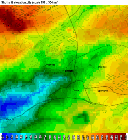
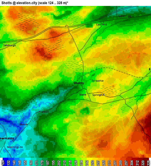
Below is the Elevation map of Shotts, which displays elevation range with different colors. Scale of the first map is from 151 to 304 m (495 to 997 ft) with average elevation of 230.7 meters (=757 ft) [note 1]
These maps also provides idea of topography and contour of this city, they are displayed at different zoom levels. More info about maps, scale and edge coordinates you can find below images.
| \ | Map #1 | Map #2 | Topo.Map |
| Scale [m] | 151..304 m | 124..328 m | × |
| Scale [ft] | 495..997 ft | 407..1076 ft | × |
| Average | 230.7 m = 757 ft | 232.2 m = 762 ft | × |
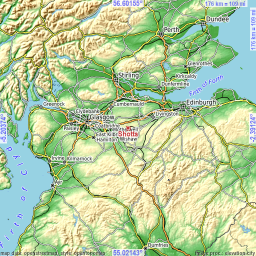
| Width | 5.49 km = 3.4 mi | 10.98 km = 6.8 mi | 175.7 km = 109.2 mi |
| Height | 5.49 km = 3.4 mi | 10.98 km = 6.8 mi | 175.7 km = 109.2 mi |
| ↑Max Latitude | 55.844191° | 55.868856° | 56.60155° |
| Latitude at center | 55.81951° | 55.81951° | 55.81951° |
| ↓Min Latitude | 55.794814° | 55.770102° | 55.02143° |
| ← Min Longitude | -3.841435° | -3.885381° | -5.20374° |
| Longitude center | -3.79749° | -3.79749° | -3.79749° |
| →Max Longitude | -3.753545° | -3.709599° | -2.39124° |
Nearby cities:
Cities around Shotts sort by population:
• Armadale elevation 187 m
9.3 km,  40°
40°
• Whitburn 173 m
8.8 km,  53°
53°
• Newarthill 155 m
8.7 km,  266°
266°
• Newmains 156 m
6.2 km,  231°
231°
• Fauldhouse 230 m
5.7 km,  81°
81°
• Harthill 197 m
5.4 km,  32°
32°
• Law 170 m
9.4 km,  214°
214°
• Cleland 149 m
7.5 km,  255°
255°
• Forth 281 m
9.1 km,  131°
131°
• Blackridge 198 m
7.4 km,  10°
10°
• Salsburgh 240 m
5.4 km,  298°
298°
• Allanton 183 m
3.2 km, 226°
Multilingual:
 En español:
Shotts elevación 216 m.
 En France:
Shotts élévation 216 m.


Sources and notes:
- [note 1] Map square and city borders are not equal. Map elevation data is calculated only from area inside that square.
- [src 1] Elevation data from geonames database provided with same terms of usage.
- [src 2] The elevation map of Shotts is generated using elevation data from NASA's 3 arcsec (90m) resolution SRTM data.
- [src 3] Base (background) map © OpenStreetMap contributors tiles are generated by Geofabrik and OpenTopoMap.
Copyright & License:
This Shotts Elevation Map is licensed under CC BY-SA. You may reuse any part from this page, if you give a proper credit by linking to this URL:
 More info on terms of use page.